 |
|---|
| Plate P-3 |
|
|---|
| Plate P-3 |
The lunar maria (Latin for seas) were considered oceans many centuries ago. We now know them to be immense basalt flows, ranging in age from roughly 3 to 4 billion years. These are discussed in relation to the photographic view from space, supplemented by closeup views taken by the Apollo astronauts on the Apollo 11 and 15 missions.
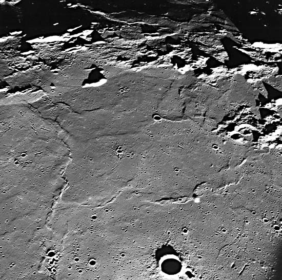
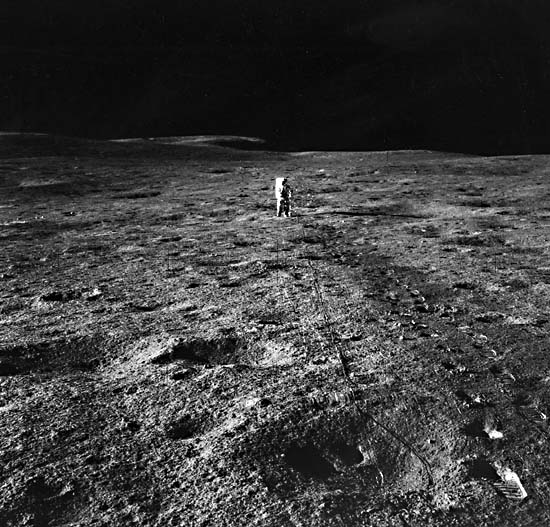
The main view (Plate P-3), taken looking west from the Apollo 10 spacecraft, shows Mare Tranquillitatis and what would become the Apollo 11 landing site. The low morning Sun brings out the topographic features of this typical mare area. The physiographic contrast between the rugged, heavily cratered highlands (top) and the lower, smoother maria is well displayed here. The primary reason for this contrast is the much lower density of large craters on the maria. However, it is clear that there are many craters on the maria, even as seen from orbital altitudes. The maria are in fact saturated with craters a few meters wide, as shown by an Apollo 12 surface view of Oceanus Procellarum (Figure P-3.1).
Returning to the orbital view of Mare Tranquillitatis, we see many mare ridges (also termed wrinkle ridges). The origin of these features is surprisingly little understood. Several different mechanisms have been proposed in two general categories-tectonic and igneous.
| Figure P-3.1 | Figure P-3.2 |
|---|---|
 |
 |
In the tectonic theories, the ridges are interpreted as folds, faults, or some combination of the two. In early USGS/NASA lunar mapping, the ridges were shown as anticlines, an interpretation since elaborated on by many workers. Solomon and Head (1979) have made perhaps the most extensive study of tectonic mechanisms and have shown that ridges in southern Mare Serenitatis probably resulted from global compression accompanying postmare cooling. This concept implies that the ridges are anticlines or possibly thrusts in places, expressed directly as topography.
Another explanation of the mare ridges is that they result partly or wholly from the intrusion or extrusion of magma (i.e., that they are basically igneous). One reason for this proposal is that in many places ridges grade into higher albedo rounded hills, suggesting viscous lava extrusions (O´Keefe et al., 1967). The ridges in such cases would form the fissures feeding these extrusions, although along most of the length, the magma did not break through. One example of such relationships is visible here: the small hill on the mare ridge just above the prominent crater (Bruce) at the bottom of the picture. The tectonic and igneous theories for the ridges are not necessarily mutually exclusive since dikes may be permissively intruded along preexisting fractures as has happened on Earth.
| Figure P-3.3 |
|---|
 |
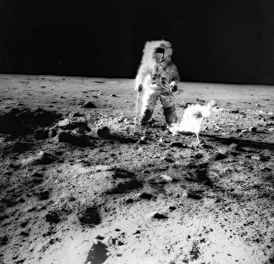
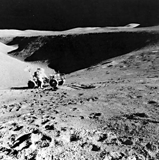
Another mare landform is the sinuous rille. None are visible in the Mare Tranquillitatis scene, but a well-known example, Hadley Rille, appears in Figure P-2.1. Two surface views of Hadley Rille from Apollo 15 are shown in this Plate to discuss not the rille itself but the structure of the mare as exposed in its walls. The Apollo 15 landing site, Hadley Base, although not on a named mare, was on the Palus Putredinus, a relatively small area of basalt in the Imbrium Basin. This north-looking surface view (Figure P-3.2), showing mission commander David Scott standing with the Rover by the 300-m deep rille, also gives a good side view of the mare topography, emphasizing its levelness. A suggestion of layering is visible in the walls of the rille.
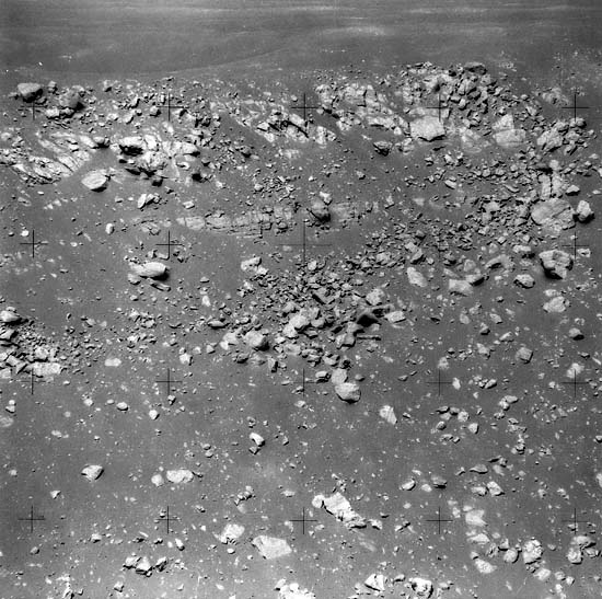
The layering is shown much better in another surface view (Figure P-3.3), looking at the southwest wall of Hadley Rille. This 40-m high cliff is one of the few good exposures of bedrock seen on the Apollo missions; most of the lunar surface is covered with the impact-generated regolith. This view reveals the layered structure of at least this mare area and may be reasonably representative of the maria in general, although the exposure itself is probably due to collapse of a lava tube as discussed in the Plate P-2 text. The layering is clearly of igneous origin and presumably represents several successive lava flows, even though intrusions cannot be ruled out. There are several reasons for presenting this particular view. Most important is that it at least suggests what has been inferred from other geologic relationships and from radiometric dates, namely that the maria were emplaced over a long time in many successive flows. They were not formed by one postimpact eruption or as an immense pool of impact melt. Furthermore, the Hadley Rille exposure is of geomorphic interest in demonstrating the superficial nature of the mare regolith. Unlike the highlands regolith, which extends to several kilometers depth (Short and Forman, 1972), the regolith on the maria is here demonstrably only a few meters deep, as shown by the fact that the igneous layers are not disrupted. 69-H-864.
Continue to Plate P-4| Chapter 10 Table of Contents.| Return to Home Page| Complete Table of Contents|