 |
 |
|---|---|
| Plate P-5 | Map |
|
|
|---|---|
| Plate P-5 | Map |
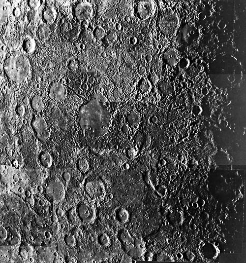
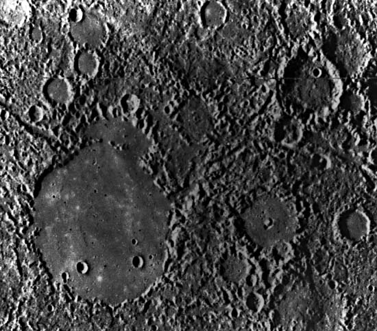
This view of Mercury (Plate P-5) covers an area near the terminator where the low Sun angle emphasizes topographic features around the 140-km wide crater Petrarch. The ancillary views show the same area as part of the "incoming side" (that first photographed on the initial Mariner 10 flyby; (Figure P-5.1) and at closer range (Figure P-5.2).
The dominant physiographic feature in the Plate view is the so-called "hilly and lineated terrain," whose chaotic nature has also given rise to the term "weird terrain." This rugged area is hard to explain by any known tectonic or geomorphic process and appears to be unique to Mercury. Two major possibilities are tectonism/volcanism or impact. The first is hard to argue for convincingly because of its vagueness and the evidence that it appears to have operated here only (although it must be remembered that we have seen only about half the surface of Mercury). The second possibility is an unusual one suggested by the fact that this area (roughly 30°S and 30°W) is antipodal to the Caloris Basin (i.e., on the opposite side of Mercury). If the Caloris Basin is an immense impact crater, the impact should have generated a series of strong surface waves spreading concentrically from the crater. In principle, these would have converged at about this area, suggesting that this convergence point may have been subjected to strong shaking and mass wasting, producing the jumbled array of hills. A natural question is whether there is any lunar counterpart opposite the Orientale Basin. The answer appears to be no, but Mercury is internally very different from the Moon, and elastic wave propagation may have been correspondingly different. The large iron core of Mercury, for instance, may have reflected or refracted body waves. The question of how the aptly named "weird terrain" formed is obviously unanswered and remains a fruitful area for research.
| Figure P-5.1 |
|---|
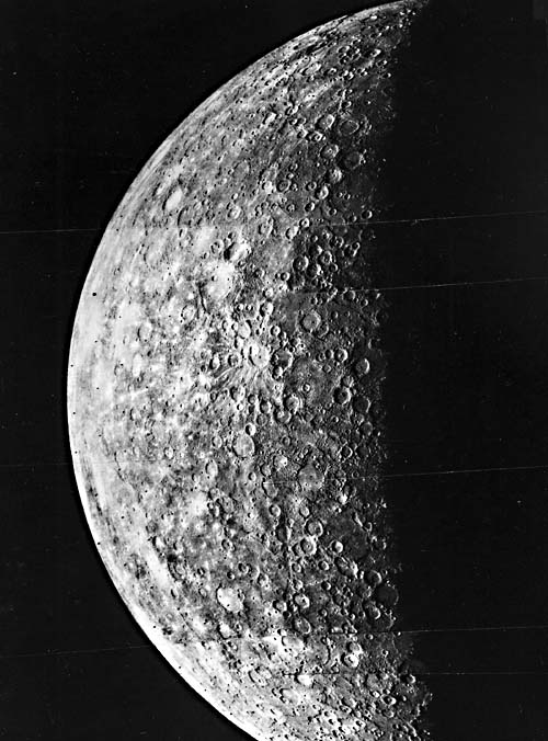 |
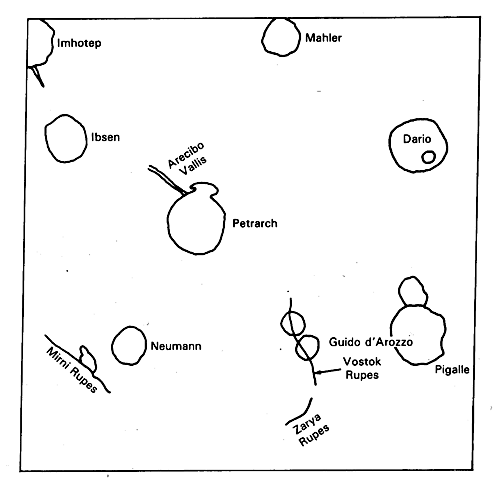
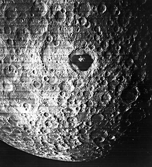
The Plate image also shows other uniquely Mercurian physiographic features. The most general one, well-shown on the distant view (Figure P-5.1), is the high proportion of terrain not obviously cratered (with large craters); this area has been called the "intercrater plains." The intercrater plains correspond roughly, in relative age, to the lunar highlands, but their precise age cannot be pinned down. They constitute a type of terrain that cannot really be matched with the lunar highlands, which are saturated with large craters as shown in a Lunar Orbiter view (Figure P-5.3) of the Moon´s far side centered on Tsiolkovsky. It seems fairly clear that the Mercurian intercrater plains represent a part of the early, but not primordial, crust whose formation overlapped the period of heavy cratering. There are several places on Mercury where lobate scarps on the intercrater plains, such as perhaps the Mirni Rupes (Figure P-5.2), overlap and apparently flow into craters. This suggests that the plains may have been formed by successive lava flows that were resurfacing the planet and obliterating craters. If correct, this possibility has important implications for planetology in that it may represent at least the last stages of formation of the earliest crust, which the writer has called the "first differentiation."
| Figure P-5.2 | Figure P-5.3 |
|---|---|
 |
 |
Other scarps, such as Vostok Rupes (Figure P-5.2), have been interpreted as reverse faults or thrusts. Martha Leake, in a 1981 Ph.D. thesis, cited Strom´s (1984) interpretation of Vostok Rupes as a thrust dipping 25 to 45 degrees to the east (right in this figure), that has shortened the crater, Guido d´Arezzo, by a 10-km westward heave along this thrust. Thrusts of this type are found elsewhere on Mercury and have generally been considered to be compressive features resulting from contraction of the planet. 75-H-83.
Continue to Plate P-6| Chapter 10 Table of Contents.| Return to Home Page| Complete Table of Contents|