 |
 |
|---|---|
| Plate T-18 | Map |
|
|
|---|---|
| Plate T-18 | Map |
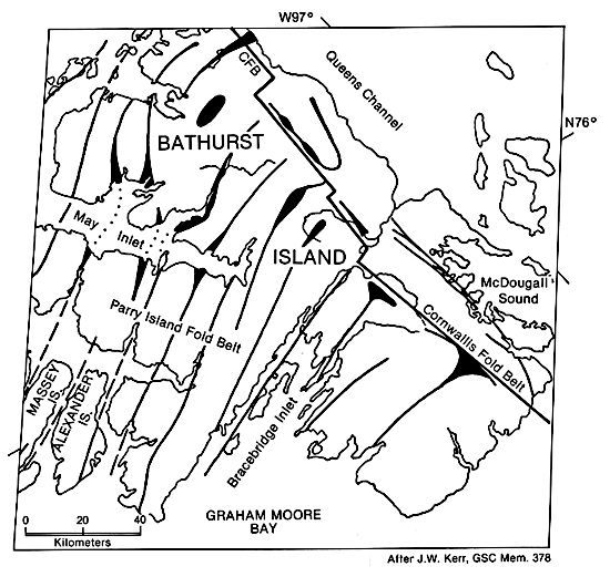
Contrast in rock types, lack of soil, and sparseness of vegetation makes the Bathurst Island Group a superbly exposed example of the interference of two fold belts. These islands lie near the center of an extensive group of islands north of mainland Canada known collectively as the Arctic Archipelago. The Bathurst group, approximately 17500 km2 in area, is centered about 76° latitude and 100°W longitude (Dunbar and Greenaway, 1956).
Vegetation on the island is restricted to lichens, mosses, and a few hardy species such as sedge and Arctic willow that grow only a few inches in height. Although the environment is extremely harsh, substantial vegetative cover is present on parts of the island. Clearly, some lithologies provide a more favorable environment for plant growth than others. The limestones and dolomites are essentially barren. Sandstones tend to support lichens, and the siltstones and shales support grasses and shrubs.
Structurally, Bathurst Island lies at the eastern terminus of the Parry Island fold belt, a unique 450-km long structural province consisting of uniformly folded broad synclines and narrow anticlines. The axes of several of these structures exceed 300 km in length.
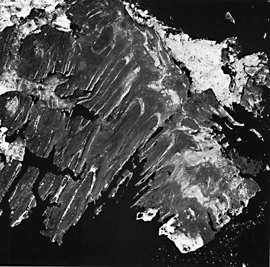
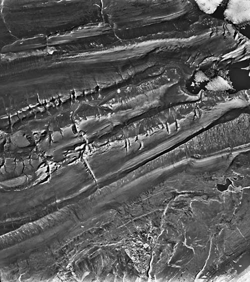
These east-northeast-trending structures, so prominent in the western portion of the island, end abruptly near the east side of the island against north-south-trending folds and faults (Kerr and Temple, 1974). Figure T-18.1, an aerial oblique photograph, shows the relationships very well. The anticline adjacent to Stuart River (right center) is faulted along its axis so as to join subsidiary anticlines on either side of the river. The north-trending folds are on the west flank of the Cornwallis fold belt, a sediment-covered northward extension of the Boothia uplift, whose major structural features had their origin in Precambrian time. Unconformities show that repeated periods of uplift have occurred in the Cornwallis fold belt; several during the Devonian, but also as late as Pennsylvanian/Permian time (Kerr and Christie, 1965).
| Figure T-18.1 | Figure T-18.2 |
|---|---|
 |
 |
The younger Parry Island fold belt was formed by compressive forces in essentially a north-south direction during the Ellesmerian orogeny. The folding was accentuated by décollement movement in a Middle Ordovician evaporite sequence more than 1000 m deep.
Strata exposed on the island consist of dolomite, limestone, shales, siltstone, and sandstones. On the Landsat image, the rocks shown are almost entirely Devonian with minor exposures of Ordovician beds in the cores of a few of the anticlines around May Inlet.
The prevalent rock type in the southern and eastern portions of the island is dolomite. The light-toned resistant beds exposed on the flanks of the structures near the upper end of Erskine Inlet are quartz sandstone. In this area, the dark grays, normally indicative of shales, are predominantly sandstones. The dark color undoubtedly results from an extensive growth of black and green lichens that favor the resistant sandstone outcrops. The light-colored quartz sandstone is too friable to form the hard, enduring substrate necessary for the slow-growing lichens.
Two physiographic units appear in this image; a Southern Plateau lying south of a line extending from just south of Bracebridge Inlet eastward to the central portion of McDougall Sound, and a Folded Upland comprising the rest of the island group.
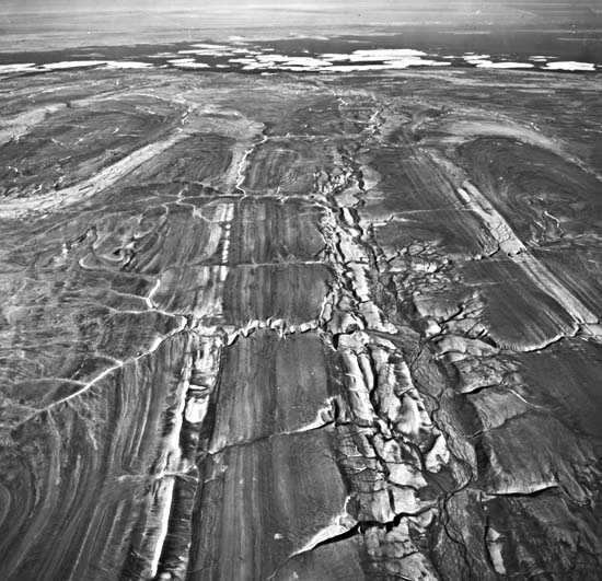
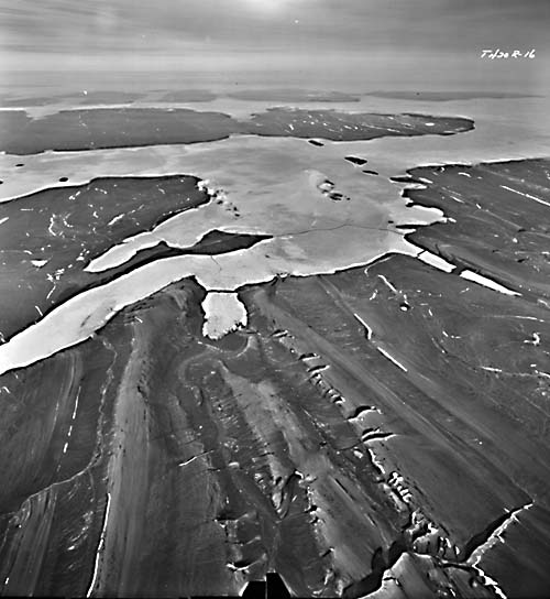
The Folded Upland is characterized by low rounded ridges and valleys resulting from differential erosion of the tilted strata of the Parry Island fold belt (Figure T-18.2 and Figure T-18.3). Dips can be determined by scarps infacing on anticlines and outfacing on synclines. Much of the secondary drainage is controlled by and parallels the strata, giving rise to a trellis pattern. At least two major drainage systems on the island flowed northward during the Ice Age when the sea level was at least 100 m lower. These drainage systems are now drowned and are known as Erskine and May Inlets.
| Figure T-18.3 |
|---|
 |
Hills in the uplands are generally smooth and broadly rounded and rarely exceed elevations of 300 m. They are dissected by deep steep-walled gullies and canyons, an erosional form common in much of the Arctic, as evident in the ancillary figures. Although the Landsat image shows excellent definition of lithologic units, good in situ exposures are absent on the ground. Deep mechanical weathering has broken, scattered, and disintegrated outcrop material to the extent that much of the surface is composed of fields of boulders called felsenmeer. Ironically, in this area, one can delineate geologic units better from 900 km above the ground than on the surface. (Actual identification of the mapped units would depend on ground work.) Some stream captures have occurred on the broad upland; others are imminent. (GCW: O. R. Russell) Landsat 20943-18161-7, August 8, 1977.
Continue to Plate T-19| Chapter 2 Table of Contents| Return to Home Page| Complete Table of Contents