 |
 |
|---|---|
| Plate T-26 | Map |
|
|
|---|---|
| Plate T-26 | Map |
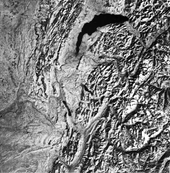
This scene and its companion to the north (Figure T-26.4) illustrate in more detail several zones in the main arc of the Alps and two major structural units of the foreland -the open folds of a thin-skinned décollement (Jura Mountains) and the older crystalline massifs (Vosges, Schwartzwald), each with its own characteristic topography. Rivers and troughs outline the structural units in the image. The pattern of the ridges also differentiates the tectonic structures. The long linear ridges extending northeast-southwest through the center of the scene are thrust slices and folds. The longitudinal valleys are carved on less resistant rocks, and many lie along the root zone of nappes. Anomalous drainage transverse to the ridges marks locations of faults or flexures. Lakes occupy some of the broad glacial troughs. The visual tour of these structures begins in the lower right corner of the Plate image and moves upward through the top of Figure T-26.4.
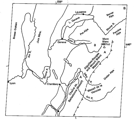
The Penninic Alps, in their type area here ("A" on index map), comprise the inner alpine zone. The Pennines here are schists and some gneisses that comprise lower older crystalline basement. They are thrust-bound on the west against the Helvetic Alps (B). Movement of the Pennines began in the Eocene and largely ceased by Mid-Oligocene after up to 140-km northward transport.
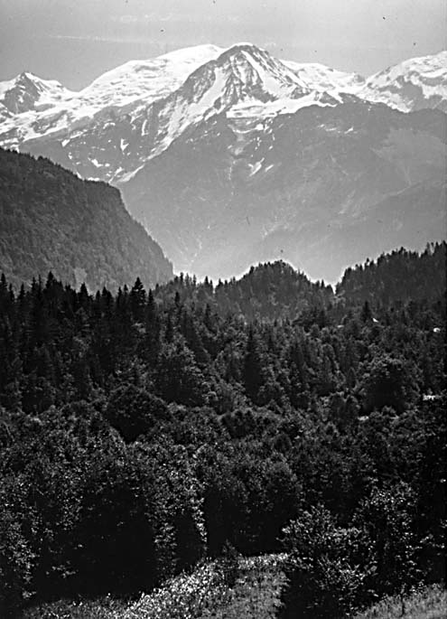
The Helvetic Belledonne, Aiguilles Rouges, and Mont Blanc (Figure T-26.1) massifs are also great thrust sheets that moved northward as much as 50 km during Mid-Oligocene to Mid-Miocene onto the molasse units to the west. Parts of the Helvetic Alps are structurally equivalent to the High Calcareous Alps.
| Figure T-26.1 | Figure T-26.2 |
|---|---|
 |
 |
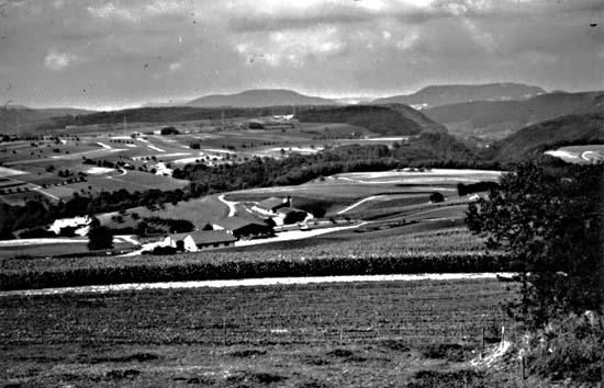
The Pre-Alps occupy a belt extending from the east side of Lake Geneva southward west of the Isère River. Tectonically, they are a décollement sheet detached and moved as much as 200 km from the Pennines to the southeast; they show evidence of emplacement episodes from Eocene through Upper Oligocene and were also affected by Helvetic events. They now overlie the Helvetic nappes. South and east of Lausanne, the Pre-Alps are a series of klippen or zones of notable brecciation. Rock units include flysch beds of Cretaceous to Eocene age and Triassic/Jurassic carbonates.
The Pre-Alps reach a height of 1000 to 1600 m. Valleys are narrow and deep, with transverse drainage controlled by faulting. Segments of anticlines and synclines are evidenced by cuestas and hogbacks. The nappes formed partially by gravity sliding as great sedimentary piles in the orogen were uplifted and laterally stressed. Plate convergence was the driving mechanism, assisted by increased thermal gradients that lowered the viscosity of rocks in the roof zones.
Lake Geneva (developed by glacial scouring) lies near the southern end of the Swiss Plains, a molasse basin that extends eastward through Bern, Zurich, Munich, and Linz. The basin received up to 6 km of fluvial, lacustrine, and marine sediments derived from alpine sources. Most units are folded and faulted near the juncture with the Pre-Alps. Although a lowlands compared to bordering mountains, they form a hilly landscape modified both by glaciation and postglacial erosion.
| Figure T-26.3 | Figure T-26.4 |
|---|---|
 |
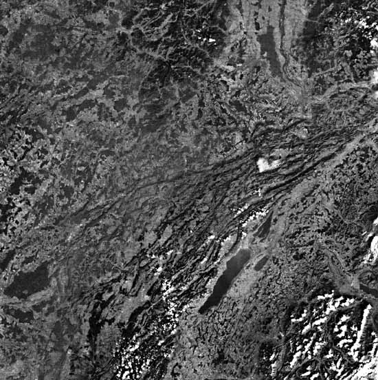 |
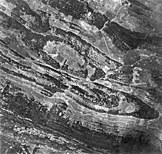
The last major mountain unit of Alpine origin is the Jura Mountains that lie to the northwest. South of Chambéry, the Jura meets the Chaines Subalpine of France. To the west in this scene is the Bresse graben. Rocks in the Jura foreland include Triassic through Cretaceous marine units on a crystalline basement (not exposed) and are overlain unconformably by Tertiary molasse. Two principal subdivisions are evident here: The Jura Blisse, a flexure belt of open to tight anticlines and synclines (Figure T-26.2, an aerial photograph) east of the Ain River, grades westward into the Jura Plateau, consisting of more open folds and gentler relief (Figure T-26.3). This folding began in the Late Miocene and climaxed in the Pliocene. The Jura is a décollement (one of the first places this style of deformation was recognized).
Figure T-26.4 depicts the northern half of the Jura where these mountains swing to the northeast. The change in style of folding from tighter to more open folds westward is clear. A third subdivision, the Jura Tabulaire, occupies a thin belt just above the northernmost folds. Rock layers there are nearly horizontal, with little apparent deformation (somewhat analogous to the Appalachian Plateau (Plates T-11 and F-26)). Near the top of the scene, the Rhine graben separates two dark areas, the crystalline massifs of the Vosges (center) and Schwartzwald (right corner). Because drainage of the Jura was incised across the developing folds, many transverse valleys or "cluses" are antecedent to the larger anticlines. The later drainage is accordant to the structure (subsequent). Products of accordant drainage are the "combes," longitudinal valleys formed by erosion of less resistant layers in isoclinal folds. (NMS) References: Ager and Brooks (1977), Anderson (1978), Leser (1984). Landsat 1078-09555-7, October 9, 1972.
Continue to Plate T-27| Chapter 2 Table of Contents| Return to Home Page| Complete Table of Contents