 |
 |
|---|---|
| Plate T-35 | Map |
|
|
|---|---|
| Plate T-35 | Map |
The African rift system is one of the most spectacular geologic features on the face of the Earth. It extends from the Red Sea in the Afar region of Ethiopia (about 10°N) (Plate T-36) to beyond the Zambezi River (150S) (Plate T-32) a distance about 4000 km (Willis, 1936). Over much of this distance, young volcanic and sedimentary rocks (Miocene to Recent) fill the rift, which lies within old (Precambrian) shield rocks (McConnell, 1972; Pallister, 1979). Like the Red Sea and Gulf of Aden rifts, the African rift marks the locus of the divergence of continental plates. Movement on this African rift is only a few millimeters per year versus centimeters per year on the other rifts. The process of continental divergence has proceeded much farther in the Red Sea rift and Gulf of Aden rift, which constitute the other two arms of a triple rift junction, than in the African rift. The African rift offers a unique opportunity to observe the initiation of plate divergence in a continental environment (Baker et al., 1972).
It was nearly impossible to study the rift in its entirety until the advent of space-acquired imagery because of its size (Mohr, 1973, 1974). One of the long-standing controversies about the rift is the extent to which preexisting Precambrian structural trends control the location and trend of the rift. Examination of imagery covering the entire rift shows that, in some locations, the rift parallels preexisting structural trends and, in other places, the rift is clearly independent of Precambrian trends. In the area shown on this Plate mosaic, the rift appears to be independent of Precambrian structures (i.e., the trend of the rift and the strike of the Precambrian structure are divergent).
| Figure T-35.1 | Figure T-35.2 |
|---|---|
 |
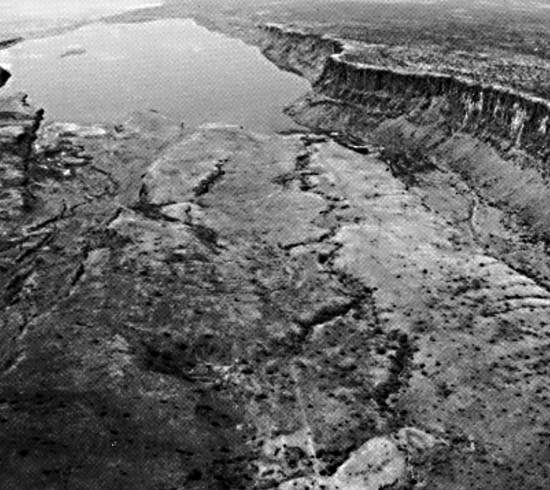 |
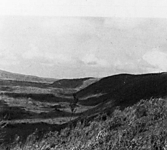
The mosaic, which covers about 500 km of the rift, displays many of the features typical of the rifting process. Bold scarps mark the faults that bound the rift. The crisp topographic character of many of these scarps indicates very recent movement on the associated faults. The ground photographs (Figure T-35.1 and Figure T-35.2) indicate the abruptness and freshness of the valley walls on both sides. Over much of their length, these scarps separate the more moist upland forests (bright red) from the arid, barren, lava-covered floor of the rift. Soda lakes (e.g., Lake Natron) and parallel north-trending extensional fractures characterize the floor of the rift. The parallel fractures and bounding faults accentuate the tensional nature of the rift and emphasize the divergence of the continental plates.
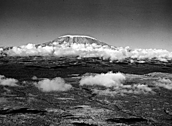
The mosaic includes the two highest mountains in Africa, Mt. Kenya (5199 m) and Mt. Kilimanjaro (5895 m; Figure T-35.3), both of which are large volcanic edifices. The volcanoes, with their circular structures and radial drainage patterns, are easily identified. Part of the lower section of the scene is shown elsewhere in Figure V-19.2. That Landsat image shows volcanoes and craters in various stages of erosion. Many of the abundant volcanoes in and near the rift have erupted extremely basic (silica poor) lavas, which suggests intimate relationships to the mantle and a paucity of partial melting of the crust. For instance, Ol Doingo Lengai erupts nephelinite lavas. Other volcanoes have carbonatite flows, equilibrated at great depth, associated with them (Baker et al., 1978).
| Figure T-35.3 | Figure T-35.4 |
|---|---|
 |
 |
The complex structure of the Precambrian rocks that comprise the uplands is clearly visible on both sides of the rift near the center of the mosaic. Within the area of the mosaic, the uplands slope away from the rift on both sides, suggesting that the rift bisects a broad crustal bulge. This uparching is similar to the general structure present along the Red Sea and Gulf of Suez (Plates T-36 and T-37) and probably is thermally driven.
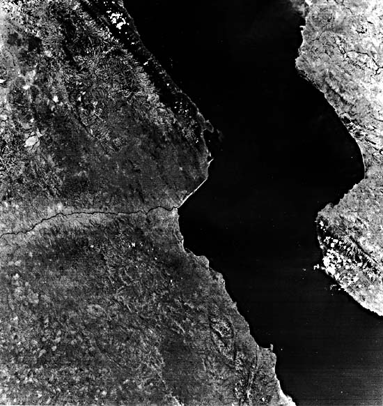
To the north, the Gregory rift joins the Ethiopian rift, which extends into the Afar Triangle (Plate T-36). To the south, the Gregory rift fans out and loses its distinctive character in the Tanzanian shield. The Western rift appears to take up the extension where the Eastern rift plays out. Figure T-35.4 shows a portion of Lake Tanganyika, which occupies a segment of the Western rift. The trough, containing the lake, appears to be offset in a right-lateral sense. The offset is more apparent than real, and the graben probably originated in this geometric arrangement without major lateral displacement (B. Rosendahl, personal communication). Here, as to the northeast, the uplands on either side slope away from the rift, suggesting a large topographic bulge. (JRE) Landsat Mosaic.
Continue to Plate T-36| Chapter 2 table of Contents| Return to Home Page| Complete Table of Contents