 |
 |
|---|---|
| Plate T-6 | Map |
|
|
|---|---|
| Plate T-6 | Map |
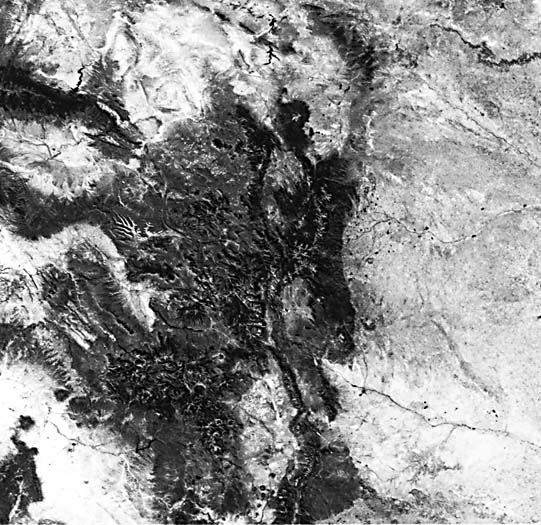
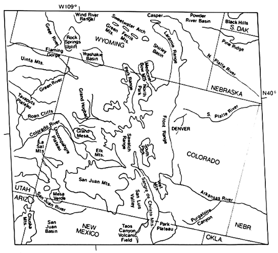
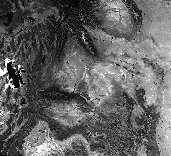
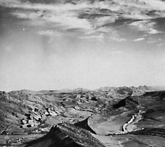
Together the two Heat Capacity Mapping Mission images (Plate T-6 and Figure T-6.1) span the Rocky Mountains and include part of the Basin and Range (Plate T-4) on the west and the Great Plains on the east. Most of the present-day topography is the result of erosion of rocks deformed and uplifted in Late Cretaceous through Middle Tertiary time. Some geologists refer to the area as the Laramide Rockies, implying that most of the structure is the result of the Laramide orogeny (Cretaceous Campanian through Tertiary Eocene). Although in general, this is true, previously established structural grain has influenced the effects of Laramide and post-Eocene deformations, and igneous activity has obscured the effects of the Laramide deformation in some areas.
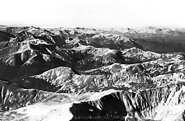
| Figure T-6.1 | Figure T-6.2 |
|---|---|
 |
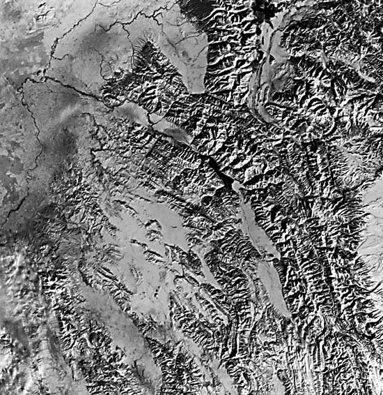 |
To the east, the rocks underlying the Great Plains are relatively undeformed. To the west, Middle to Late Tertiary extension of the Great Basin has disrupted and obscured many of the trends established during the Laramide. In between lies a complicated mosaic of generally broad basins (Powder River, Big Horn, Green River, Shirley, Uinta, etc.) (light-toned in Plate), separated by abrupt basement-cored uplifts (dark-toned, from vegetation) sprinkled with smaller basins, such as Washakie and North Park, and isolated uplifts like the Rock Springs uplift and San Rafael Swell (Plate T-7). A major overthrust. belt (Wyoming Thrust Belt/Hingeline), a zone of extensive dècollement, overthrusting, and folding, lies along the western margin of the province. Figure T-6.2, a Landsat band 7 image, shows some of the detail of these complexly folded and thrusted rocks where the Snake River Plain interrupts the Thrust Belt.
Several structural trends are prominent in the region: north, Front Range and Wyoming Thrust Belt; northwest, Wind River Mountains and Uncompahgre uplift; west-northwest, Owl Creek Mountains and Shirley Basin; west, Uinta and San Juan Mountains; and northeast, San Rafael Swell and the margins of several basins and uplifts. There are regional lineaments parallel to each of these directions.
Taken as a whole, the region is a portrait of large-scale continental collapse resulting from prolonged normal (B-type) subduction along the western edge of North America and consequent intracontinental thrusting west of the Overthrust Belt along the older Precambrian continental margin during Mesozoic and Early Tertiary time. Folding and thrusting in the west began in Late Jurassic time. Through the end of Cretaceous time, convergence, and consequently the maximum compressive stress axis, was oriented east to east-northeast. This produced north-trending thrust faults, west-northwest-trending left-slip faults, northeast-trending right-slip faults, and east to east-northeast-trending tensional features. During Eocene time, convergence became more northerly (northeast to north- northeast), producing a new stress field and a new suite of structural features. The new stress regime made use of many previously existing structural trends, modifying or changing the sense of movement on them. This reorientation of stress fields, coupled with a strong northwest trend established during Late Paleozoic deformation, has produced a complex regional structural fabric.
Several post-Eocene features affect parts of the area. The San Luis Valley (and perhaps North and South Park) is a downfaulted intermontane depression within the Late Tertiary Rio Grande Rift. The Snake River Plain and Absaroka volcanic field are part of a widespread Tertiary episode of extension and extrusion. The Middle to Late Tertiary extension in the eastern Great Basin reversed the sense of movement of some of the thrust faults of the western Overthrust Belt.
Topographically, a northwest-trending lineament marks a fault along the edge of the Medicine Bow Mountains, extending southward along the northeastern border of the North Park basin. Other faults are indicated by the linearity of the edges of many anticlinal ranges such as the Sawatch, Elk, Mosquito, and Sangre de Cristo Mountains. Both North and Middle Parks also show topographic linearity resulting from faults.
Many ranges are deeply eroded, faulted anticlines. Erosion of the sedimentary cover has resulted in monoclinal ridges called cuestas, hogbacks, or flatirons, depending on steepness of dip of the strata. (Cuestas are eroded on gently dipping sediments, flatirons on steeply dipping sediments.) Figure T-6.3 depicts the alpine geomorphology of the Rocky Mountains in this view of Loveland Pass, Colorado. Broad undissected upland "flats" can be seen, despite numerous sharp arêtes and horns carved by glaciers. The high rugged terrain with steep valley sides and broad glacial cirques and troughs makes beautiful mountain scenery. In addition, asymmetry of the folds is evidenced by differences in steep scarp faces and gentle back slopes (e.g., Laramie Mountains).
| Figure T-6.3 | Figure T-6.4 |
|---|---|
 |
 |
The problem of antecedence or superposition arises where rivers of the region cut across mountain ranges (i.e., the Laramie, Arkansas, and North and South Platte Rivers). Although these rivers were previously thought to be antecedent, they are now considered to be superimposed.
Figure T-6.4 is a view of differential erosion of the uptilted rocks along the Front Range at Morrison, Colorado. Resistant sandstones hold up these hogbacks. (JRE) References: Anderson et al. (1975), Dickinson (1977), Gries (1981, 1983), Hunt (1974), King (1977), Lowell and Gries (1983), Matthews (1978), Rocky Mountain Association of Geologists (1972), Suppe (1985), Thornbury (1965, pp. 287-405). HCMM 0528-19310-1, October 6, 1979.
Continue to Plate T-7| Chapter 2 Table of Contents| Return to Home Page| Complete Table of Contents