 |
 |
|---|---|
| Plate V-22 | MapV-22.1 |
|
|
|---|---|
| Plate V-22 | MapV-22.1 |
Volcanic rocks and intrusive magmatic-metamorphic crystalline rocks are frequently coassociated in terranes in which these several rock types are emplaced contemporaneously or in a succession related to stages in an orogenic cycle. It is unusual, however, to find young volcanic structures and products resting directly on ancient stable cratons. The Plate scene and Figure V-22.3 testify to the occasional condition in which Tertiary/Quaternary volcanism can develop on supposedly stable Precambrian shields, producing flows and ejecta deposits that have escaped primarily from fissure feeders that utilize deep crustal fractures. Striking examples of dark basaltic flows are found on heavily jointed crystalline surfaces in North Africa and the Arabian Shield.
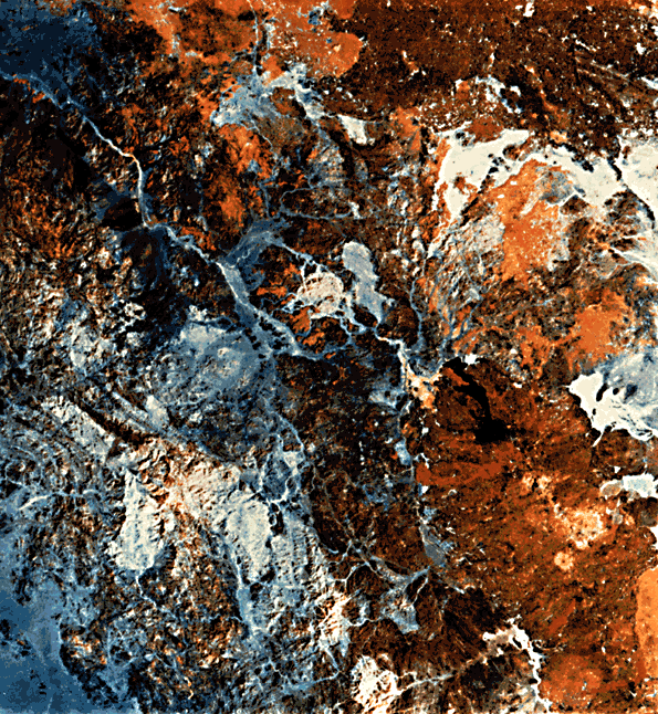
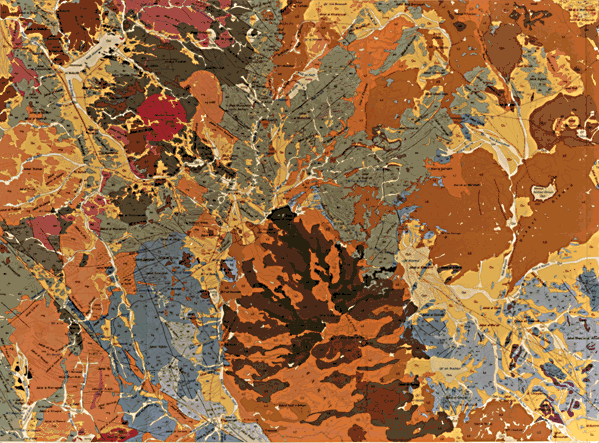
The main Plate is a color-ratio composite made from the combinations of bands 5/4 (blue), 6/5 (green), and 7/6 (red) for this Landsat MSS scene. This rendition enhances certain rock units and improves their overall recognition. To assess the quality of discrimination, compare these units with their corresponding equivalents in part of the 1:250 000 Al Madinah Quadrangle (Sheet 24) map prepared by the U.S. Geological Survey for the Kingdom of Saudi Arabia as reproduced below at reduced scale in lieu of an index map (Pellaton, 1982).
| Figure V-22.1 | Figure V-22.2 |
|---|---|
 |
 |
Three groups of Upper Proterozoic rocks are present in this shield region, but the oldest, the Hulayfah Group, lies outside the scene. Next are members of the Al Ays Group, with lithologies ranging from pyroclastic rocks, andesites, rhyolitic tuffs, epiclastic sandstone, graywackes, and other sedimentary types. These are overlain by the Furayh Group, which is composed of a lower conglomerate/sandstone, next a unit containing other sedimentary lithologies, then an andesite-basalt lava and pyroclastic sequence, and a basin-filling section of mature sedimentary deposits. During Proterozoic time, these groups were periodically invaded by intrusions ranging from gabbros through granodiorites and tonalites after the Al Ays Group was emplaced, and a variety of igneous bodies (including alkalic to peralkalic granites) subsequent to the Furayh Group. Late Precambrian/Early Cambrian orogenic events led to low-grade metamorphism (greenstone facies) and tectonic fracturing.
Except for localized remnants of Cambro/Orodovician sandstones, the region persisted as a stable landmass until the Tertiary. Then, a series of olivine basalt flows (b1, b2), followed by trachyphonolitic rocks (b3, tr), and finally Quaternary basalts (b4, b5) (all labeled on the color map) were extruded from fissures and conical vents. Upwards of 400 m of volcanics piled up between the earliest phase, some 11.1 ± 0.8 Ma ago and flows as young as the 13th century A.D.
In the color composite, most of the flow units can be distinguished from each other by sharp to subtle differences in color tones (best seen on the original). Unit b1 appears light brown; b2, dark yellow to medium brown; b3, tan-brown; b4, orange; and b5, black to orange. These differences relate more to extent of weathering over time than to compositional variations. Precambrian clastic/volcanic units show up as brownish-black. Crystalline igneous rocks usually are varying tones of bluish-white to light tan. Quaternary sabkhas (saline clay beds) are rendered in light blue, which can be confused with similar tones for some granitic rocks.
| Figure V-22.3 |
|---|
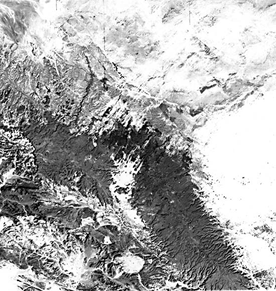 |
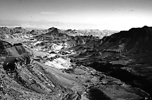
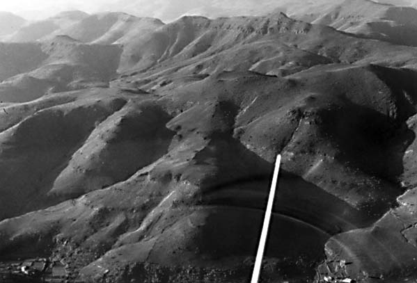
Topography (Figure V-22.1) is characterized by dissected plateaus between the Hijaz Mountains to the west and a peneplain farther east. Basalt plateaus (Figure V-22.2) are known as harrats. Prominent in the Landsat scene is Harrat Rahat (lower right), a convex upland whose relief is produced mainly by volcanic craters and cones. Several internal- draining wadis (ephemeral desert channels) cut steep gorges where they pass over mountainous terrain (upper left in Plate).
Figure V-22.3 illustrates similar terrain on the Arabian Shield inland from the coast farther north (Gass and Mallick, 1966), again as imaged by Landsat. Precambrian units at the lower left are exposed where remaining Paleozoic cover (upper right) was stripped off. The prominent Harrat al ´Uwayrid runs north westward near the line of unconformity. In the center of the image are numerous cones and craters giving vent to young dark basalts. Landsat 1446-07195, October 12, 1973.
Continue to Plate V-23| Chapter 3 Table of Contents.| Return to Home Page| Complete Table of Contents