 |
 |
|---|---|
| Plate V-4 | Map |
|
|
|---|---|
| Plate V-4 | Map |
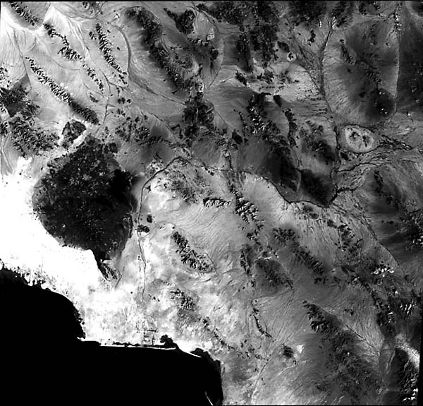
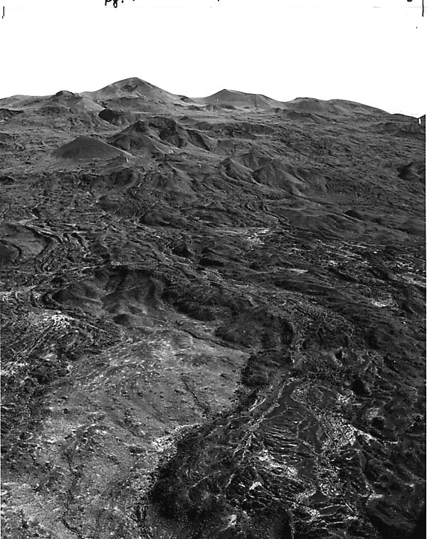
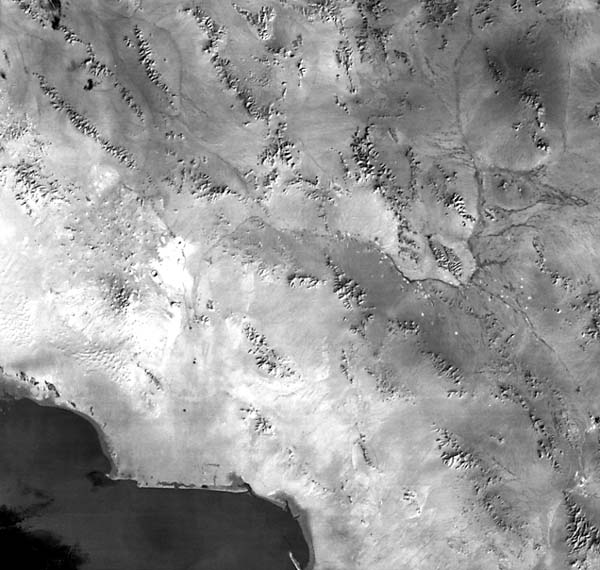
At the edge of the block-fault mountains of the Basin and Range and east of the Colorado River delta, the young Pinacate Volcanic Field intrudes abruptly onto the low desert terrain of northwestern Sonora state in Mexico (Wood, 1974). Seen in this Landsat TM image, the field is characterized by a continuous spread of coalescing basaltic lavas from numerous vents (more than 200 can be mapped on site), many still surviving as cinder cones. The field now extends over some 1500 km2 in a crudely circular pattern, smoothed at its edges by aprons of erosional debris from the volcanic deposits. Dune sands from the Gran Desierto (see Plate E-11) have encroached from the west, and sand and alluvium reach its eastern side. Parts of the field remain only a few hundred meters above sea level, but the central field rises to a maximum elevation of 1303 m at the twin peaks of Cerro Pinacate (A) (Figure V-4.1). In this figure, note the presence of breached cinder cones, overlapping lava flows, and lava channels.
| Figure V-4.1 | Figure V-4.2 |
|---|---|
 |
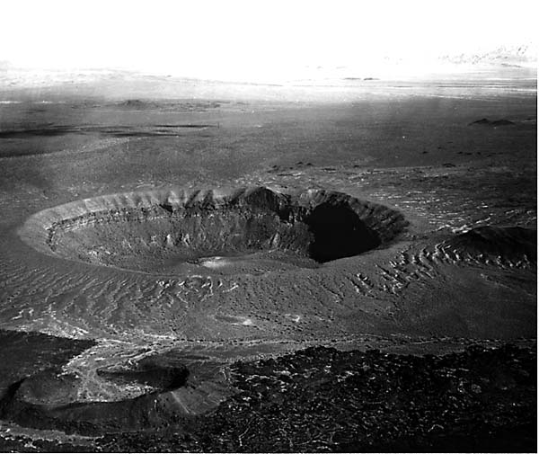 |
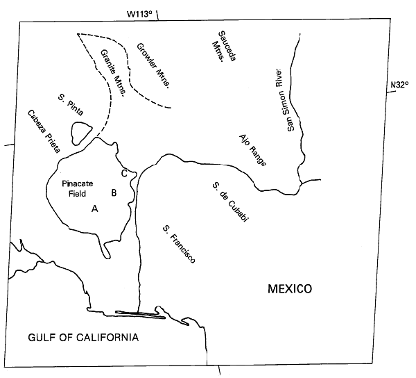
Of special interest in this field are the 10 larger ringed depressions that have been termed craters. Their names and locations are plotted on the index map, covering part of the scene, as adapted from maps in Jahns (1959). Most of these craters lie in an east-west trending zone along the northern border of the main field. Typical of these craters, although isolated off the zone, is Crater Elegante (B) (Figure V-4.2). This nearly circular depression has a maximum diameter of ~1500 m and a depth of 243 m. Its rim rises only a few tens of meters above the local level. The crater base consists of covered older volcanic rocks, followed by several basalt flows that dip gently away from the center. Overlying this is a sequence of cinder deposits, scoria, and basalt breccia, then about 50 m of tuff breccias and ash. These make up prominent rim beds that extend beyond the immediate crater, suggesting fallout and surge deposits of ejecta. Within the crater are deltaic and lacustrine deposits of volcanic debris carried into the crater when it was occupied by a small lake.
Another landmark is Cerro Colorado (C), a young tuff ring with an outer dimension of 1600 m and an irregular rim rising to 110 m on the southeast. Unlike the other craters, this one displays only a series of tuff breccias that contain volcanic bombs and occasional metamorphic and granitic rock fragments. A basalt unit lies near the base along the inner southwest wall.
These craters have been identified as maars by some investigators, implying explosive ejection as steam is generated from encounters between rising magmas and ground water. Foundering of the upper structure may have occurred as magma, on reaching the surface, vesiculated violently with escape of volatiles. Cerro Colorado resembles a Hopi Buttes type diatreme and maybe just an incomplete step in the eventual collapse sequence. The other craters probably also passed through a diatreme stage before collapse.
| Figure V-4.3 |
|---|
 |
The thermal image (band 6) of the Pinacates acquired by the TM 15 days earlier discloses several interesting phenomena (Figure V-4.3). The tonal contrast in band 5 between the (dark) volcanic field and surrounding (light) sands almost disappears in the temperature rendition. Generally, dark basalts absorb more incident solar radiation then lighter-toned rocks, and reradiated thermal energy therefore shows as higher radiant temperatures (light tones in band 6). Some of the fresher recent flow units in the eastern field indeed stand out as lighter thermal tones, but certain other dark flows do not. Individual cinder cones can be spotted in the thermal image because of bright-toned thermal highs along their Sun- facing southeastern slopes. Caption modified from comments by C. A. Wood, NASA/Johnson Space Center. Landsat 40199-17332-5, January 31, 1983.
Continue to Plate V-5| Chapter 3 Table of Contents.| Return to Home Page| Complete Table of Contents