 |
 |
|---|---|
| Plate F-15 | Map |
|
|
|---|---|
| Plate F-15 | Map |
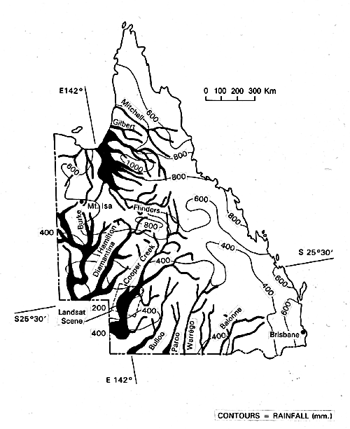
The Channel Country streams of southwestern Queensland experienced spectacular flooding in the monsoonal season of early 1974. Rainfall totals for January show that up to 1 m of rain fell in the headwaters of various Channel Country rivers. The monsoon of that year displayed exceptional strength and southward penetration. The rainfall was as much as four to six times the annual average.
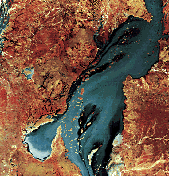
The areal extent of flooding in Queensland shows the enormity of this meteorological phenomenon and its consequences (Figure F-15.1). The extremely low gradient plainslands experienced their greatest (peak) flooding in recorded history. The 1974 maximum discharge for Cooper Creek has been estimated at Collamurra Waterhole, just over the South Australia border upstream from the settlement of Innamincka. The flow was 4000 m3/s (141 000 cfs), with a depth of 16 m in the deepest section of the channel. The mean flow velocity of 0.85 m/s was capable of transporting gravel through the reach.
| Figure F-15.1 | Figure F-15.2 |
|---|---|
 |
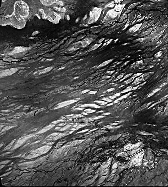 |
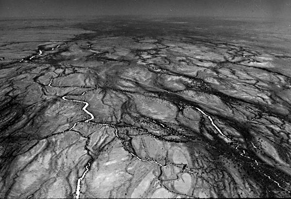
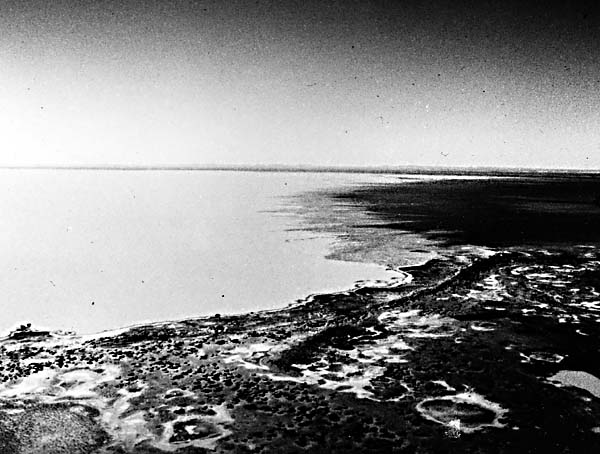
Unfortunately, the Innamincka reach is somewhat anomalous for Cooper Creek. The channel is relatively narrow and deep because it is confined in a valley of duricrust and bedrock across the Innamincka Dome, a Miocene fold. The reach shown in the Landsat scene is exceptionally broad and shallow. Floodwater has spread over a maximum width of 60 km. Flow depths are highly variable, ranging from perhaps 7 or 8 m over the deepest channels to only 1 or 2 m over extensive interchannel highs. The latter are mainly braid bars formed during past climatic conditions in which Cooper Creek was a sandy braided stream conveying a higher average discharge than at present. Figures F-15.2 and Figure F-15.3 show these relict braid bars at two times of low flow (low- altitude aerial vertical and oblique photographs). Note the anastomosing channels that comprise the active fluvial system. Figure F-15.4 shows a small area along Cooper Creek during the height of the 1974 flood.
The gradient of Cooper Creek in the study area is extremely low, approximating 0.2 m/km. Coupled with the broad shallow character of flooding, this results in very slow passage of the flood peak. The peak at the northeastern corner of the Landsat scene was observed on February 2, 1974. However, it took 13 days to reach the South Australian border, 481 km downstream. Thus, the rate of travel for the flood peak averaged 37 km per day or 1.54 km/hr. Using this figure, the Landsat scene taken on February 6 shows the flood peak in the vicinity of Lake Yamma Yamma. The falling flood stage is occurring north of Lake Yamma Yamma, and the rising stage is occurring to the south.
| Figure F-15.3 | Figure F-15.4 |
|---|---|
 |
 |
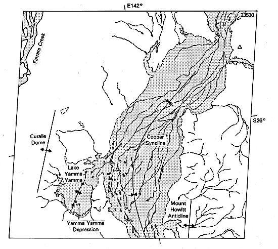
The channel of Cooper Creek is structurally controlled. Its course on the Landsat image corresponds to a broad syncline, lying on a south to northeast trend between the Mount Howitt Anticline and the Curalle Dome. These structures seem to have developed in the Miocene, deforming a sequence of Cretaceous and Tertiary sediments and associated duricrusts. Silcrete, a crust rich in silica, forms many of the resistant elements in the areas between active stream channels. The streams generally shifted as the structures formed, although Cooper Creek crosses the Innamincka Dome as previously noted.
Lake Yamma Yamma is a playa that occupies a structural depression. Floodwater entering the basin has entrained sediment from its floor, carrying it to the southwest, where it appears as a bright area on the image.
Another anomalous color feature of the image is the presence of extremely dark areas within the zone of flooding. These have a streamlined shape, and they parallel the southward flow of Cooper Creek floodwaters. C. J. Robinove (1978) of the U.S. Geological Survey has interpreted these anomalies as wet but unflooded areas of dark alluvial soil. Several high areas correspond to areas of high elevation, but other areas do not. Perhaps zones of water laden with sediment derived from the same dark soils provide some of the anomaly. Landsat 1563-23530, February 6, 1974.
Continue to Plate F-16| Chapter 4 Table of Contents.| Return to Home Page| Complete Table of Contents|