 |
 |
|---|---|
| Plate F-7 | Map |
|
|
|---|---|
| Plate F-7 | Map |
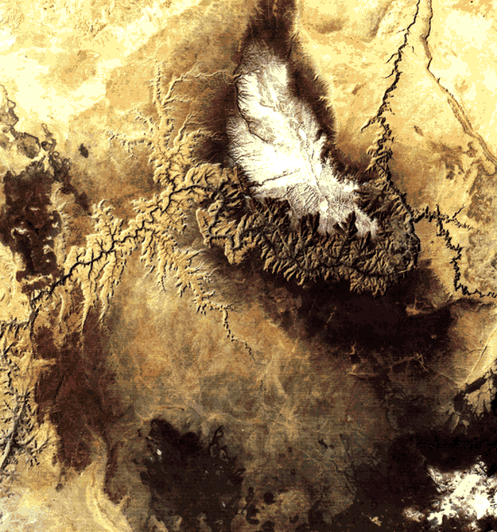
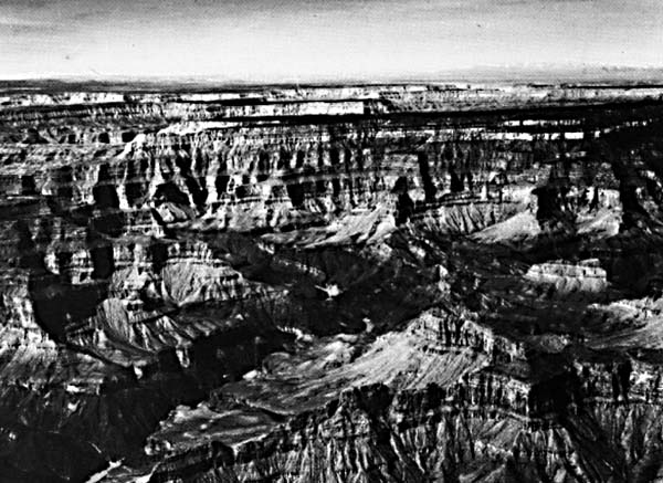
The Grand Canyon is a spectacular example of river incision. Here, the Colorado River crosses a broad upwarp of Paleozoic sedimentary rocks, reaching elevations in excess of 2700 m (9000 ft) on the forested Kaibab Plateau (here dusted with spring snow). The canyon measures 1.6 km in depth and 19 km from rim to rim. It exposes relatively flat Paleozoic sediments unconformably overlying Proterozoic sediments and Archeozoic schist and gneiss (Figure F-7.1).
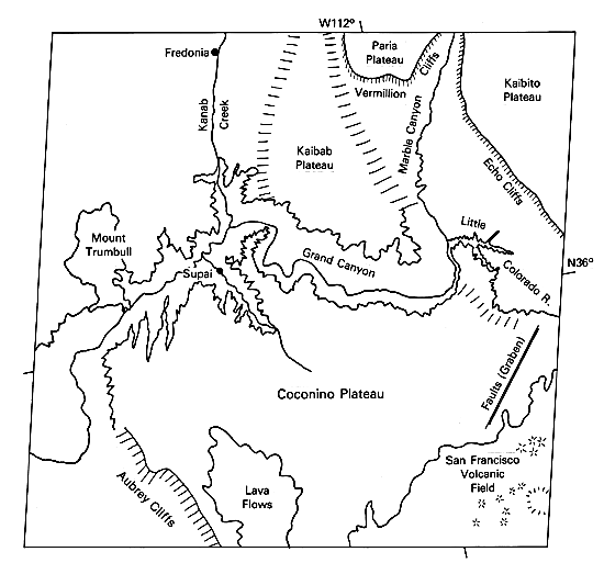
The rim of the Grand Canyon is held up by the resistant Permian Kaibab Limestone that underlies extensive areas of the Kaibab and Coconino Plateaus. Marble Canyon of the Colorado River is named for the exclusive incision into this unit (Figure F-7.2). At Echo Cliffs and Vermillion Cliffs, the brightly colored Triassic units are exposed, including the Moenkopi and Chinle Formations. The cliffs rise to massive caprocks of the Triassic/ Jurassic Glen Canyon Group, which underlies the Kaibito and Paria Plateaus.
| Figure F-7.1 | Figure F-7.2 |
|---|---|
 |
 |
Two young volcanic fields developed within the sedimentary sequence. The San Francisco Peaks at the lower right include a 3700-m high core surrounded by cinder cones. Volcanic activity occurred through the Quaternary. The youngest cones are less than 1000 years old. The Mount Trumbull/Uinkaret Plateau area at left center also includes Quaternary volcanism. Volcanic flows from this field actually entered the Grand Canyon from the north, forming a dam in the inner gorge 180 m high. The river had cut to within 15 m of its present depth when this dam formed, 1.2 ± 0.6 million years before the present.
The history of the Colorado River at the Grand Canyon is quite complex and remains unresolved. The view of Charles B. Hunt (1969) is that an ancestral Colorado River (mainly from the San Juan drainage) was antecedent to the Kaibab Upwarp. Gravels on the Kaibito Plateau show that this river was in existence by Late Miocene time. This river joined with the ancestral Little Colorado River to exit the Colorado Plateau south of the present Colorado´s course to Lake Mead.
Because of extensive basin-and-range faulting in the Miocene and Pliocene, much of the original landscape has been greatly modified. Ponding of drainage by shifting fault blocks, filling of basins with water and sediment, and spillage of water across developing divides may have all contributed to the complex history of the river downstream of the Grand Canyon. As the Basin and Range province to the west became low-lying, the Colorado Plateau rose. The immense relief of the Grand Canyon developed from this tectonic disparity, but the details of the story remain to be found.
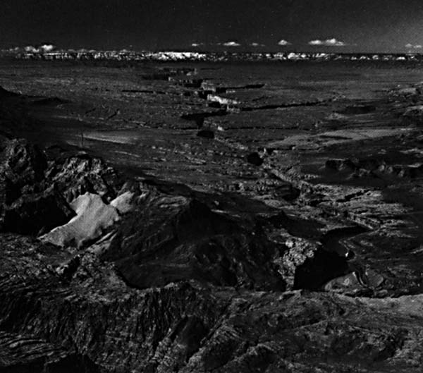
| Figure F-7.3 |
|---|
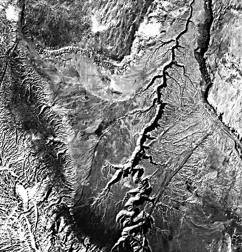 |
Figure F-7.3 is a Landsat 4 image of the Marble Canyon. Note the structural control of drainage on the Kaibab Limestone. A prominent fault scarp can be seen in the southwest quadrant of the image. It is also unusual that the tributaries appear to be barbed, forming V-junctions that point north (toward the top of the image). In fact, the river flows southward at Marble Canyon toward the Kaibab/Coconino Uplift.
The Colorado River channel falls from an elevation of about 1000 m at the northeast corner of this scene to less than 300 m at Lake Mead, 50 km west of the scene. This reach of 450 river kilometers has 161 rapids, which generate nearly all the elevation change (Howard and Dolan, 1981). The rapids are preferentially located where the river crosses regional and local fracture zones, many of which are visible on this Landsat image. Side canyon tributaries, which are mostly structurally controlled, deliver extremely coarse debris to the main canyon floor through floods and debris flows. The resulting debris fans produce rapids composed of such immense boulders that only extremely rare floods are capable of significantly altering their form. The rapids result in constricted flow in the Colorado River. The high-velocity constricted flow of the main channel induces scour, producing deep pools immediately downstream of the rapids. Pools as deep as 25 m (35 m at high flow) are generated by this process. These sedimentation and erosion features of the canyon floor are familiar to the thousands who annually visit this region through river-rafting expeditions. Landsat 1284-17384, May 3, 1973.
Continue to Plate F-8| Chapter 4 Table of Contents. Return to Home Page| Complete Table of Contents|