 |
 |
|---|---|
| Plate D-12 | Map |
|
|
|---|---|
| Plate D-12 | Map |
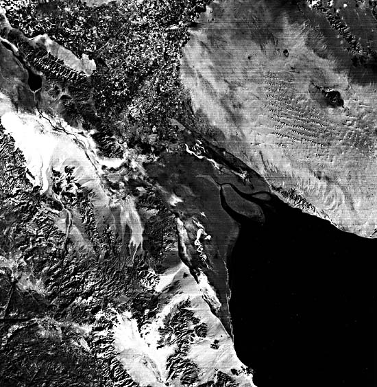
At the northern end of the narrow elongate Gulf of California, the Colorado River has been depositing sediment for centuries to form river delta. During the Quaternary alone, the delta has prograded farther into the basin to form a cone of sediment that covers more than 7700 km2. The delta is located entirely within the country of Mexico and is divided between the Mexican states of Baja California to the west and Sonora to the east.
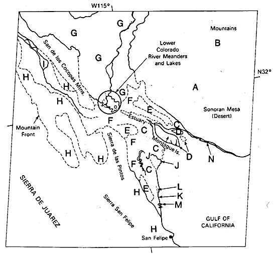
The basin into which the Colorado delta is building is bound by two major fault zones that form its east and west margins. East of the Gulf of California, a family of lateral faults has caused a small escarpment that separates the elevated (120 to 180 m) Sonoran Mesa (upper right part of the scene) from the basin. This mesa is desert land composed of relatively undisturbed Pliocene/Pleistocene strata overlain by dunes (A) and alluvium (B). The western boundary of the basin is marked by large normal faults that create an abrupt transition from the Sierra de Juarez of the Peninsular Ranges (a Mesozoic plutonic complex) to the basin floor. Three other mountain ranges of lesser importance extend into the basin (see index map). All of these ranges are located to the left or west of an imaginary dividing line up the center of the Gulf of California in Plate D-12. As is common with fault-controlled tectonic troughs, elevation changes over short distances can be extreme. In this case, relief up to 1200 m is attained in some areas over a distance of about 6.5 km; however, elevations of about 700 m are most common for the mountains that form the western boundary of the basin.
| Figure D-12.1 | Figure D-12.2 |
|---|---|
 |
 |
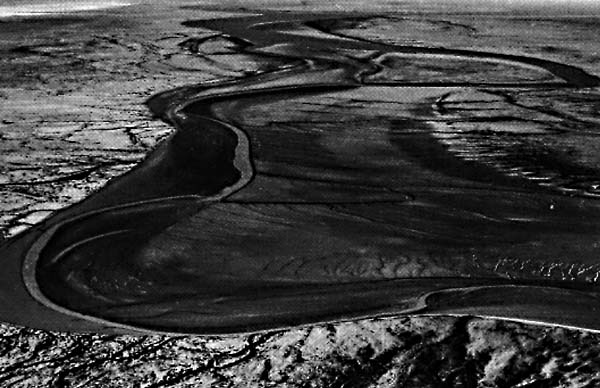
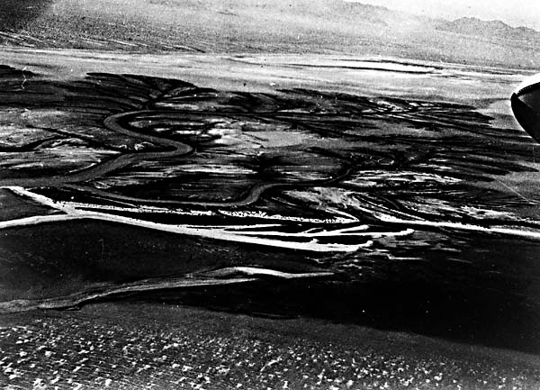
Because of the elongate configuration of the Gulf of California, the Colorado River delta deposits are subject to distribution and reworking by strong currents (over 200 cm/sec) associated with an enormous tidal range (greater than 10 m). In comparison to tidal effects, the importance of wave action in this delta is small (McGowen and Garner, 1970). As a result, a vast area of tidal flats (C) and tidal bars (D) has developed. Some tidal bars, such as Montague Island, are exposed at low tide. Others that have the same elongate shape remain subaqueous features throughout the tidal cycle. Since the entire area is arid (less than 76 to 100 mm/yr), vegetation is sparse, often allowing topographic lows in the upper tidal plain to develop into salt pans (E). When unusually high-water events occur, such as during the passage of a hurricane, marine water inundates the supratidal flat (above the influence of the normal tides), where evaporation and salt accumulation take place. In the valley fill north of the supratidal flats (F), the soil remains moist with fresh water and supports plant growth. This region is extensively cultivated (G), as is apparent in the upper left corner of the scene. The channel patterns (Figure D-12.1) are complex and show the result of modification by tidal processes. Migration of the channels is common, and at low tide, these barren sand flats are the site of small dendritic drainage channels.
| Figure D-12.3 |
|---|
 |
In addition to the sediment contributed to the basin directly by the Colorado River, erosion of the steep mountain fronts provides abundant coarse debris to form alluvial fans. Between the mountain front of the Sierra de Juarez and the San de los Cocopas Mountains to the east, alluvial fans from these respective sources have helped to form a miniature basin where a playa lake (I) has developed.
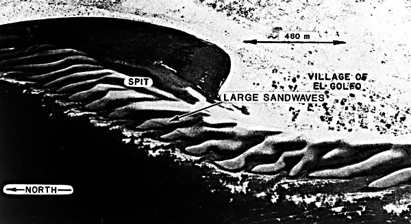
Numerous smaller scale features occur along the coast (Meckel, 1975). These include tidal channels (J), daily providing fine- grained sediment and marine water to the tidal flats; narrow sandy beaches (K); stranded beaches and beach ridges, commonly called cheniers (L); tidal deltas (M); and basinward-building coastal barriers (N), some of which have large sand waves in the intertidal zone (Figure D-12.2). In this figure, large sand waves have formed in the intertidal zone along the Sonoran coastline. Longshore currents, from right to left in the photograph, have created a spit that has effectively sealed a small coastal bay at low tide. Figure D-12.3 represents a part of the Colorado River on the Baja California side. In this photograph, waves are breaking on the thin transgressive beach in the foreground. Behind this sandy coastal ridge (chenier) are the channels of a tidal delta and its associated tidal flats. White areas in the background represent salt pans of the supratidal surface. Alluvial fans originating in Cretaceous granites form the landward margins of the supratidal environment. These coarse detrital fans are prograding across the supratidal surface. Landsat 2335- 17311-7, December 23, 1975.
Continue to Plate D-13| Chapter 5 Table of Contents| Return to Home Page| Complete Table of Contents|