 |
 |
|---|---|
| Plate C-10 | Map |
|
|
|---|---|
| Plate C-10 | Map |
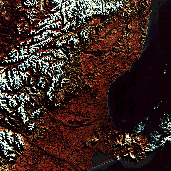
The islands of New Zealand and their adjacent submarine pedestal are continental in deep structure, but are now surrounded by oceanic crust. The coasts of the two main islands include an amazing variety of landforms, from subtropical beaches in the north to fjords in the south. This scene and the following will illustrate two adjacent regions of the South Island that have very different coastal landscapes.
New Zealand has had a long and complex geologic history, but by Late Cretaceous time, most of the former relief had been eroded away (see also Plate T-58). Individual tectonic blocks tilted and submerged and were covered by shallow-water Tertiary marine sediments that buried most of the previous rocks. By Oligocene time, the New Zealand region was almost entirely submerged. Then about 30 Ma ago, the Kaikoura Orogeny began and continues to the present time. New Zealand and Japan are similar in that most of the relief is the result of uplift in the last few million years.
| Figure C-10.1 | Figure C-10.2 |
|---|---|
 |
 |
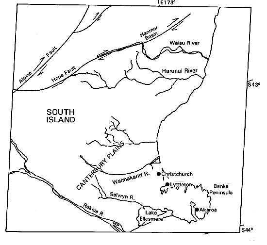
This view has three main topographic elements: (1) the snow-capped Southern Alps, the main mountain range of the South Island, with its fault-controlled glaciated valleys; (2) the alluvial Canterbury Plains; and (3) the eroded basalt dome of Banks Peninsula. The mountains are noted for active earthquakes along great right-lateral strike-slip faults, of which the Alpine Fault and the Hope Fault can be traced in the upper left part of the image. While the mountains were rising and eventually accumulating multiple mountain ice caps during the Pleistocene Epoch, the erosional debris was spreading eastward to build the Canterbury Plains. Most of the alluvium on the plains was deposited as outwash of relatively recent ice ages. The Rakaia, Waimakariri, Hurunui, and Waiau are bedload rivers, carrying mostly sand and gravel derived from glacial erosion.
The rivers deliver their massive loads to the east coast, but strong swells from the east and powerful longshore currents have prevented the building of deltas. At the time the image was made, the current north of Banks Peninsula was carrying plumes of sediment northward from the river mouths, bypassing small headlands.
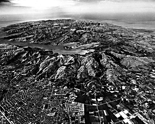
In relatively Late Pleistocene times, probably during a time of glacially lowered sea level, the volcanic Banks Peninsula was joined to the rest of the South Island by the prograding alluvial plain. The volcano was active from two major eruptive centers from about 12 to 5 Ma ago. Since then, it has been deeply eroded (Figure C-10.1). Both old calderas have been breached by erosion and are now submerged. The harbor town of Lyttleton, near Christchurch, and the original European settlement in New Zealand at Akaroa are each in one of the breached calderas.
| Figure C-10.3 |
|---|
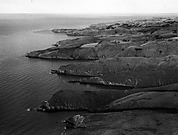 |
South of Banks Peninsula is Lake Ellesmere, a shallow lagoon enclosed by a Holocene barrier spit. A similar but smaller lagoon is barely visible at the Christchurch city waterfront. Figure C-10.2 shows accretion (beach) ridges at Birdlings Flat along the north edge of Lake Ellesmere.
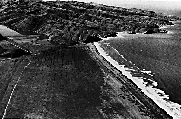
Banks Peninsula is noted for its plunging cliffs (Figure C-10.3), steep headlands with almost no abrasion platforms at their base. They reflect wave energy so efficiently that they are not being intensely eroded (Cotton, 1951). Their development is related to the multiple low sea levels of the Pleistocene Epoch, when fluvial and periglacial dissection of the basalt dome was graded to a now-submerged level. With the postglacial rise of sea level, the former subaerial cliffs were drowned as much as 35 to 55 m and now rise from water too deep to cause significant wave refraction and surf. Landsat 2192-21265, August 2, 1975.
Continue to Plate C-11| Chapter 6 Table of Contents.| Return to Home Page| Complete Table of Contents|