 |
 |
|---|---|
| Plate C-15 | Map |
|
|
|---|---|
| Plate C-15 | Map |
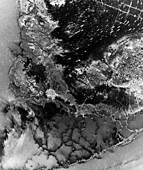
The southern tip of Florida is a limestone platform only a few feet above or below sea level. Its relation to the karstic sinkhole terrain of central Florida and to the shallow Bahamas carbonate platform beyond the deeper straits of Florida is clearly depicted in the HCMM scene shown as Figure C-15.1. For the last 100 million years, the continental crust here has slowly subsided, allowing new limestone to vertically accumulate at a net rate of 2 to 5 cm per 1000 years. During the ice ages, however, the Florida peninsula was emerged as a flat limestone plateau. Ground- water solution through the limestone produced a sponge-like karst terrain, with mazes of underground caverns and innumerable surface sinkholes (see Plate KL-4).
During the last interglacial age, about 125 000 years ago, sea level was higher than at present by as much as 6 m, and the climate was warmer than today. A warm shallow sea spread over the Florida peninsula and deposited a new layer of coralline, algal, and muddy limestone. The reef edge of most active coral growth was somewhat southeastward of the trend of the modern Florida Keys. Behind the reef, over most of Florida Bay and the Everglades, was a shallow carbonate bank, with isolated patch reefs. Just as today, hurricanes then probably tore reef limestone fragments from the reef margin and threw the abraded debris across the shallow lagoon floor. Algal-browsing fish, sponges, and boring organisms further comminuted the debris to limy mud.
| Figure C-15.1 | Figure C-15.2 |
|---|---|
 |
 |
In the last full-glacial period, culminating about 18 000 years ago, all of southern Florida was exposed a hundred or more meters above sea level. On a nearly flat surface relief (with occasional coralline mounds), the new layer of limestone developed sinkholes and caves, interconnected with older systems at depth. The area probably looked like the Yucatan Peninsula of today (Plate KL-3). Wave erosion during low sea level apparently removed the entire former reef southeast of the Keys and cut back into the back-reef and lagoon limestone.
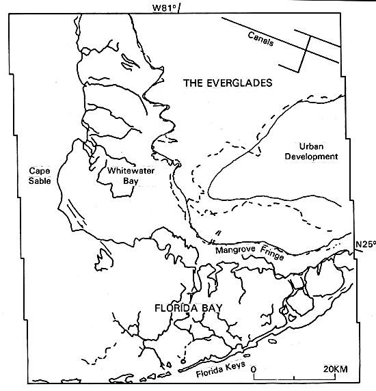
By 7000 years ago, the edges of the Florida peninsula were again being submerged. By 4000 years ago, sea level was only a few meters below its present level, continuing its slow uniform rise. The eroded limestone surface supported a distinct vegetational and sedimentational zonation, which gives the area its fascinating modern landscape. Most of the land in the image is in Everglades National Park.
Under 1500 mm of annual precipitation, the highest part of south Florida is actually a low stable dome of water centered over Okechobee, well shown north of the Everglades on the HCMM scene (Figure C-15.1). The water drains radially to the coast, impeded by the thick growth of saw grass (Juncus sp.), with no distinct channels carrying the flow. Rather, the water spreads seaward through the grass in a barely detectable current. Elongate streamlined hammocks of hardwood trees in the Everglades, which show white in the radar image, demonstrate that the major water movement in the Everglades is southward and westward in a great sweeping arc into Whitewater Bay.
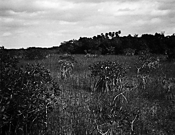
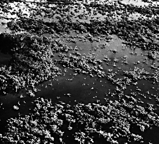
At the margin of the saw-grass prairie, sea water intrudes along tidal creeks and spreads onto the prairie surface. The salt- intolerant grasses are displaced by red mangrove (Rhizophora mangle; Figure C-15.2), which shows on the radar image as a light-colored zone.
| Figure C-15.3 | Figure C-15.4 |
|---|---|
 |
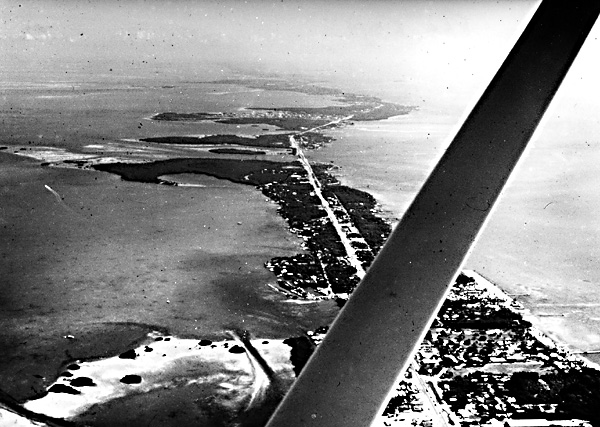 |
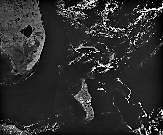
Florida is near the northern limit of coral growth, and the modern reefs are fragmentary and incomplete. The modern Florida Keys (Figure C-15.3 and Figure C-15.4) have some underwater reef tracts, but basically are only thin coral fringes and coral sand spits resting on the eroded foundation of the limestones of the last interglacial age. Behind the Keys, diverse shallow marine fauna and flora thrive in Florida Bay. Many of the organisms build limestone shells or supporting structures, while other predators destroy these frameworks. The net result is a shallow bay only 1 or 2 meters deep, with the distinctive reticulate network highlighted in the radar image of corroded algal-encrusted reef remnants separated by soft limy mud.
As sea level rises and continues to submerge southern Florida, each of the depositional environments migrates landward. The still-exposed area of last interglacial limestone is only about 1 m above sea level, but has suffered extensive urban development. Around it, peat deposits in the saw-grass prairies of the true Everglades slowly transgress onto the flanks of the exposed limestone. Simultaneously, the saline mud and peat of the mangrove swamps creep over the freshwater saw-grass peat. Finally, aided by hurricane winds and high water, the limy mud of Florida Bay is thrown onto and into the mangrove forest as the shoreline recedes. With time, the old limestone surface at any single point has been or will be covered first by a few centimeters to a meter or so of saw-grass peat, then mangrove peat and mud, and finally by shallow-water limy mud of Florida Bay. Numerous shallow boreholes in the Everglades have documented the succession, and radiocarbon dates on the basal peat confirm that the process has been continuing for at least the last 4000 years (Scholl and Stuiver, 1967). The future of terrestrial animals, including man, in southern Florida is gloomy on the time scale of the next few hundred or thousand years. But for aquatic species, from alligators to zebra fish, the future is bright. They can anticipate greatly extended environments. Seasat SAR, Rev. 809, August 22, 1978.
Continue to Plate C-16| Chapter 6 Table of Contents.| Return to Home Page| Complete Table of Contents|