 |
 |
|---|---|
| Plate C-2 | Map |
|
|
|---|---|
| Plate C-2 | Map |
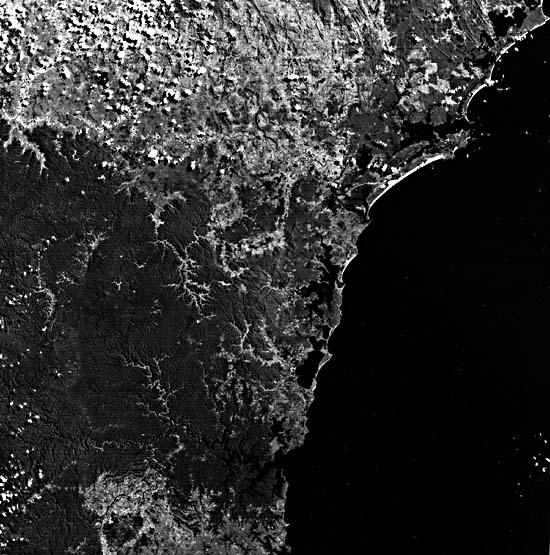
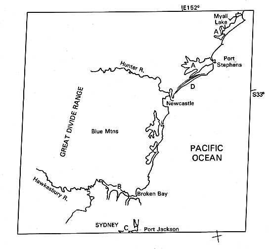
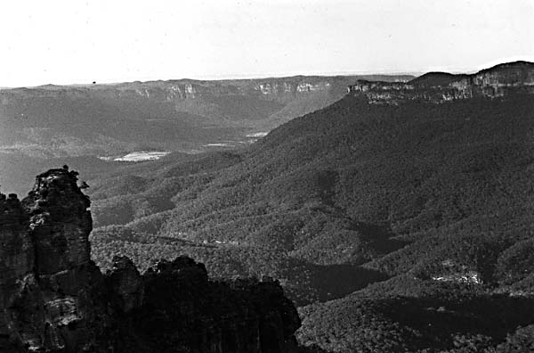
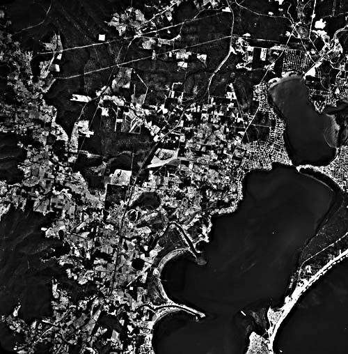
The New South Wales coast of southeastern Australia is underlain by Paleozoic and Mesozoic platform sedimentary rocks, mostly sandstones. In the northern half of this view, relief is low, valleys are broad and shallow, and the drowned entrances at the coast are also broad and shallow (A). In the south, dissection of more resistant sandstone created narrow, entrenched meandering valleys (Figure C-2.1) that, when drowned, become steep narrow branching estuaries such as Broken Bay (B). Port Jackson, the harbor of Sydney and one of the world's great harbors (D), was actually overlooked by James Cook in 1770 because of its narrow mouth.
The continental shelf off New South Wales is less than 40 km wide and is deeper than the world average. Wave energy on this coast is high. Winds from the south and southeast blow unobstructed across the Tasman Sea from New Zealand or Antarctica. The tide range is only moderate, less than 2 m.
| Figure C-2.1 | Figure C-2.2 |
|---|---|
 |
 |
The broad shallow estuaries north of Newcastle (33°S) are enclosed or protected by sand barriers of two different ages. The Pleistocene beach and dune systems date from the last interglacial time, about 135 000 to 120 000 years ago. They are soil- and vegetation-covered and are somewhat degraded by erosion. The younger beach and dune barriers are Holocene in age and show in the image by their very bright tones (D). The older beach ridges record a long period of subaerial to water and wind erosion during the most recent ice age, when sea level was much lower than at present, before the return of the sea to this coast only 6000 to 6500 years ago (Thom et al., 1981).
The beaches show a tendency to form perpendicular to the dominant southeast swell even though the rocky coast trends more nearly north-northeast. Most beaches have a zetaform, or logarithmic-spiral plan view, with sharp concave curvature immediately north of a projecting headland and a progressively more open curvature facing to the north (Figure C-2.2). The pattern can be easily explained by the refraction of waves moving onshore obliquely against the regional trend of the coast.
The drowned meandering valley of Broken Bay (B) just north of the city of Sydney is an excellent example of a subaerial valley that has been submerged by rising sea level without substantial marine modification. The same dendritic and meandering pattern can be seen upstream from the head of submergence and in the drowned part. The lower tributaries have been dismembered or betrunked by submergence so that each now enters the sea instead of the trunk river. Such a pattern, common also in Chesapeake Bay (Plate C-23), is a diagnostic feature of submergence of a fluvially eroded landscape.
| Figure C-2.3 | Figure C-2.4 |
|---|---|
 |
 |
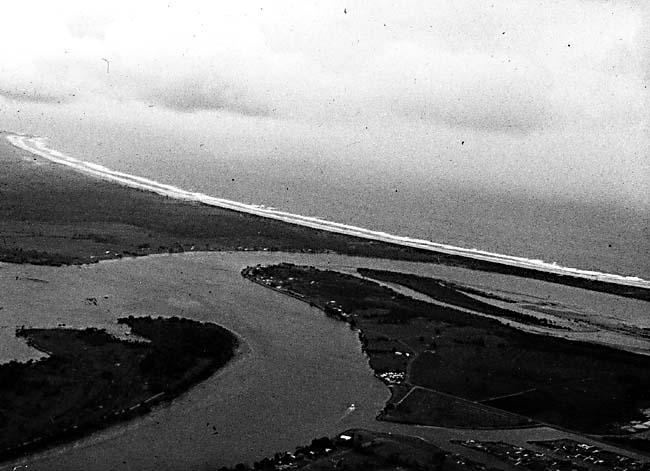
As the last ice age ended and sea level rose toward its present level about 6500 years ago, the shallower estuaries in the north developed new barrier beaches, partly from sand supplied by reworking of the older beach ridges in the embayments. The initial effect of submergence was a marine transgression, with seawater flooding into the embayments and depositing onlapping marine sediments. After a few thousand years of relatively stable sea level, younger beach ridges accreted in front of the older ones, and the coast prograded by deposition. For the last 2000 to 3000 years, the beach ridges have stabilized; sediment supply from offshore and alongshore is balanced by wind transport off the beaches into dunes. Some of the beaches are now in an equilibrium condition, poised between erosion and accretion. Figure C-2.3 illustrates this at Tuggerah Lake, a lagoon enclosed by a sand barrier, with elongate distributary levees extending along small stream channels. Vegetation-covered parabolic dunes back the northern end of the barrier beach.
In the south, the deeper narrower estuaries have accumulated fewer and smaller beaches. The coast is more irregular, with bold headlands of rock and narrower harbor entrances (Figure C-2.4). Longshore littoral transport is inhibited by the more rugged coast and deeper water immediately offshore. Landsat 2263-23003-6, October 12, 1975.
Continue to Plate C-3| Chapter 6 Table of Contents.| Return to Home Page| Complete Table of Contents|