 |
 |
|---|---|
| Plate KL-2 | Map |
|
|
|---|---|
| Plate KL-2 | Map |
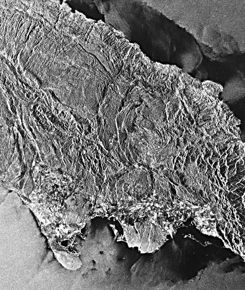
The Seasat image on the opposite page covers central Jamaica, one of the two most westerly islands of the Antillean Island Arc; the other is Cuba. This Seasat radar image has two advantages over Landsat images: (1) the radar beam at low depression angles tends to accentuate small-scale landforms, and (2) no cloud- free Landsat imagery of this tropical area is available.
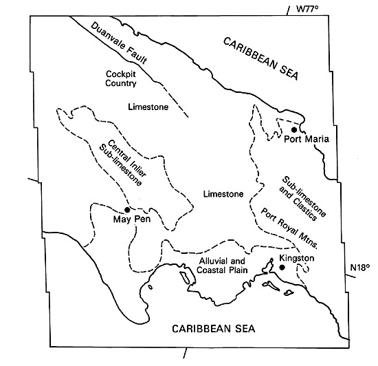
Zans (1958) divided Jamaica into two physiographic regions based on structure, the Eastern Mountain Mass and the Main Block, the latter occupying two thirds of Jamaica. The Eastern Mountain Mass consists of Cretaceous and Lower Eocene clastic rocks with mafic and felsic intrusives (Versey, 1972). The Main Block represents a dissected limestone plateau with elevated inliers of sub-limestone and clastic rocks.
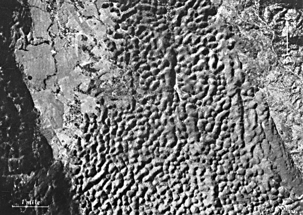
The oldest limestone unit, the Yellow Limestone Formation, was deposited over a large part of the Main Block during the Cretaceous and Tertiary strata. The Yellow Limestone consists of two impure limestone beds separated by bedded clastic rocks. From the middle Eocene to Lower Miocene, the clastic influx ceased, and the relatively pure White Limestone Formation was deposited primarily over the Main Block. The White Limestone displays the most widespread and best-developed karst topography on Jamaica (Sweeting, 1958) and can be readily identified on the image from the fine dimpled texture (see cockpit Plateaus region on index map).
| Figure KL-2.1 | Figure KL-2.2 |
|---|---|
 |
 |
The White Limestone Formation rarely exceeds 460 m thickness; however, 1500 m has been observed (Versey, 1972). Several facies of this limestone have been mapped in the Cockpit Plateaus inland from the north coast. Along the north coast lies the Coastal Series which consists largely of a raised reef. Between the Coastal Series and White Limestone is the Montepelier Formation, a fine-grained calcareous detritus or chalk consisting dominantly of planktonic microfauna. Deformation of these chalks occurred by folding with few fractures. The chalk porosity is primary; therefore, water transmission is through the body of the rock rather than along solution channels (Versey, 1972).
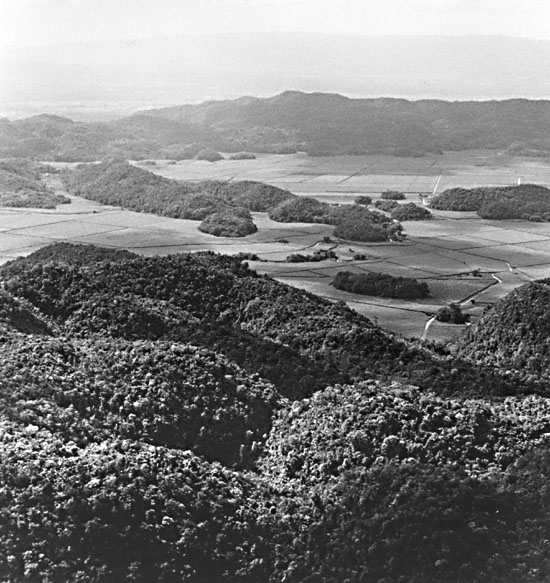
In contrast with the coastal chalk, the limestone over central Jamaica is recrystallized into a dense rock with little primary porosity. Intense fracturing, however, has resulted in secondary porosity. A third facies mapped is characterized by a nodular or rubble texture (Versey, 1972.). Most of the karst topography can be traced back to the influence of a Late Tertiary block-faulting episode that cracked the limestone units into a three-dimensional fracture system. The two dominant fracture sets, one east-west and the other north-south, have had the most influence on karstification, but an oblique secondary set of fractures has, in places, left a strong overprint (Figure KL-2.1). The Duanvale Fault (see index map), the major east- west fault shown on the image, effectively marks the northern edge of the cockpit or kegel karst topography (Michael Day, written communication, 1985).
Beneath the Cockpit Plateaus (index map), ground-water drainage is principally through solution-enlarged joints and rubble zones. Many of these separate passages coalesce to produce master conduits. On rare occasions, high intensity storms will culminate in subsurface floods. The natural plumbing system is not designed to handle unusually large volumes of water; thus, the backs up and causes radical fluctuations in the ground-water ponding and may lead to secondary surface flooding. It is quite possible that most of the work by solution is accomplished during these storm events. Corrosion is also accelerated because much of the coarse clastic debris carried off by overland flow is shuttled down through the subsurface channels.
| Figure KL-2.3 |
|---|
 |
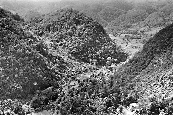
A striking uniformity of fine dimpled texture exists over a very large segment of the radar image. This texture is directly due to the development of thousands of solution doline or cockpits on the White Limestone (Figure KL-2.1 and Figure KL-2.2). Poljes with mogotes or residual karst hills can be found in northern Jamaica (Figure KL-2.3). Some controversy exists over the origin of cockpits, which nearly all exhibit solution deepening. An unanswered question concerns how much influence subsurface flow may have on their evolution. The dominating influence, however, is probably runoff and subsequent solution at the pit floor. Day (1976) found that every depression he examined in a study area along the north coast had an outlet. Very few of these outlets showed any evidence of collapse. The infiltration through these outlets was efficient, and only during intense storms did water back up and produce temporary ponds. Accelerated weathering and biologic activity generally occurs at those places that have the longest moisture residence times-in this instance, the cockpit floors. Seasat SAR Rev. 0608, August 8, 1978.
Continue to Plate KL-3| Chapter 7 Table of Contents.| Return to Home Page| Complete Table of Contents