 |
 |
|---|---|
| Plate KL-5 | Map |
|
|
|---|---|
| Plate KL-5 | Map |
The region of karst topography in Yugoslavia could rightly be called one of the type karst regions of the world because much of the pioneering work in karst began here. In fact, the term "karst" comes from the Slav word, "krs," and is associated with the limestone country in western Slovenia, Yugoslavia. Other terminology, such as doline, uvala, and polje, also originated here (Jennings, 1971).
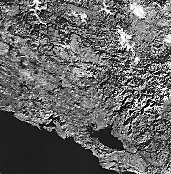
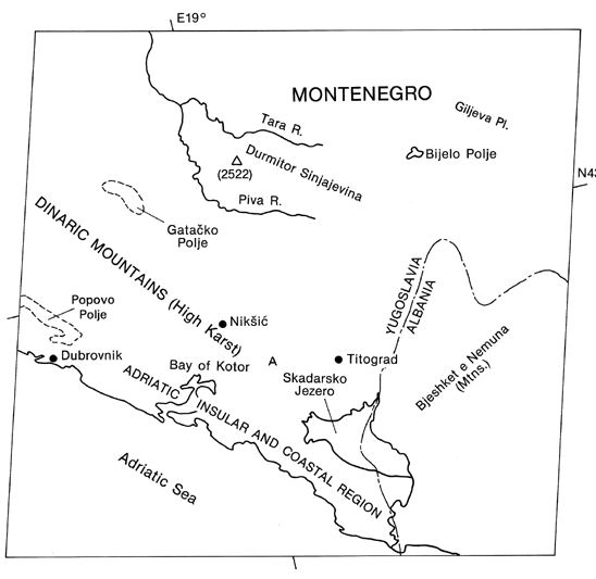
Karst landscape covers principally the southwestern third of Yugoslavia. The karst country falls into three zones based on geographic setting and hydrogeology. These zones are: (1) the Adriatic insular and coastal region, (2) the high karst region of the Dinaric Mountains, and (3) the inner region. This Landsat image of southern Yugoslavia encompasses portions of the Adriatic insular, coastal, and high-karst regions; however, only in the high-karst area, or Dinaric Mountains (see index map), can karst be recognized on the image. The Dinaric Mountains display the most developed solution topography in the country.
| Figure KL-5.1 | Figure KL-5.2 |
|---|---|
 |
 |
The karst topography can be recognized by the dimpled nature of the land surface and the lack of integrated surface drainage (A on index map). With the exception of a few streams immediately adjacent to the coast, virtually all the drainage flows to the northeast into the Black Sea. From the Landsat image, drainage in much of the high-karst region is unrecognizable.
Most of the rocks in the Dinaric Mountains are late Paleozoic and Mesozoic limestones and dolomites, representing, for the most part, a shallow marine environment. The rest of Yugoslavia (eastern two- thirds) is characterized by clastic flysch-like sediments interbedded occasionally with limestone lenses.
Structurally, the Dinaric Mountains have been interpreted in several ways: (1) a large overthrust sheet, (2) part of a mega- anticlinorium, and (3) a combination of all diastrophic disturbances (Herak, 1972). The presence of unconformities and deformed strata indicate that multiple phases of diastrophism have taken place, beginning in the Late Paleozoic and continuing sporadically through the Mesozoic era. It was not until the Late Cretaceous and Early Tertiary, however, that significant deformation and uplift had a major influence on the development of karst landforms.
Thus, the evolution of Yugoslavian karst was slow, but it continued with increasing volume and intensity with time (Herak, 1972). With each orogenic event from the Late Cretaceous on, a different system of joints, fractures, and faults shattered the carbonate rocks to develop an intricate system of pathways for percolating ground water. Folding of the strata produced separate watersheds and barriers, resulting in the impoundment and concentration of water flow. Therefore, accompanying each uplift event was a renewed phase of karstification.
| Figure KL-5.3 | Figure KL-5.4 |
|---|---|
 |
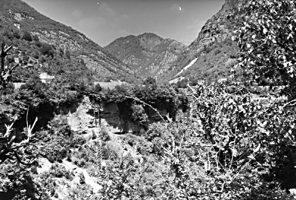 |
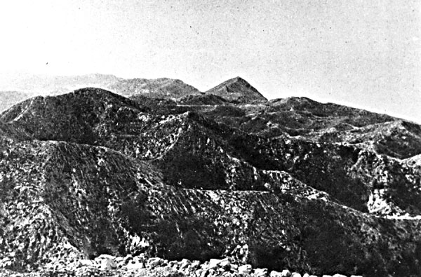
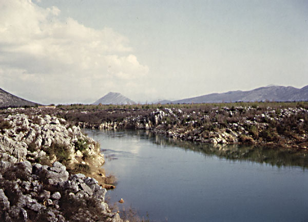
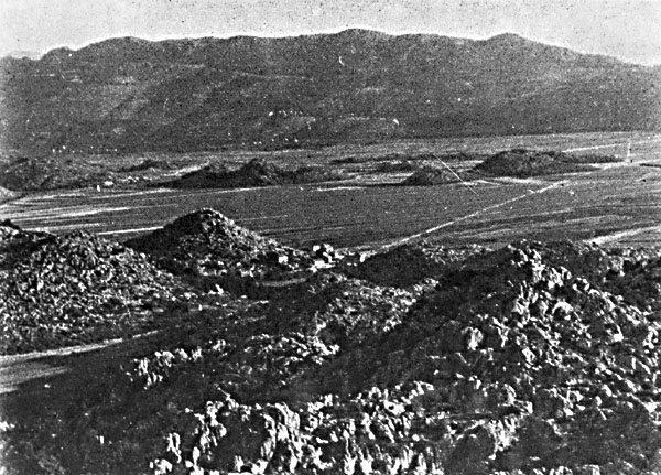
The Dinaric Mountain region is a veritable outdoor museum of karst landforms. Literally hundreds of examples of karren, dolines, pits, swallow holes (ponors), dry valleys, uvalas, poljes, karst plains, and caves are found in a variety of shapes and sizes. Because of their scale, most of these features cannot be picked out on the Landsat imagery, but collectively, they impart a unique textural signature. This signature is well displayed at "A" on the index map where the pitted, hummocky-looking surface is exposed northwest of Skadarsko Jezero (lake). The nature of this topography can be grasped from Figure KL-5.1 and Figure KL-5.2. Figure KL-5.1 shows dolines that impart a megapock-marked surface. These solution sinkholes developed in Mesozoic carbonates in the Biokovo Mountains immediately northwest of the image. Several poljes are included in the image area, but the best-developed one is the Popovo Polje (see index map and Figure KL-5.2), which displays the typical flat-floor and residual conical hills or hums on its surface. The term "hum" comes from the name of the village Hum found within the Popovo Polje (Figure KL-5.2). The side boundaries of many of the poljes are controlled by faulting. A hint of this can be seen from the northwest-southeast trend of structures associated with the Popovo Polje. Another polje, Polje Stasevica, shown in Figure KL-5.3, is located northwest of the image. Poljes may widen and coalesce to form distinct valleys such as one near Titograd (Figure KL-5.4).
The polje surfaces are frequently flooded during the autumn and winter and are dry during the summer (compare Popovo Polje (Figure KL-5.2) with Polje Stasevica (Figure KL-5.3)). The flooding cycle is highly dependent on climatic conditions and fracture solution permeability. Most of the water from the poljes infiltrates quickly to subsurface conduits where it flows freely through fracture-controlled solution channels. Water from one polje will frequently emerge in an adjacent polje only to be drawn into another subsurface hydrologic system (Herak, 1972). Landsat 1104-08595-7, November 4, 1972.
Continue to Plate KL-6| Chapter 7 Table of Contents.| Return to Home Page| Complete Table of Contents