 |
 |
|---|---|
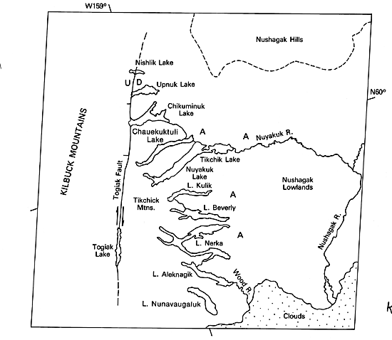
| Plate KL-7 | Map |
|
|
|---|---|
| Plate KL-7 | Map |
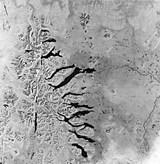
Mertie (1938) classifies glacial lakes into four categories: (1) glaciotectonic lakes (influenced by faulting or folding of surface), (2) rock-basin lakes (including tarns or cirque lakes), (3) pit lakes (kettles formed by melting of ice beneath glacial till), and (4) barrier lakes (water impounded by end moraines). This image of southwest Alaska displays examples of all four lake types. The barrier lakes dominate and can be seen to finger out of the Tikchik Mountains to the east onto the Nushagak Lowlands. These lakes are dammed by bedrock overlain by end moraines that are discernible by the broad dark-toned areas east of the lakes (area A on index map). Because of the hummocky topography of the moraines at the eastern ends of the lakes, overflow channels have developed between lakes (e.g. note the channel between Lake Kulik and Lake Beverly).
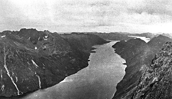
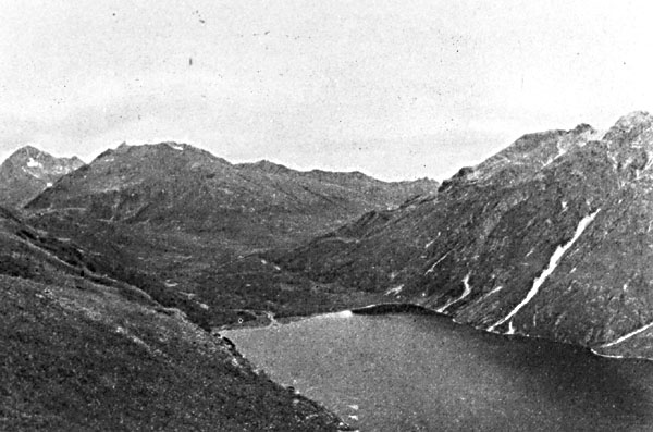
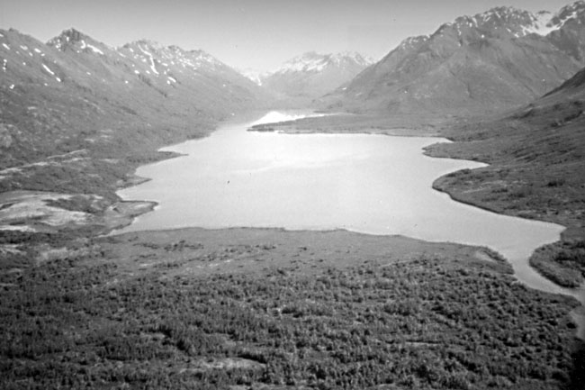
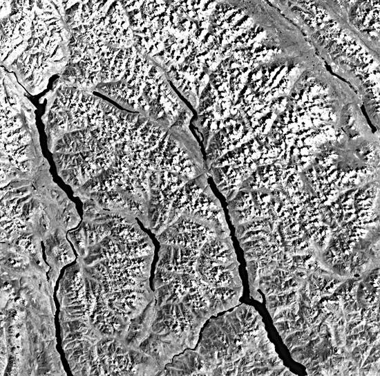
These finger lakes (Figure KL-7.1) are similar to the finger lakes of New York State. Nuyakuk Lake, Alaska, and Seneca Lake, New York, for example, are similar in shape and area (both approximately 175 km2); however, they differ in depth (284 and 189 m, respectively). Curiously, many of the finger lakes in both Alaska and New York have a boxed or rectangular shoreline at the lake head, as can be seen on the northwest end of Lake Nerka (Figure KL-7.2). This is apparently due to the development of a delta across the valley floor.
| Figure KL-7.1 | Figure KL-7.2 |
|---|---|
 |
 |
Togiak Lake (Figure KL-7.3) is situated along the Togiak Fault and is an example of a glaciotectonic lake. The Togiak Fault is a major right lateral strike-slip fault (a continuation of the Denali- Farewell Fault) and shows evidence of recent activity (Hoare and Conrad, 1978). The lake lies at the northern end of a pull-apart basin into which the Quaternary alkali basalts were erupted (mostly south of the image area).
Rock-basin lakes are generally too small to be resolved by Landsat´s multispectral scanner system, but careful examination of the image, especially west of the Togiak Fault in the Kilbuck Mountains, reveals a number of larger tarns occupying cirques.
Pit lakes or kettles appear on the image as small lakes scattered about in the morainal deposits to the east of the finger lakes. Figure KL-7.1 shows a few of these lakes on the far side of Lake Chauekuktuli. Note the split-like projections (Figure KL-7.1) that mark one of the more recent end moraine deposits and glacial standstills.
The size of these finger lakes indicates that, during the Pleistocene, the Kilbuck and Tikchik Mountains supported a vast ice field that has since disappeared. There are still, however, a few remaining small active glaciers in the northern Tikchik range.
| Figure KL-7.3 | Figure KL-7.4 |
|---|---|
 |
 |
Mertie (1938) finds evidence of ice action high above Nuyakuk Lake, the largest finger lake, indicating an ice thickness of at least 900 m at the lake site during maximum glaciation. He also estimates that the ice moved eastward 65 km from the head of the lake. All outwash channels at that time drained east and south across the Nushagak Lowlands. As the glaciers ablated, the residual moraines altered the drainage and produced the dams that confined the lakes. A multitude of lake terraces of varying heights, ranging from 2 to 20 m above the present lake levels, suggest a complex adjustment of postglacial drainage.
The Nushagak Lowlands to the east of the finger lakes is blanketed with glacial outwash. The lowlands are underlain by nonresistant Cretaceous flysch in a structurally low region between the Tikchik Mountains and the Alaska Peninsula. The Tikchik and Kilbuck Mountains are underlain by a structurally complex assemblage of highly indurated volcanogenic rocks of prehnite-pumpellyite metamorphic facies (Steve Box, 1985, written communication). North of Nuyakuk Lake, the rocks are primarily interbedded volcanogenic graywacke and argillite of Mesozoic age (Steve Box, 1985, written communication). The structure is complex, and the lakes only locally follow the strike of bedding. Faults, cleavage, and regional jointing also influence the trends of the finger lakes.
Finger lakes are common in other mountainous regions where glaciation has widened and straightened preglacial drainage valleys. Some of these lakes can be remarkably long, as are Upper and Lower Arrow Lakes and Kootenay Lake, in southern British Columbia (Figure KL-7.4). Landsat 1018-21200-6, August 10, 1972.
Continue to Plate KL-8| Chapter 7 Table of Contents.| Return to Home Page| Complete Table of Contents