 |  |
|---|---|
| Plate E-11 | Map |
| |
|---|---|
| Plate E-11 | Map |
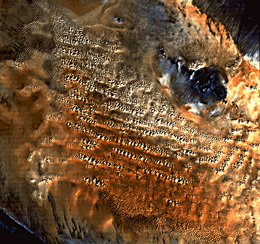
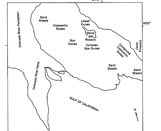
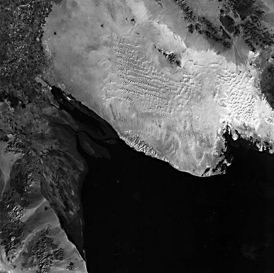
The color Plate on the opposite page is an enlargement of part of a full Landsat TM image showing the Sonoran Desert of northwest Mexico and the adjacent Gulf of California. To set the context, the full scene, hereafter referred to as the "Plate scene," is reproduced at a smaller size below the color enlargement, along with an index map for the entire scene. The enlargement vividly portrays the details that be extracted from TM images after additional computer processing.
The 310 000-km2 Sonoran Desert has more than 3800 km of sea coast. Considerably more than one half of the desert is within 80 km of a coast (Crosswhite and Crosswhite, 1982). According to these authors, the Gulf of California, bottom right in the Plate, was formed in the center of the present Sonoran Desert by tectonic rifting of the San Andreas fault system about 12 Ma ago. Faulting and tectonism created the basin and range topography characteristic of the Sonoran Desert (this Plate and Plate E-12) and of the Great Basin Desert (Plate E-13).
The present Colorado River delta forms inland from where the river empties into the Gulf of California (Plate D-12). The Gran Desierto sand sea lies in a basin about 60 m deep east of the Colorado River. Northwest-southeast-oriented mountain ranges typical of the Basin and Range Province stand both west of the Colorado River floodplain and east of the sand sea. The ranges are sharp-peaked and have broad alluvial fans.
| Figure E-11.1 | Figure E-11.2 |
|---|---|
 |  |
Most of the rocks underlying the Gran Desierto are of igneous origin. The Sierra Pinacate, part of which appears along the right margin of the full scene (Figure E-11.1) from which the color Plate is extracted, is a large field of volcanoes (see Plate V-4). As summarized by May (1973), the Pinacate is of Quaternary age with small sections containing rocks of Tertiary age. Eruptive activity continued into the Holocene, but the field is presently dormant or possibly extinct. Cerro Pinacate, a ring just visible in the Plate, reaches an elevation 1000 m above the alluvial plain that surrounds the volcanic field.
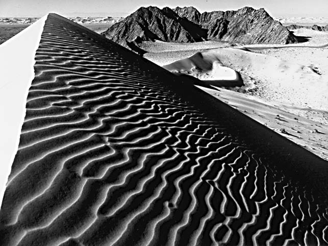
The sand sea overlies lava beds. According to May (1973), lava outcrops are constantly being buried or exposed on the sand sea as the winds shift. The Sierra del Rosario within the sand sea is about 25 km long and 5 km wide. The range consists of granite with pegmatite dikes (May, 1973). The dunes around the Sierra del Rosario average 180 m in height (May, 1973). Simple, compound, and complex star dunes dominate the area. The complex star dunes southwest of the Sierra del Rosario consist of three to four arms and lineup in a linear array. Below the southernmost linear-star dune array and on the one directly above it, crescentic and linear dunes are visible in the color image on the south-trending arm of the dune. Small linear and crescentic dunes lie in the interdunal areas. Simple star dunes are north and northwest of the complex dunes. Ripples on one of the star dunes appear in Figure E-11.2.
| Figure E-11.3 | Figure E-11.4 |
|---|---|
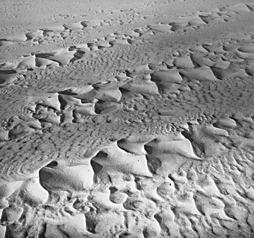 | 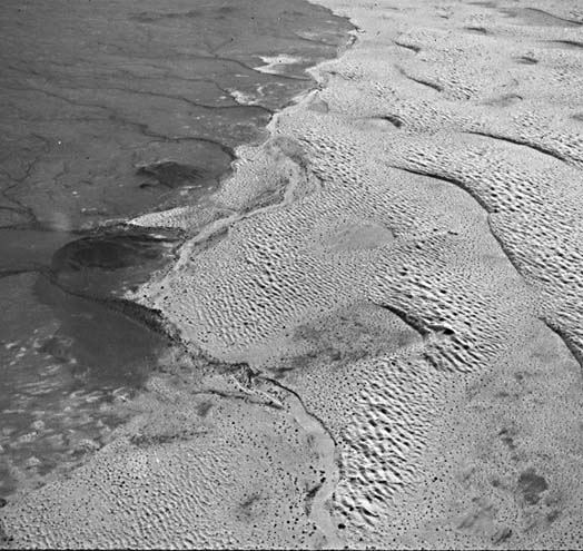 |
Figure E-11.3 shows rows of simple three-armed star dunes. Note the parallelism of the arms from dune to dune. Between the rows are compound transverse dunes of low relief. This dune array grades eastward into patterns of complex crescentic dunes crested with small star dunes. Still farther east near the Pinacate Field, they merge with compound crescentic dunes (Greeley et al., 1985).
Small linear dunes are distributed within the sand sheets north of the Sierra del Rosario. Isolated small star dunes also occur there. The change in dune orientation among the clusters reflects the change in wind direction due to elevation changes near the range. Proceeding west, these dunes grade into very small simple crescentic dunes close to the limit of resolution of the TM image.
Figure E-11.4 is an oblique aerial photograph showing the borders of the lava flow of the Pinacate lava field and the sand sea. This figure is just off the right center of the Plate scene. The compound crescentic dunes are superposed with compound transverse dunes. The southwest boundary of the lava shows a mixture of bright eolian material and dark volcanics. Eolian sediments cover the lava flow as a gradually thinning mantle (Greeley et al., 1985). Landsat TM 40174-17392-7, January 6, 1983.
Continue to Plate E-12| Chapter 8 Table of Contents.| Return to Home Page| Complete Table of Contents