 |
 |
|---|---|
| Plate E-19 | Map |
|
|
|---|---|
| Plate E-19 | Map |
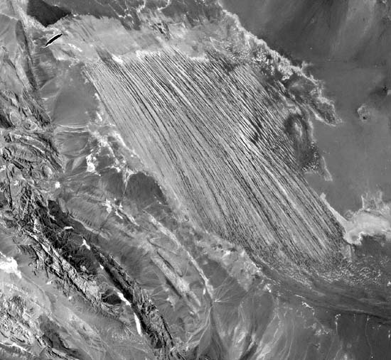
The Lut Basin in southeastern Iran contains several ancient interior drainage systems separated by low ridges and residual mountains. Selivanov (1982) describes the recent paleoclimatology as alternations of wet and dry periods. He contends that these alternations, coupled with tectonic compression of the basin fill sediments into scarcely perceptible folds, resulted in unusual types of relief being formed during the second half of the Quaternary.
The yardangs up to 80 m high of the western Lut Desert, in the center of this Plate, are among the largest yardangs on Earth. They are carved out of the Lut Formation, a fine- grained horizontally bedded silty clay and limy gypsiferous sands with an estimated thickness of 135 to 200 m. Salt, gypsum, and silty clay encrust the unit (Krinsley, 1970).
These yardangs were described by Gabriel (1938) as deposits from Lut Lake that resemble desert cities separated by "boulevards." He notes that no erosion channels on the ground and no evidence of water erosion are found and that "the surface of the land had been formed merely by the wind" (p. 198).
| Figure E-19.1 | Figure E-19.2 |
|---|---|
 |
 |
The yardangs trend north-northwest, parallel to the prevailing winds, and are separated by 100 m or more of troughs. According to McCauley et al. (1977), the surfaces of the yardangs are covered by a layer of gypsiferous clay 10 to 15 cm thick. This clay layer swells when wet and prevents rainwash from penetrating the pronounced running-water- eroded gullies on the flanks of the yardangs.
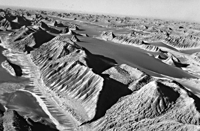
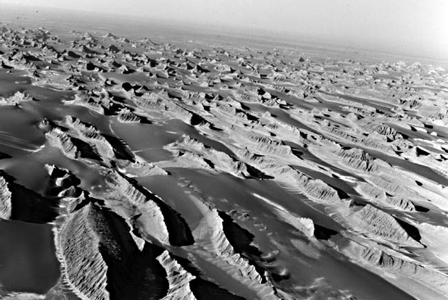
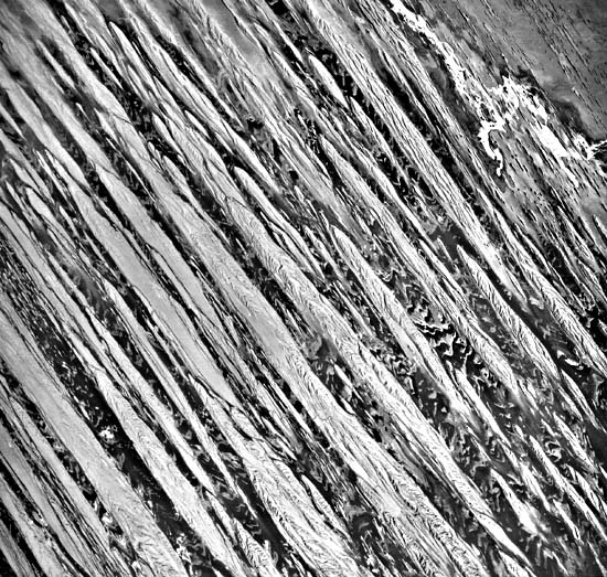
As shown in Figure E-19.1 and Figure E-19.2, oblique aerial photographs, only the broadest yardangs have flat or rounded summits. In the other yardangs, the ridges are narrow. Most of the yardangs in the foreground of Figure E-19.2 have similar widths. Figure E-19.3, a vertical aerial photograph of 10 km of the Lut yardangs, shows some of the relief on top of the yardangs. The spacing between many of the yardangs appears to be regular. On some of the yardangs, the horizontal bedding of the Lut Formation may be seen on the gullies.
| Figure E-19.3 |
|---|
 |
Note the small, scattered crescentic dunes on the troughs to the right of and behind the front central yardang in Figure E-19.2. The orientation of the dunes parallels the orientation of the yardangs, which suggests that the wind was coming from the direction of the foreground of this photograph. The salt stains in the furrows on the front yardang at the far left in this figure indicate that the floor of the yardang area has been . This is mentioned by Dresch (1968), who notes that the base of the convex ridge slope makes a steep angle with the floor due to erosion from periodic floodwaters. The waters from the north penetrate the furrows and sap the base of the slopes to a height of 1 to 2 m.
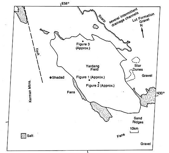
As noted in the index map, the yardangs are bounded on the west by alluvium from the Kerman Mountains. Thrust faults and fractures cut through the Mesozoic sedimentary rocks in this range. The plateau of the Lut Formation bounds the field on the north and east. Buttes and small yardangs north of the field are separated from the Lut Formation by a scarp. Salt playas locally surround the yardang area. Their boundaries are actually mobile zones that shift with each flooding (Krinsley, 1970). The elongated salt-crusted playa southeast of Shahdad, in the left center of the Plate, is flooded periodically.
A few star dunes are found east of the yardang field. Star dunes are believed to form in areas where effective winds blow from several directions. Therefore, evidence exists for two wind regimes, an early strong NNW-SSE regime that created the yardangs, followed by a more recent multidirectional wind regime that created the star dunes. The relief of the yardangs probably controls the wind regime among the yardangs to create crescentic dunes, although star dunes exist above the yardang field. Southeast of the Lut Desert, yardangs are sand ridges that Krinsley (1970) believes are derived from materials excavated from the furrows between the yardangs. The sand ridges terminate in a sand sea in eastern Lut Desert, which can be seen on Plate E-20. Landsat 2592-05510-7, September 5, 1976.
Continue to Plate E-20| Chapter 8 Table of Contents.| Return to Home Page| Complete Table of Contents