 |
 |
|---|---|
| Plate G-12 | Map |
|
|
|---|---|
| Plate G-12 | Map |
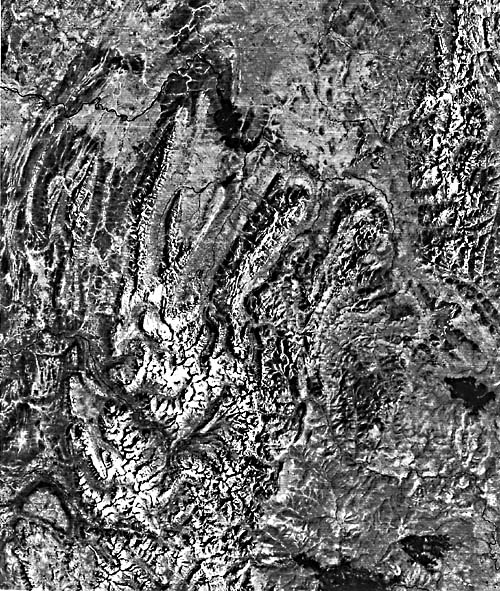
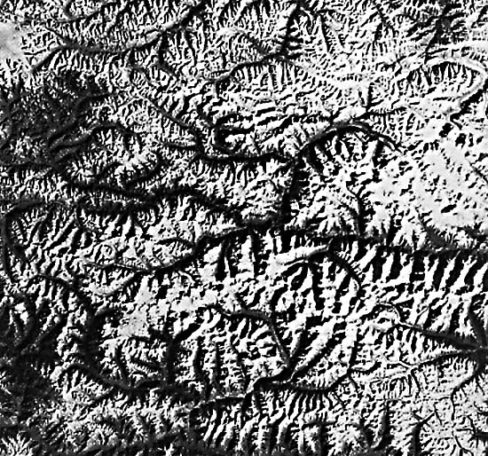
A cirque is "a deep steep-walled half-bowl-like recess or hollow, variously described as horseshoe- or cresent-shaped or semi-circular in plan, situated high on the side of a mountain and commonly at the head of a glacial valley, and produced by the erosive activity of a mountain glacier" (Bates and Jackson, 1980). During an active period of glaciation, a cirque is occupied by a cirque glacier or by the head of a valley glacier (see Plate G-8 and Figures G-8.1 and G-8.2). An arête is "a narrow serrate mountain crest or rocky sharp-edged ridge or spur, commonly present above the snowline in rugged mountains (as in the Swiss Alps) sculpted by glaciers, and resulting from the continued backward growth of the walls of adjoining cirques" (Bates and Jackson, 1980) (see also Figures 9-20, G-8.2 and G-12.1). A horn is"a high rocky sharp pointed peak with prominent faces and ridges, bounded by the intersecting walls of three or more cirques that have been cut back into the mountain by headward erosion of glaciers" (Bates and Jackson, 1980) (see Figures 9-20 and G-8.2.). An excellent discussion of the origin of cirques, arêtes, and horns is found in Embleton and King (1975a).
This Plate is a Landsat image of a part of the Ural Mountains of the Soviet Union showing the characteristic scalloped pattern of numerous cirques, some of which contain cirque glaciers. The intercirque ridges on the mountain sides and mountain crests have been eroded into the knife-like ridges (arêtes). Where three or more arêtes intersect, horns are present. The cirques, and associated arźtes and horns, can be readily identified on Landsat and other satellite images or photographs of equivalent or better spatial resolution (see also Figure G-26.2).
| Figure G-12.1 | Figure G-12.2 |
|---|---|
 |
 |
According to Horvath (1975), the Ural Mountains (Ural´skiy khrebet) contain a core of crystalline rocks with folded Paleozoic and Mesozoic rocks on the west. The area of the Ural Mountains included in this Plate is called the Subpolar Urals (Pripolarnyy Ural) with the highest mountain peak, Gora (Mount) Narodnaya, reaching 1894 m in elevation. The index map locates a few of the numerous cirques, arêtes, horns, and cirque glaciers that can be delineated on Plate G-12.
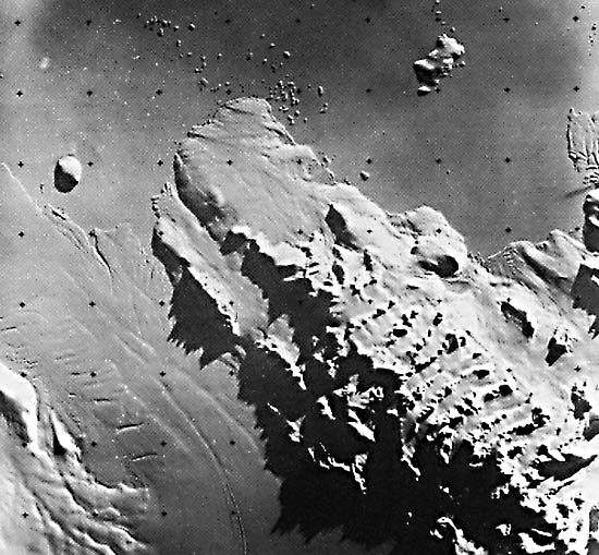
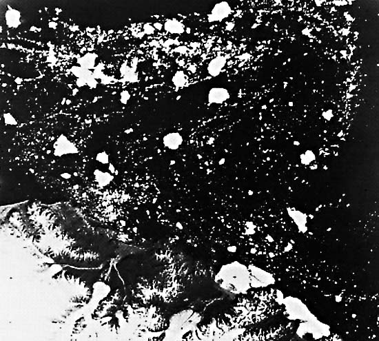
Figure G-12.2 is a Landsat-3 RBV image of part of the northern coast of East Antarctica (40°29´S, 162°31´E) showing the northern part of the Bowers Mountains (peninsula) and the eastern part of the tidal terminus of the Rennick Glacier (Williams et al., 1982). The image was acquired at a solar elevation angle of only 6°. This low Sun angle highlights the subtle morphological details on the glaciers, such as crevasses and flow features, the topography of the peninsula, and the group of icebergs surrounded by sea ice offshore from the tip (Cape Cheetham) of the Stuhlinger Ice Piedmont. According to Armstrong et al. (1973), an ice piedmont is a variation of the piedmont glacier (Plate G-7) and is defined as "ice covering a coastal strip of low-lying land backed by mountains. The surface of an ice piedmont slopes gently seawards and may be anything from 1 to 50 km wide, fringing long stretches of coastline with ice cliffs. Ice piedmonts frequently merge into ice shelves [see Plate G-2]." Of particular interest are the shadows cast by the arêtes along the ridge crests on the western side of the peninsula. The solar azimuth angle is 65°E; because the ridges trend about 10°W, the illumination is nearly at right angles. The jagged nature of the arête landform is clearly evident in the shadows that are cast on the Rennick Glacier.
| Figure G-12.3 |
|---|
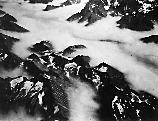 |
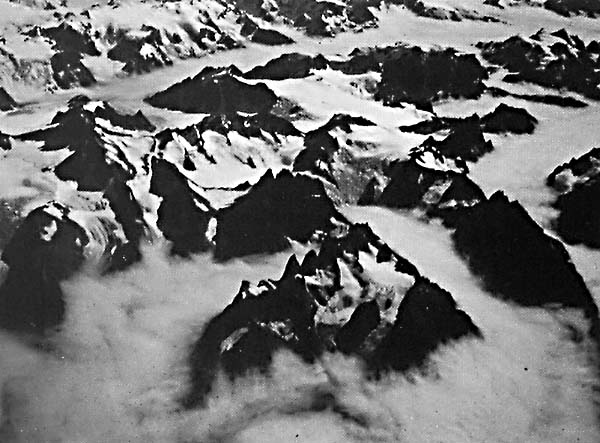
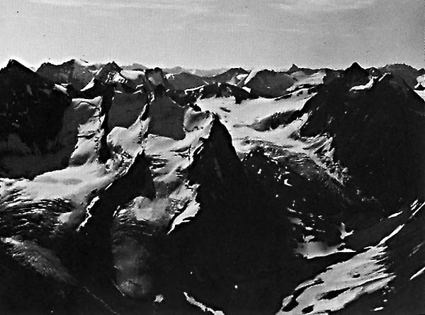
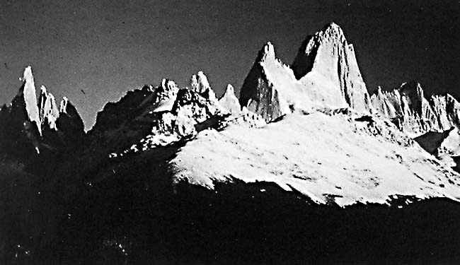
Figures G-12.1 and G-12.3 are a pair of oblique aerial photographs of cirques, cirque glaciers, arêtes, and horns that are characteristic of the southeastern coast of Greenland and often visible to airline passengers flying the Great Circle route between eastern United States and northern Europe. Fog banks fill most of the valleys in the two photographs. Figure 9-19 is a view of an ice-sculpted massif in the Patagonian region of South America. Compare the geometry of the shadows cast by the arêtes on Figure G-12.2 with Figures G-12.1, G-12.3, and 9-19. Landsat 1330-07040-7, June 25, 1973.
Continue to Plate G-13| Chapter 9 Table of Contents.| Return to Home Page| Complete Table of Contents|