 |
 |
|---|---|
| Plate G-20 | Map |
|
|
|---|---|
| Plate G-20 | Map |
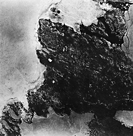
Located in the District of Franklin, King William Island presents glacial landforms typical of the Canadian Arctic Lowlands. The island had been totally glaciated during the Wisconsinan glaciation, leaving numerous glacial landforms related to major continental ice flows, stagnations and retreats of ice fronts, and later glacier surges. At the beginning of the Holocene, the entire island (highest elevation 30 m above sea level) was submerged by the sea, which reworked the original glacial landforms, washed the fine sediments from the prominent formations, and redeposited them in low-lying areas. The present vegetation belongs to the mid-Arctic ecosystem, and its distribution is closely related to drainage conditions.
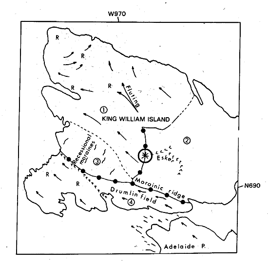
The bedrock formations consist essentially of carbonate rocks-limestone, dolomite, sandy limestone, and sandy dolomite of Ordovician and Silurian age. Outcrops consisting of flat-lying beds 10 cm to 1 m thick are frost-shattered to a depth of several meters and are rubbly on the surface. Major rock outcrops are identified by "R" on the index map.
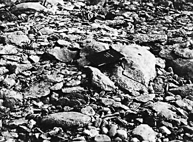
Unit 1 on that map shows flow patterns of continental glaciers. The ice-flow landforms (fluting and drumlins) consist of long ridges, commonly separated by elongated lakes that parallel the ridge crests, which indicate that ice advanced from the southeast, separating into northwest and northeast flows on either side of a major bedrock prominence. Northwest flow is believed to be the older of the two advances because some of the fluting forms southeast of the bedrock area have been overridden by northeastward flow. On the north tip of the island, the landforms show ice-flow transverse to flows south of the bedrock prominence. Large unvegetated areas (light tones on the Landsat imagery) are due to the removal of fine-grained materials by wave action during retreat of the sea, leaving a blanket of coarse-grained material unable to retain sufficient humidity to support vegetation. Figure G-20.1 is a close view of an unvegetated end-moraine ridge; although the boulders on the ridge are generally frost-shattered, a number of rounded rocks, shaped by wave action during the marine recession, are still intact. Because they are both composed of frost-shattered carbonate rocks, it is often difficult to differentiate bedrock ridges from till ridges.
| Fig G-20.1 | Figure G-20.2 |
|---|---|
 |
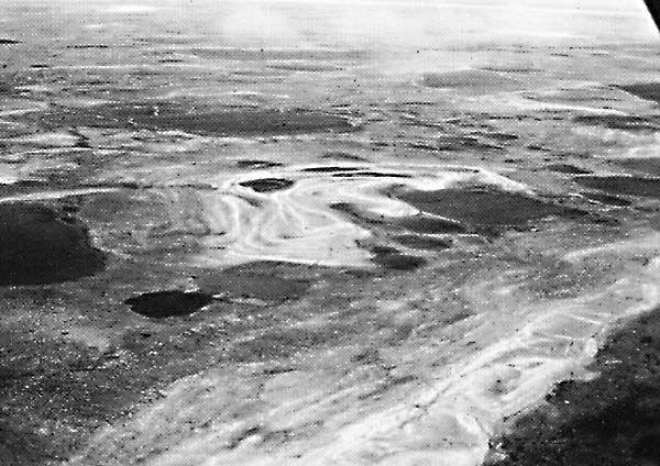 |
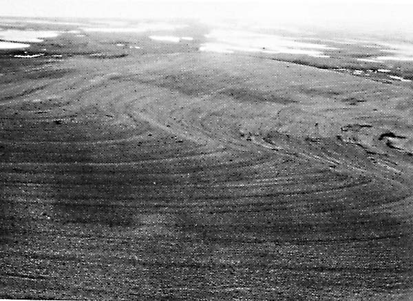
Unit 2 covers an area of massive ice stagnation. The area is covered by a blanket of hummocky till containing numerous subcircular lakes. The poor drainage, due to the lack of relief and the presence of fine material, favors the presence of vegetation over most of the area. A large end moraine separates the southeast part of the stagnant ice topography from the fluted terrain of units 1 and 4. Note that the southern arm of the moraine has been reworked by the younger ice surge described in unit 4. Figure G-20.2 is an aerial view of the contact between the moraine and eskers (identified by an asterisk on the index map), the highest point on the island. Several levels of beaches were formed on the slopes of the morainic ridge during the marine regression (Figure G-20.3). The circular lakes on the foreground of the moraine (G-20.1) are typical kettle lakes formed by the collapse of drift over melting blocks of stagnant ice.
Unit 3 comprises several small ridges formed during a retreat of an ice front. The low-relief undulating ridges oriented in a southwest-northeast direction indicate that the ice front retreated toward the southeast. These recessional moraines were formed by successive retreats and stabilization of the ice front, the ridges corresponding to stable ice fronts and the troughs to ice recessions. Some of the older ice-flow patterns (similar to those of unit 1) are still visible underneath the more recent recessional moraines.
| Fig G-20.3 |
|---|
 |
Unit 4 corresponds to a later glacier surge flowing in a northwest direction. The drumlin field on Adelaide Peninsula (southeast of the Landsat imagery) and northeast part of King William Island shows that the glacial flow was deflected to a more westerly direction as the glacier impinged on the frontal moraine that separates units 2 and 4. The drumlins are composed of till with a matrix that is fine enough to retain enough moisture to support vegetation. The low areas between drumlins, as well as the base of the drumlins, are covered by wet marine sediments. The drumlin field is bounded by a large rock outcrop located at the southwest tip of the island (light tone on the Landsat imagery). On the rock outcrop, the ice-flow features change slowly to more gravelly flutings that are unable to support vegetation, which explains their lighter tones.
Because of the cold and semiarid conditions on King William Island, the vegetation is dependent on the nature of the soils and the drainage conditions. This strong control of vegetation patterns by even slight differences in soil moisture in this severe arctic environment facilitates the geological interpretation based on Landsat imagery by enhancing tonal differences among various landforms and soil types. Fieldwork and low-altitude air photography are still necessary for a detailed geomorphological study of King William Island, but the use of Landsat imagery permits the reconstruction of several phases of the Wisconsin glaciation by providing an overall view of the various glacial landforms. (GCW: J. R. Belanger) Landsat 20914-17165, July 24, 1977.
Continue to Plate G-21| Chapter 9 Table of Contents.| Return to Home Page| Complete Table of Contents|