 |
 |
|---|---|
| Plate G-24 | Map |
|
|
|---|---|
| Plate G-24 | Map |
A kettle lake is defined as "a body of water occupying a kettle, as in a pitted outwash plain or in a kettle moraine" (Bates and Jackson, 1980). A kettle is defined as "a steep-sided, usually basin- or bowl-shaped hole or depression, commonly without surface drainage, in glacial-drift deposits (especially outwash and kame fields), often containing a lake (kettle lake) or swamp; formed by the melting of a large detached block of stagnant ice (left behind by a retreating glacier) that had been wholly or partly buried in the glacial drift. Kettles range in depth from about one meter to tens of meters and in diameter to as much as 13 km ...."(Bates and Jackson, 1980).
| Fig G-24.1 | Figure G-24.2 |
|---|---|
 |
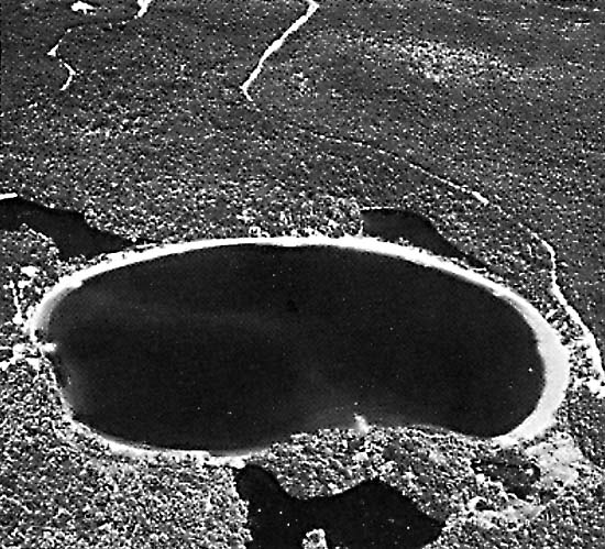 |
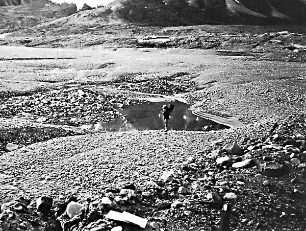
Figure G-24.1 shows a typical modern kettle still actively forming in an outwash plain of the upper Schuchert Dal of eastern Greenland. This kettle still contains part of the ice block whose melting is creating the depression. Kettle lakes are common features in the morainal and outwash deposits of surging glaciers because, after the surge is completed, a large area of fractured glacier ice becomes stagnant, usually for one or more decades until the next surge event.
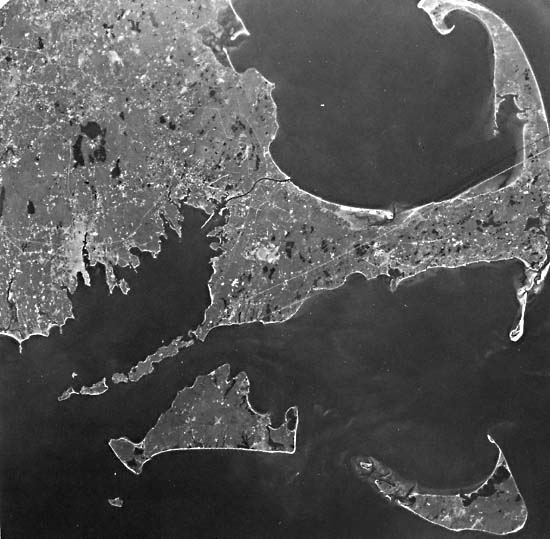
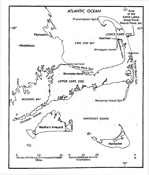
This Plate is a Large-Format Camera (LFC) photograph (STS Mission 41-G) of the Cape Cod, Massachusetts, area and environs. The index map for southeastern Massachusetts locates the principal geographic place-names and areas of kettle lakes discussed in the text.
| Fig G-24.3 | Figure G-24.4 |
|---|---|
 |
 |
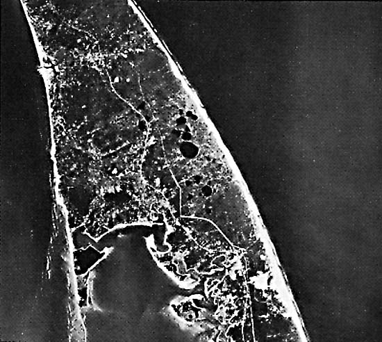
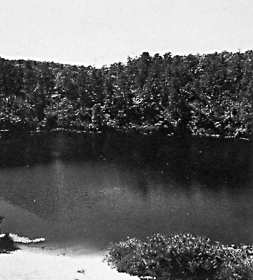
Cape Cod is a classic area of glacial and fluvioglacial deposition resulting from the interaction of three large lobes of the ice sheet that advanced over the Cape Cod area in Late Wisconsinan time and then gradually receded to the north (Oldale, 1976a, 1976b, 1982; Chamberlain, 1964; Strahler, 1966). Stillstands of the margins of these three lobes-Buzzards Bay lobe on the west, Cape Cod Bay lobe in the middle of Cape Cod, and South Channel lobe to the east-are marked by prominent terminal moraines and/or a diversity of ice-contact and outwash deposits that range in thickness from 60 to 180 m (Oldale, 1976a). The area between Eastham and northern Truro is underlain by thick delta and outwash-plain deposits deposited in the interlobate area between the Cape Cod Bay and South Channel lobes as the main ice sheet retreated to the north and west (Oldale, 1976a, 1968; Oldale and Barlow, 1986; Koteff et al., 1967). At the margins of these thinning glacier lobes, copious quantities of morainal material became draped over buried stagnant ice, with outwash streams carrying debris onto and across the outwash plain. As the larger blocks of ice melted, numerous collapse depressions called kettles (Figure G-24.2) formed in the outwash plain. In the northern part of Wellfleet and the southern part of Truro, numerous kettles formed, many of which are now freshwater lakes, because the bottom of the kettle intersects the groundwater table (U.S. Geological Survey, 1972; Oldale, 1968). Figure G-24.3 is a vertical aerial photograph of this group of kettle lakes, which range in diameter from about 50 to 800 m (Gull Pond). Many of the kettles in this area do not intersect the ground-water table and are discernible only on topographic maps (U.S. Geological Survey, 1972) or on stereopairs of aerial photographs. Also, many of the kettle lakes do not completely fill their depressions or do not represent the actual irregular shape of a depression. For example, Great Pond (Figure G-24.2) partly fills an irregular kettle in association with four other smaller ponds. Its circular shape is mainly the result of post-kettle-formation processes, particularly reworking of the shores of Great Pond by wind and wave erosion of glacial deposits and redeposition as narrow sand bars between Great Pond and its four satellite ponds. Figure G-24.4 is a ground view of Round Pond, a water-filled kettle at the northern end of the group, near Truro. Large-Format Camera 4107-0664, October 7, 1984.
Continue to Plate G-25| Chapter 9 Table of Contents.| Return to Home Page| Complete Table of Contents|