
You can gain a feel for the terrain and the town layout by looking at the next two views. The first is an aerial oblique photograph taken in mid-afternoon (note shadows) on January 25, 1988 looking east at the northern part of Morro Bay towards the hills in the background. The town of Morro Bay is situated in the center of the photo. We have digitized and enlarged this oblique photo to let you see details within the vicinity of the town area. Click on the credit line or the image to enlarge it. Use the scroll bars to see areas initially off screen.
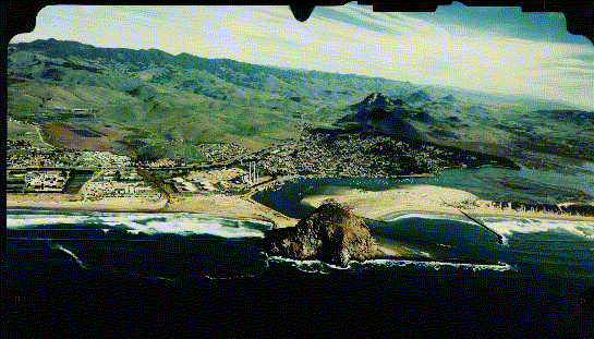
(credit: Golden State Aerial Surveys, San Luis Obispo, California, )
1-3: Flipping back and forth between this oblique photo and the band 3 image on the previous page, try to locate in the image as many of the ground features you can. Also, look ahead to the photo just below and try to locate in the Landsat image the place where the photo was taken. ANSWER
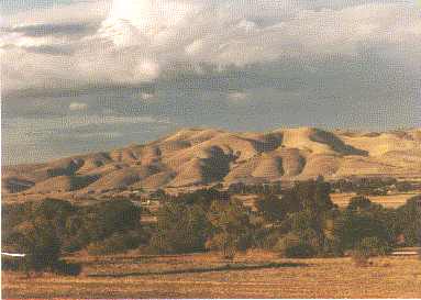
The second view was taken from a hill slope south of the Los Osos (Spanish for "The Bears") on the ground looking
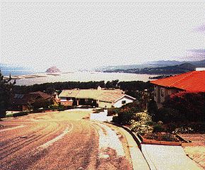
north across the body of water named Morro Bay, with the town of that name in the distance. One surface feature stands out in both scenes: Morro Rock , a great erosional monolith made of granite that reaches a height of 175 m. (574 ft) above the Pacific.
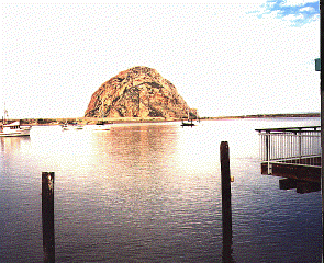
Technically, this is a sea stack, an outlier of rock that became detached from the mainland as waves cut away at the shoreline. Here, we see a narrow deposit of sand, caused by deposition in shallow water. This sand bridge connects the stack with the mainland, producing what is known as a "spit". The granite, sea stack mass is part of the Santa Lucia Range , along which we find California oak trees and other trees and foliage that comprise the northernmost extension of Los Padres National Forest. The western edge of this range, with a conspicuous granite peak, appears in this view taken from a point SE of Morro Bay.
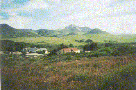
Denser forests extend from the higher elevations (about 260 m or 850 ft, in the Landsat subscene) into the lowlands along streams. Many of these hillsides however are covered mostly with natural grasses which reach their full greenery during the rainy season from October through April. By May, these grasslands assume a pleasing golden yellow-brown color that persists through summer into early Fall. This foliage provides a trademark for the California Coastal Ranges. The brownish background contrasts with the deep greens of the oaks and evergreens is in the next photograph.

Primary Author: Nicholas M. Short, Sr. email: nmshort@epix.net
Collaborators: Code 935 NASA GSFC, GST, USAF Academy
Contributor Information
Last Updated: September '99
Webmaster: Bill Dickinson Jr.
Site Curator: Nannette Fekete
Please direct any comments to rstweb@gst.com.