
Thematic Mapper Bands
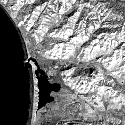
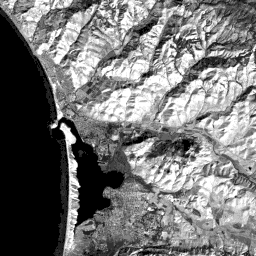
After that quick look at the scene setting, we are set to start our exercise in image interpretation. As this could be your first effort at this process, we suggest you now become familiar with this Landsat subscene as we rendered in all seven TM bands.
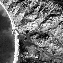
TM 1
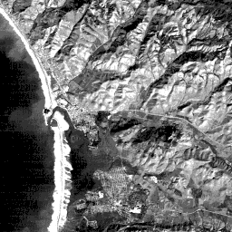
TM 2
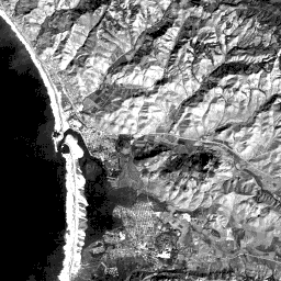
TM 3
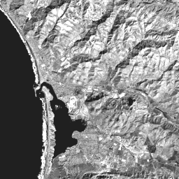
TM 4
TM 5
TM 6
TM 7
Each image has its own tonal characteristics, along with distinctive shapes defined by tonal boundaries and patterns, that help to identify ground features. You can view the histograms for each band clicking on each of the following links: histogram 1, histogram 2, histogram 3, histogram 4, histogram 5, histogram 6, histogram 7. Note that each histogram is bimodal, having one peak at very low values (water) and the second at various mid-DN values.
Feature Identification Map
In the review that follows, to focus attention, we identify specific features and patterns by letters on an overlay of the background image in which we flattened the gray tones. Take a look at the map now. You can link to this map any time by clicking on the underlined and colored letter. (To remove it once displayed, follow the sequence: 1. Mouse click on the Escape button; 2. Click the Close button; 3. Click the X button at the upper right corner of the screen.) To make a convenient reference, we suggest you print this map and keep it handy if you do not wish to download the map. The background image is made from TM 1 in which the gray levels were deliberately contracted to show only small contrasts.
1-4: As a preliminary to the more detailed feature descriptions that follow in this section, make a simple table with each of the seven TM bands running horizontally along rows and the following categories making up the vertical columns: silt in ocean water; wave breakers; beach sand on a bar; the town of Los Osos; the marshy delta; sun-facing slopes (toward lower right); shadows. In this table' boxes (draw them or imagine them) put down some representative gray level ranging from very light tone; light gray; medium gray; dark gray; blackish (your choice will be somewhat subjective). ANSWER

Primary Author: Nicholas M. Short, Sr. email: nmshort@epix.net
Collaborators: Code 935 NASA GSFC, GST, USAF Academy
Contributor Information
Last Updated: September '99
Webmaster: Bill Dickinson Jr.
Site Curator: Nannette Fekete
Please direct any comments to rstweb@gst.com.