
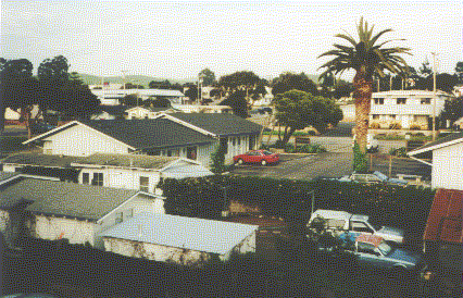
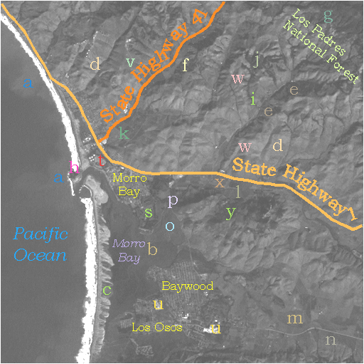
We can easily identify the towns in this subscene because of their prominent rectangular street patterns (towns labeled in yellow). The light tones emanating from the streets indicate that most are concrete rather than asphalt. Typical stores and residences in downtown Morro Bay appear below.
At the north end of the bay is a major electric power-generating plant, as seen here.
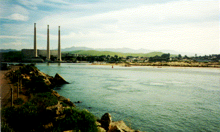
Taking a close look in the image (at t), we see a row of two light dots and then three more to the north. A glance at the aerial oblique photo quickly reveals their identity. The stacks are not clearly resolvable in the image but the large central power plant just behind them does show as a dark-toned rectangle (it has a flat-topped roof coated with a material such as asphalt).
Several small, very bright-toned patches appear in Los Osos (as at u) and elsewhere. Some of these are borrow pits where sand and gravel deposited during earlier ocean floods is extracted for construction and other purposes.
1-6: Look for the five oil storage tanks in each of the seven TM images. Can you find them. Explain. ANSWER
At this point we close our first look at the Morro Bay subscene. We will trace the expression of the labeled features described above in other bands and call attention to several additional features that stand out better in one or more of those bands. Now, rather than proceed to the next band, TM 2, we investigate the subscene presented in band 4, which is optimal for highlighting actively growing vegetation as bright tones.
Here is TM band 4.
TM Band 4
A first reaction may be that much of the land now displays in brighter tones and the ocean is almost uniformly dark (except where heavy silt still shows at the mouth of the river crossing the wetlands delta). Of course, much of this brightness comes from vegetation. Some of the dark fields (r) [missing-dk] are now quite bright. Similar rectangles in Morro Bay and Los Osos are city parks and meadows.
Mystery Feature
There is a mysterious area at s, that we challenge you to identify as we work through this Section. It's very bright in band 4 but not in the overlay image. Its identity may be more obvious in the enlarged version (from a modified TIFF image)below.
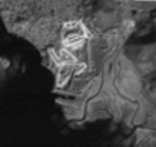
1-7: Take your first guess now. Clues: the patterns and tonal contrast. ANSWER
Band Information Characteristics
Looking again at the band 4 image, the coastal marsh (o) is bright also, except near the water where it darkens (more mud, less vegetation). Another area within the mountains (at v), which is somewhat darker in band 1 even though it's on a slope facing the sun, is uniformly bright. As a hypothesis, it may be a zone in which the grass cover is thicker and more active (perhaps new growth of grass from the first Fall rains).
The shadowy sides of the mountains are, in most places, less dark than in band 1 and reveal more detailed structure representing features on these slopes. This lightening is due to the presence of vegetation. However, very dark shadows do persist on the north slopes of several hills east of Morro Bay town.
The beach, quite bright in band 1, is now darker in the sandy areas to a medium tone. To its west, the breakers that are so bright in 1 now appear in a mottled, streaky pattern that probably correlates with the different parts of the waves. Some parts face towards the sun (more reflectance into the TM sensor) and other parts of these transient curved surfaces face away (and appear darker).

Primary Author: Nicholas M. Short, Sr. email: nmshort@epix.net
Collaborators: Code 935 NASA GSFC, GST, USAF Academy
Contributor Information
Last Updated: September '99
Webmaster: Bill Dickinson Jr.
Site Curator: Nannette Fekete
Please direct any comments to rstweb@gst.com.