
Harrisburg, PA and Nigeria/Cameroon Radar Images
Examine the aircraft SLAR image (K band) of Harrisburg, PA (near the bottom left) shown below:
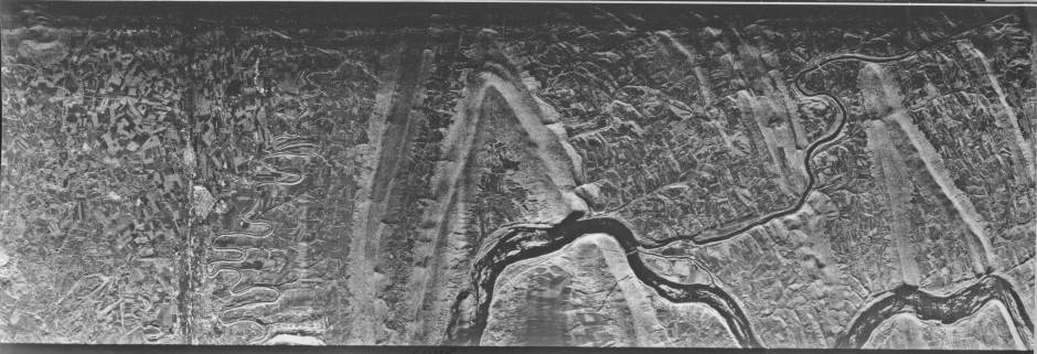
In the image, river surfaces, roads, and streets, being smooth and flat, appear dark, whereas buildings, being strong corner reflectors, tend to be light (bright). Moist and bare fields show up in various darker shades but those with crops have lighter tones. The more rugged terrain (ridges with notable topographic relief) resemble those in an aerial photo, in which hill shadows are prominent, such as at lower Sun angles. The brighter slopes are oriented towards the aircraft, which flew along the bottom of image, and are at near range. Note that as the look angle increases (towards top), a general darkening (because of an overall drop in signal return), and more distorting of terrain features, occur.
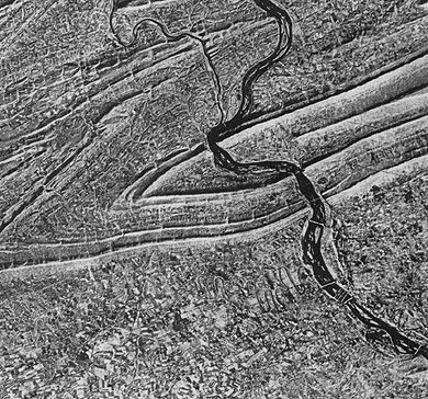
By flying the radar along parallel flight lines, so that it always illuminates from the same direction (thus, the aircraft acquires signals only while flying in one direction) and maintains appropriate incidence angles, it acquires strips of images with identical shading characteristics, which allows us to merge them into mosaics. The image below is a composite of radar strips taken during a flight series over an uneven hilly terrain making up part of an igneous/metamorphic shield in the Nigeria/Cameroon border region of western Africa. This mosaic is about 97 km (60 mi) on a side.
8-9: Fit the first larger-scale image of Harrisburg (above) into this mosaic. What don't you see in both these images that is often present in Landsat images on a transient basis? In the K-band image, something in the valley near the Juniata River is evident that you probably can't see in the X-band mosaic; what? ANSWER
The image below is a composite of radar strips taken during a flight series over an uneven hilly terrain making up part of an igneous/metamorphic shield in the Nigeria/Cameroon border region of western Africa. This mosaic is about 97 km (60 miles) on a side.
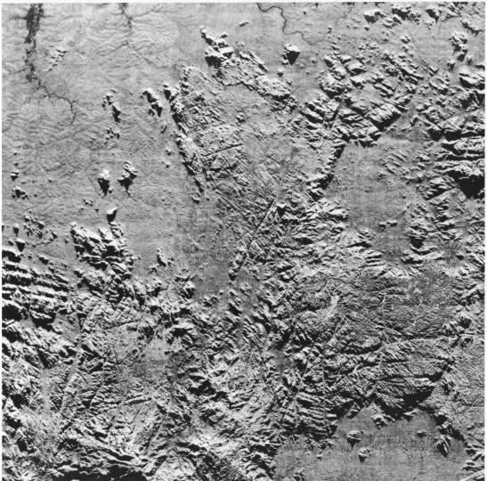
Even though the surface is heavily vegetated (tropical forests), the penetrating radar shows mainly its topographic character and adeptly displays fracture systems that have been weathered out into narrow valleys.
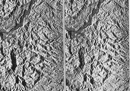
Flight crews can set successive flight lines to obtain sidelap imagery, in which part of the same area in each line strip appears in the adjacent strip but at different angles. In principle, two side-looking radars operating simultaneously at different look angles from the same platform can achieve a comparable effect. This allows viewing in stereo which, despite distortions in terrain shapes, further aids in characterizing and analyzing topography. Examine the two images (from the western U.S.) below, stereoscopically to check out this effect. To do this, print this page and cut the two images apart, then place them at a proper separation. If you are not familiar with how to view two scenes with a stereoscope, check the first part of Section 11.
From T.M. Lillesand and R.W. Kieffer, Remote Sensing and Image Interpretation, 2nd Ed., © 1987. Reproduced by permission of J. Wiley & Sons, New York.
8-10: Where is the highest point in the stereo pair? How could you have deduced this without viewing the two images through a stereoscope? ANSWER

Collaborators: Code 935 NASA GSFC, GST, USAF Academy
Contributor Information
Last Updated: September '99
Webmaster: Bill Dickinson Jr.
Site Curator: Nannette Fekete
Please direct any comments to rstweb@gst.com.