 |
 |
|---|---|
| Plate T-16 | Map |
|
|
|---|---|
| Plate T-16 | Map |
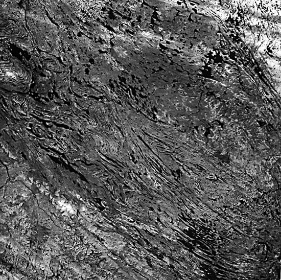
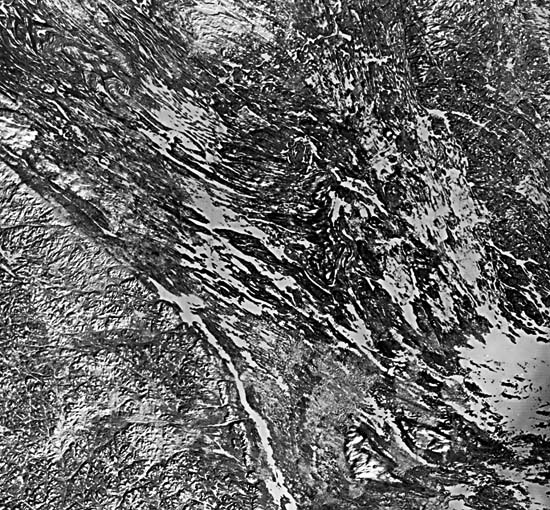
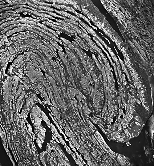
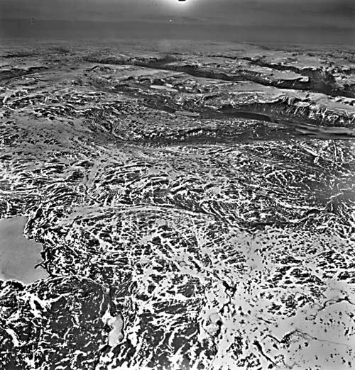
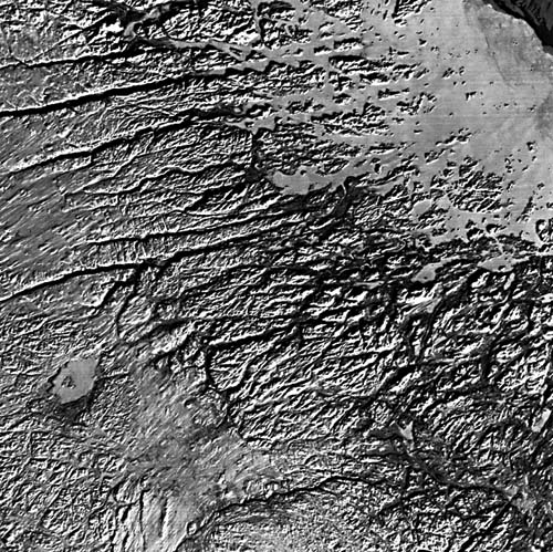
Like much of the Canadian Shield, the region in this image and in Figure T-16.1 is one of low relief, resulting from eons of erosion and Pleistocene glaciation. The effect of structure and lithology on erosional topography (Bird, 1972) is brought out in a low-Sun-angle midwinter Landsat-4 image (Figure T-16.1). Glacial scour along bedding contacts in the fold belt produced most of the linear lakes, thus emphasizing the form of folding through the tonal contrast between water or snow and rock (Figures T-16.2 and T-16.3; vertical and oblique aerial photographs, respectively) .Glacial cover overlies and "smooths" some of the surface. Fractured terrain of the Churchill Province (upper right corner of the Plate) is quite similar to that of the Superior Province(lower left). Both have low knobby hills. As seen from Landsat, the interaction of fracture-producing tectonism, differential stream erosion, and glacial action in this part of the shield is well expressed by the topography evident in the two Labrador Trough images and in the neighboring Nain Province to the east (Figure T-16.4).
| Figure T-16.1 | Figure T-16.2 |
|---|---|
 |
 |
Although one cannot identify the rock types present in the Landsat scenes, the topographic texture clearly distinguishes four major groups of rocks -those in the Superior Province, the juxtaposed miogeosynclinal and eugeosynclinal facies of the Trough, and the Churchill Province. Both topographic orientation and texture suggest that the Churchill and Superior rocks are much more integrated (metamorphically homogenized) than either of the geosynclinal units and that contrasts in erosional resistance are greater among sedimentary rocks of the miogeosyncline than those of volcanic origin in the eugeosyncline.
It is interesting to compare the appearance of the Labrador Trough to that of the other orogens in this chapter, particularly the Appalachians to the south. In general, the rocks of the Labrador Trough are more tightly folded and have a finer grained topographic texture than those of the Appalachians. The Labrador orogen is much narrower than younger orogens. The fine versus coarse texture of eugeosynclinal versus miogeosynclinal appears to be true of other orogens.
This Proterozoic orogen is unusual in that it represents deformation of a sedimentary sequence that accumulated entirely on continental crust (Gastil et al., 1960). Although ophiolite-like assemblages are present, the crust in this part of the Canadian Shield did not rift enough to allow emplacement of new oceanic crust. Thus, the Labrador Trough is more akin to intracratonic basins like the Michigan Basin than to the Appalachians.
| Figure T-16.3 | Figure T-16.4 |
|---|---|
 |
 |
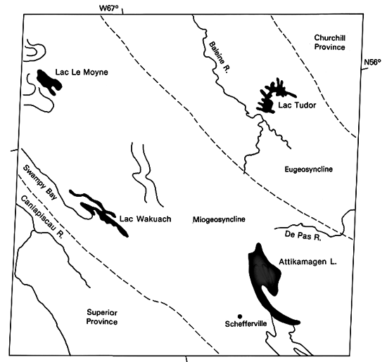
The Labrador Trough constitutes the eastern segment of the Circum-Ungava belt that wraps around much of the northern Superior Province of eastern Canada (Dimroth, 1970). It was a linear deposition basin that lay between the Archean Ungava craton on the west and the eastern continuation of the Churchill Province. The Grenville Province overrides (?) the trough on the south and does not quite abut against the southwestern edge of the Nain Province.
As subsidence progressed slowly, a well-defined miogeosyncline formed on the west side, with a eugeosyncline of similar width on the east. Sediments dominate the miogeosyncline, whereas volcanic rocks are predominant in the eugeosyncline. These facies accumulated through most of the Aphebian Era of the Lower Proterozoic, and all rest on crystalline sialic basement of Archean gneisses. The miogeosynclinal rocks include some banded iron formation (BIF), which occurs in huge deposits around Schefferville.
Deformation of the trough (initially about 200 km wide) was contemporaneous with the Hudsonian orogeny (1800 to 1600 Ma). This converted the eastern zone into a large synclinorium with strong folding in the miogeosynclinal zone, compressing the trough to its present width of 80 to 120 km. Folds range from open to tight (isoclinal), and many are doubly plunging (conspicuous patterns in the space images and aerial photograph). High-angle thrusting is common in the western zone, in places producing repeated sequences, with eugeosynclinal units overriding westward. A major low-angle thrust forms a tectonic boundary between the geosynclinal facies. Field relations, including the presence of staurolite, kyanite, and sillimanite (diagnostic of higher pressure mineral assemblage), indicate a continent/continent collision. (NMS) Landsat 1438-1501345;6, October 4, 1973.
Continue to Plate T-17| Chapter 2 Table of Contents| Return to Home Page| Complete Table of Contents