 |
 |
|---|---|
| Plate T-39 | Map |
|
|
|---|---|
| Plate T-39 | Map |
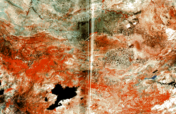
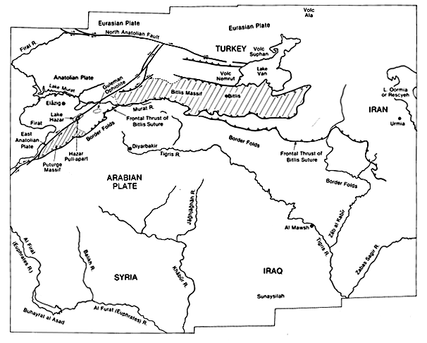
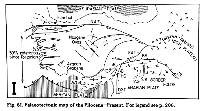
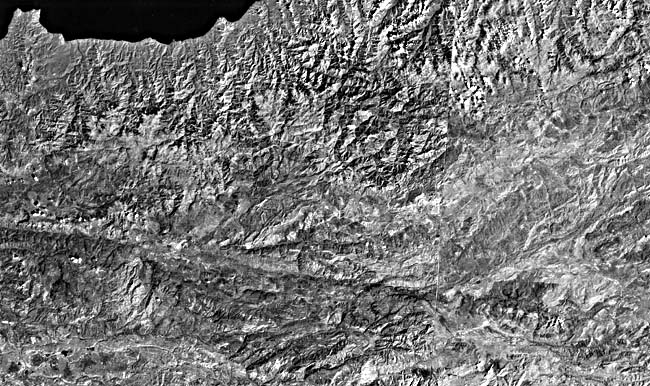
The mosaic and the accompanying ancillary images show the North Anatolian (NAT) and East Anatolian (EAT) transforms, the faults bounding the northern and southern edges of the Anatolian plate located in southeastern Turkey (Figure T-39.1, from Sengor and Yilmaz (1981)). Much of this part of Turkey and adjacent countries typifies the geomorphology of an active plate boundary where two continental blocks are colliding. Continental collision began in the Miocene as the result of closure of a Neo-Tethys Ocean (Dewey and Sengor, 1979; Sengor and Yilmaz, 1981). The Neo-Tethys began to close in Late Cretaceous time and continued through the Early and Middle Tertiary. This closure resulted in Miocene collision of the Arabian plate and the Eurasian plate (locally, the Black Sea plate) along the Bitlis-Zagros (BS-ZS) suture. This continent/continent collision formed an accretionary terrane, "welding together" several smaller continental blocks and an associated accretionary prism of ophiolite mélange between the two larger continental plates. Convergence continues today, forcing the pie-shaped Anatolian plate westward along the North and East Anatolian transform faults. The westward movement of the Anatolian plate is taken up along a subduction zone (i.e., free face) to the south and west (Figure T-39.1). Extension over the free face produces a series of grabens similar to the Great Basin (Plate T-4).
| Figure T-39.1 |
|---|
 |
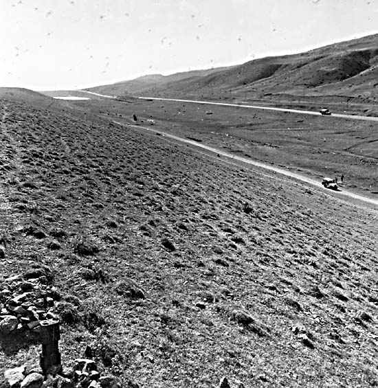
The North (right-lateral) and East (left-lateral) Anatolian transforms typify strike-slip faults that bound continental plates. These faults are generally vertical, cutting the entire continental crust, and therefore have a linear trace over many hundreds of kilometers marked by valleys (Figure T-39.2) or linear lakes. Close-in inspection of geologic and geomorphic features on opposite sides of such linear valleys are commonly offset and appear to have been dragged against the fault. These faults may juxtapose entirely different geologic terranes. For example, the East Anatolian transform fault juxtaposes rocks (mainly igneous and metamorphic) of the Anatolian plate against accretionary prism rocks (crystalline rocks) and ophiolite mélange in thrust contact with Arabian plate strata (folded and thrusted sediments). Minor curvatures along these faults produce either transpressional (folds and uplifts) or transtensional features (pull-apart grabens).
| Figure T-39.2 |
|---|
 |
The geologic terrane south of the East Anatolian transform is a good example of a continent/continent suture zone. This region consists of an accretionary prism of ophiolite mélange and remnants of small continental plates (e.g., Bitlis and Poturge Massifs) that were "welded" onto sediments of the large continental (Arabian) plate to the south (Sengor and Yilmaz, 1981). The actual suture is marked by the Frontal Thrust of the Bitlis Suture. A segment of the Frontal Thrust Zone is visible across the mosaic as an undulating line separating sedimentary rocks to the south from principally crystalline rocks to the north. This thrust exposes crystalline rocks of the Bitlis and Poturge Massifs, as well as ophiolite mélange in thrust contact overlying Eocene sediments of the Arabian plate. The upper plate of this thrust has moved at least 15 km southward since the beginning of continental collision in the Miocene (Livaccari and Merin, 1986). Southeast of the thrust are the Border Folds, a zone of imbricately thrusted and folded sediments marking the northern edge of the Arabian plate. North of the thrust are remnants of small continental blocks (Poturge and Bitlis Massifs) located within an ophiolite mélange (i.e., the East Anatolian accretionary prism). One such ophiolite assemblage is the Guleman (see index map).
A portion of the East Anatolian transform is visible on this image as a northeast-trending linear valley located just north of the Poturge Massif and ophiolite mélange. Large segments of the Euphrates and Murat Rivers follow this valley. Lake Hazar (this Plate) marks a small graben (i.e., Hazar pull-apart) associated with this left-slip fault. Arpat and Saroglu (1972) documented 22 km of left-slip offset along this fault and movement of 5 to 10 cm that occurred in places along this fault during a 1971 earthquake.
| Figure T-39.3 |
|---|
 |
A segment of the 1200-km long North Anatolian transform to the west of the mosaic is visible as a linear valley trending west-northwest in the two-image mosaic of Figure T-39.3. North of the fault are the Pontids structural unit; to its south are the Anatolids, which have more ophiolites and olistostromes. Portions of the Euphrates and Yesil Rivers follow this valley. Dewey and Sengor (1979) reported that this fault has 85-km right-slip displacement and, based on earthquake data, is currently active. (GCW: Z. S. Merin) Landsat Mosaic.
Continue to Plate T-40| Chapter 2 table of Contents| Return to Home Page| Complete Table of Contents