 |
 |
|---|---|
| Plate V-11 | Map |
|
|
|---|---|
| Plate V-11 | Map |
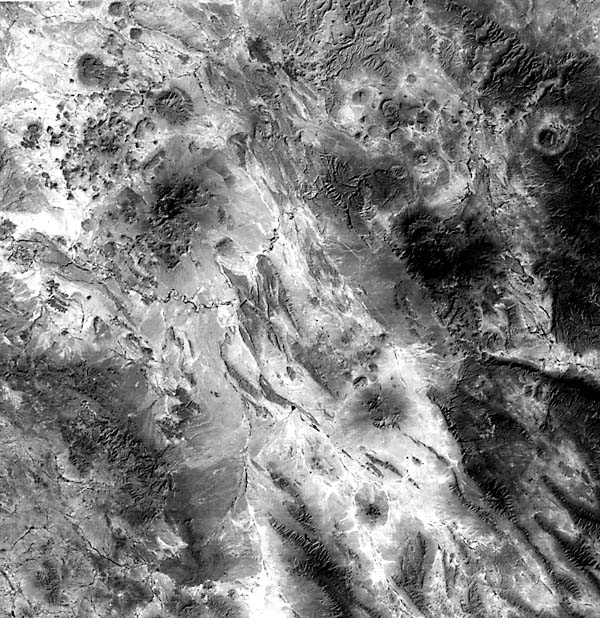
This scene displays a composite of landforms that fall into the volcanic, tectonic, and desert categories. Volcanism of Tertiary age abounds in the Big Bend National Park area and surroundings in Texas and extends across the Rio Grande River into northern Coahuilla and Chihuahua states in Mexico.
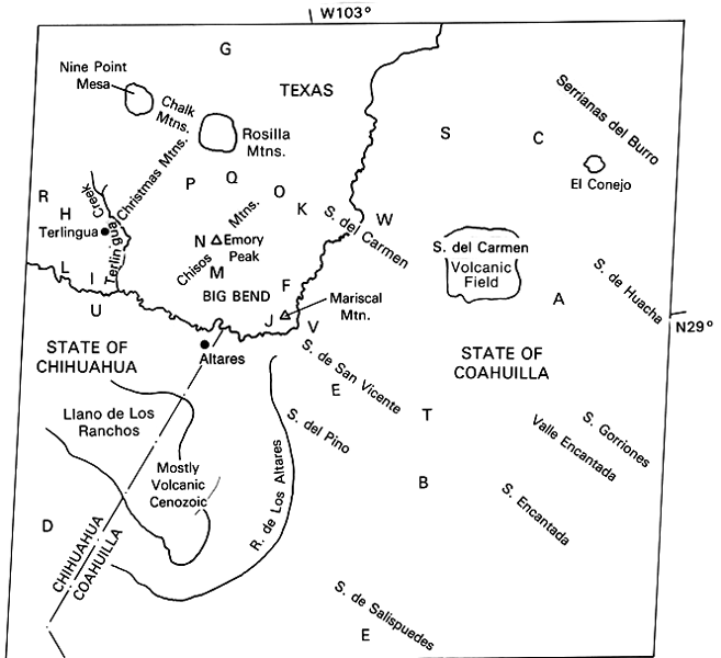
The tectonic framework for the scene places it in a structurally complex setting. The region lies along the eastern edge of the Mexican Cordillera adjacent to the Sierra Madre Orientale. On the Mexican side, the Sierra del Carmen and other ranges make up the Coahuilla Marginal Fold Belt (A), which lies between the Sabinas Basin (B) and the El Burro-Picachos Massif (C). The basin itself is the eastward extension of the Coahuilla Platform or Shelf (D). Numerous plunging anticlines (E), trending northwest, form strongly dissected mountainous terrain; some anticlines are breached (especially evident in the next scene to the south (Plate T-19). Similar anticlines (F) extend into the Big Bend country.
In the Trans-Pecos Texas area and to the north, three distinct periods of tectonic activity can be deciphered from structural and stratigraphic evidence. Paleozoic sedimentary units were involved in folding and thrust-faulting along a northeast-southwest trend that has been tied to concurrent activity in the Ouachita system. Cretaceous marine and continental sedimentary rocks, including numerous limestone units in the lower sections, and overlying sands and clays were strongly deformed during the Laramide orogeny that closed in the Early Tertiary. This affected beds within the central Park area, the Sierra del Carmen in the United States, and most of the nearby mountains in Mexico. Northeast-dipping thrusts follow the trend of the Santiago Mountains (G). Other contemporary structures include the Terlingua Monocline (H) and Terlingua (I) and Cow Heaven (J) fault zones. Block-faulting also began at this time, resulting in down-dropped segments (Sunken Block (K)) and uplifts (Mesa del Anguila (L)). These tectonic disturbances were accompanied by igneous activity expressed as sills and vent extrusions. The Early Tertiary witnessed deposition of clastics derived by erosion of Laramide terrain. From Middle Eocene throughout Oligocene, more than 1600 m of sandstones, clays, tuffs, basalts, and trachyandesites accumulated in the basins. Continuing Tertiary/Quaternary deformation produced broad open folds and normal faults along earlier lines of weakness, further tilting and raising the uplifts.
| Figure V-11.1 | Figure V-11.2 |
|---|---|
 |
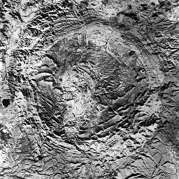 |
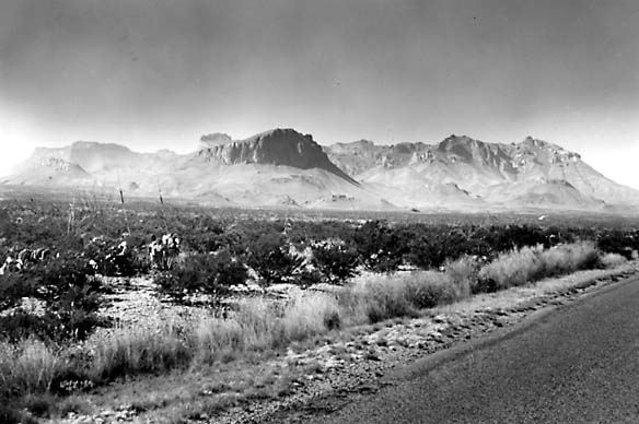
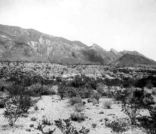
Most volcanic landforms here owe their inception to Tertiary volcanism that climaxed possibly by the Miocene. The general trend was mafic basalts (Lower Cretaceous to Mid-Eocene) -> trachyandesites (Eocene to Early Oligocene) -> riebeckite rhyolites (Oligocene and younger). The Chisos Mountains (Figure V-11.1), rising to 2410 m at Emery Peak, consist of pyroclastic and lava flow units mixed with tuffaceous sandstones and clays. These are topped by the Burro Mesa rhyolite and ignimbrite flows. The main event, of post-Burro Mesa age, culminated in numerous intrusions of granite, microgranites, and other silicic rocks into the Chisos Mountains (Sierra Quemada (M) and Ward Mountain (N)) and surrounding locations in the McKinney Hills (O), Paint Gap Hills (P), Grapevine Hills (Q), Rosilla and Chalk Mountains, and elsewhere. In Figure V-11.2 and Figure V-11.3, the Solitario (R), a classic laccolithic dome, is shown close up from the air and the ground. Quicksilver deposits around Terlingua are associated with the volcanic activity. In the Cenozoic, extrusive volcanism was also widespread in northern Mexico, as around the Llano de Los Ranchos, and intrusive, including El Conejo, occur at (S) and (T).
| Figure V-11.3 | Figure V-11.4 |
|---|---|
 |
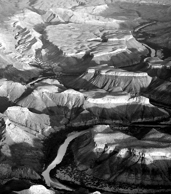 |
The volcanic areas show a variety of landforms developed by erosion of laccolithic hills and of caprock formed from resistant flow units. Spectacular scenery in and around the Big Bend is highlighted by several steep-walled canyons (Figure V-11.4) such as Santa Elena (U), Marsical (V), and Boquillas (W). Additional/Reference: Maxwell and Dietrich (1972). Landsat 1816-16430, October 17, 1974.
Continue to Plate V-12| Chapter 3 Table of Contents.| Return to Home Page| Complete Table of Contents