 |
 |
|---|---|
| Plate V-2 | Map |
|
|
|---|---|
| Plate V-2 | Map |
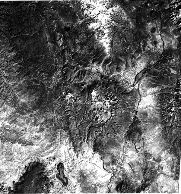
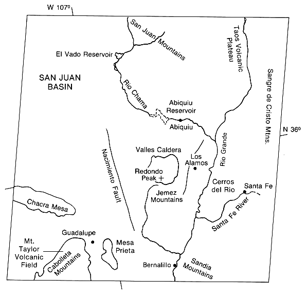
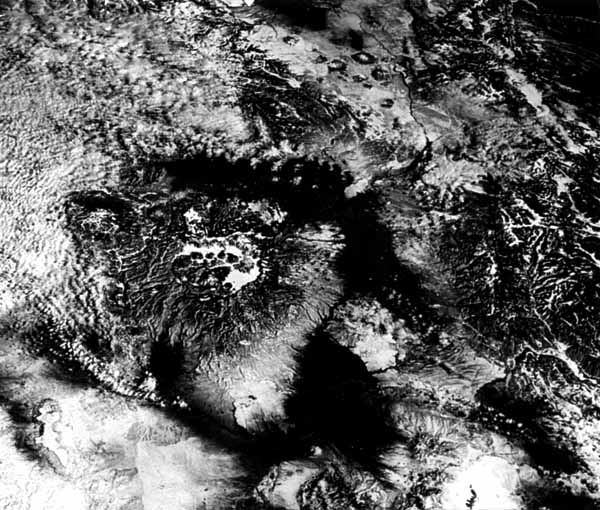
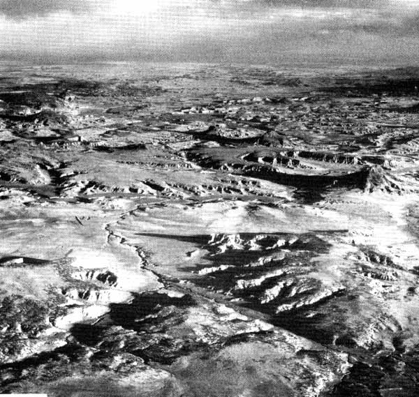
This image focuses on volcanic features in north- central New Mexico, the regional setting of which was shown in the preceding Plate. Dominating the scene and that in the oblique space photograph taken during the Apollo 9 Mission (Figure V-2.1) is the subcircular Valles caldera in the center of the Jemez Mountain volcanic complex about 70 km north of Albuquerque (Bailey and Smith, 1978). The central caldera, 19 by 24 km in rim dimensions, is the classic example of resurgent cauldrons as defined by Smith and Bailey (1968).
The Jemez Mountain volcanic complex is built on a basement of Precambrian igneous-metamorphic and Paleozoic/Mesozoic sedimentary rocks on the west and overlaps and interbeds with Cenozoic continental sediments that fill the Rio Grande Rift on the east (Ross et al., 1961). The abrupt escarpment along the western edge of the Sierra Nacimiento adjacent to the Jemez Mountains marks the trace of the Nacimiento Fault, a reverse fault that bounds a block of predominantly Precambrian rocks (Figure V-2.2). The volcanic field itself consists of material erupted from more than 100 vents. A variety of landforms, ranging from maar volcanoes to massive silicic domes, was created.
| Figure V-2.1 | Figure V-2.2 |
|---|---|
 |
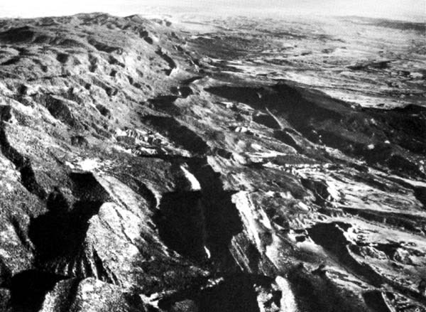 |
Jemez volcanism began about 10 to 12 Ma ago with the eruption of basalts, andesites, dacites, and rhyolites that continued until about 3 Ma, building up a broad thick ( >1000 m) pile of flow units. Flanking the complex are several basalt fields, including the Santa Ana Mesa (south), Cerros del Rio (east), and Los Setos (north). At 1.7, 1.4, and 1.1 Ma, rhyolite magma erupted explosively, spreading thick ashflow deposits (Bandelier Tuff) that locally attain thickness of + 300 m (Figure V-2.3) over the flanks of the complex. These successive expulsions of magma caused collapse of the roof of the magma chamber along ring faults, forming three nested calderas. Two of these, the Toledo caldera (1.45 Ma) and the Valles (1.09 Ma) are of nearly equal size. Only the youngest of these (Valles) has a well-defined morphology that forms a prominent depression. The cumulative thickness of volcanic infill within the calderas reaches 1 km on the west and 3.5 km on the east. Following the collapse of the Valles caldera, renewal of magma pressure in the underlying chamber caused uplift of the caldera floor and formation of a central resurgent dome. Accompanying this resurgent uplift, eruption of viscous rhyolite along the caldera ring-fault system resulted in extrusion of an arcuate ring of lava domes around the central resurgent uplift. Redondo Dome is transected by a northeast-trending medial graben apparently controlled by older basement structures. Pleistocene erosion has cut deep radial canyons into the flanks of the complex. Cutting of the exceptionally deep San Diego Canyon on the southwest flank caused draining of a former caldera lake.
The intersection between the Jemez Lineament and the Rio Grande Rift provided a structural control for generation and emplacement of the Jemez magma system. Other volcanic fields, including the Raton basalt field and the Spanish Peaks to the northeast, the Springerville field, and the Mt. Taylor field, lie generally proximate to the lineament. Several domical mountains and cones in the Taos Plateau volcanic field stand just west of the Rio Grande River in the Rift where it extends into Colorado. An Oligocene intrusive complex lies along the eastern rift margin northeast of the Sandia Mountains. North-south Tertiary dikes (barely visible in the image) cut Cretaceous and Tertiary sedimentary rocks along the northeast flank of the San Juan Basin.
| Figure V-2.3 |
|---|
 |
The Mt. Taylor volcanic field is another of the large Tertiary outpourings that concentrated along the periphery of the Colorado Plateau since the Miocene (Hunt, 1938). Basalts and other lava types extruded from its many central vents into Cretaceous sedimentary rocks, building up an unbroken plateau-the Mt. Taylor Mesa-that extends 500m or more above the surrounding terrain (see Figure V-1.3). Mt. Taylor itself (just below the bottom edge of the Plate) is a stratocone-shaped structure that towers to 3500 m above sea level. At the low Sun angle in this late Fall image, individual volcanic cones and necks, some of Holocene age, are discernible in the central mesa. Mesa Prieta is an outlier of this same field.
The Christensen and Lipman (1972) model alluded to in Plate V-1 proposed a plate tectonics control over volcanism in the southwestern United States. Prior to 30 Ma ago, calc-alkaline volcanism associated with the continental side of a subduction zone was predominant. Following deactivation of this zone as the North American Plate began to override the East Pacific Rise, bimodal volcanism-both basaltic and alkalic series-became the norm. However, the Jemez Mountain field may be an exception inasmuch as a wide range of magma types have been emplaced in the last 13 Ma. Caption modified from comments by R. Bailey (USGS) and G. Heiken (Los Alamos National Laboratory, personal communication). Landsat 10856-17022-7, November 26, 1974.
Continue to Plate V-3| Chapter 3 Table of Contents.| Return to Home Page| Complete Table of Contents