 |
 |
|---|---|
| Plate F-20 | Map |
|
|
|---|---|
| Plate F-20 | Map |
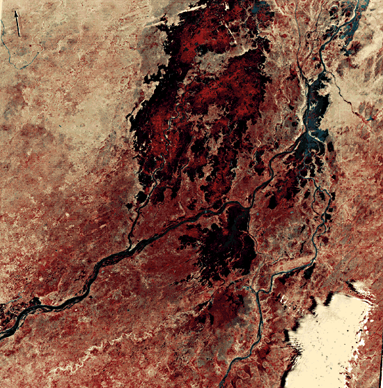
This region of the central West African nation of Mali shows the proximal portion of the Niger River's inland delta. Flowing northeastward from the Guinea Highlands, the Niger derives a relatively large discharge from these tropical uplands. In central Mali, the climate becomes semiarid. The mean annual precipitation is approximately 500 mm at Mopti, the major town of the region. It decreases to less than 200 mm at Timbuktu, located 300 km northeast of Mopti. Rainfall is quite variable, and droughts, such as the catastrophic Sahel drought of 1968-1973, are an unfortunate occurrence for the region's inhabitants.
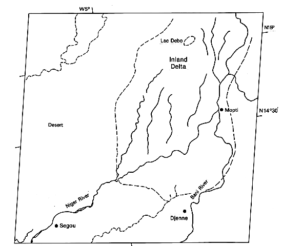
The distributary pattern of channels shows that this region is a great inland delta (Figure F-20.1). A great cratonic basin, the E1-Djouf or Taoudene, receives the northeasterly flowing Niger and its tributary, the Bani River, which has its confluence at Mopti. The delta extends to the northeast of this Landsat scene, covering an area of about 40000 km2.
| Figure F-20.1 | Figure F-20.2 |
|---|---|
 |
 |
The Niger inland delta serves to spread out the seasonal flows of the river. During the summer flood season, high discharges enter the delta apex. Large areas of open and shallow water are visible north of Mopti. One of these is Lac Debo at the top center of the scene. The flood crest may take 3 months to pass through the marshes, lakes, and channels of the delta.
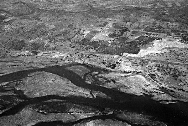
The dark tones of the delta region correspond to the wetland vegetation, which contrasts markedly with the semiarid region outside the river's influence (northwest portion of the image). Desert pavement surfaces, also called reg or hamada, characterize this area. Sand dune development, which is minimal here, increases northward as precipitation decreases. A great sand sea, the Azaouâd, occurs north of Timbuktu, and the Niger turns to the east at this point, locally following the east-west dune trend (McKee, 1979), as is evident in the view from the Apollo 9 spacecraft (Figure F-20.2) .
During the Quaternary, the Niger River was profoundly influenced by climatic change. At the glacial maximum for the northern hemisphere, approximately 18000 years B.P., cooling of the Atlantic Ocean induced an intensification of the trade winds. In addition, the migration of the polar front toward the Equator effectively pushed the Saharan arid zone southward into the present Sahel. Reduction of summer rains in the savanna regions further contributed to aridity. Higher wind velocities and greater aridity allowed active sand dunes to extend southward, effectively blocking the Niger River near modern Timbuktu, 300 km northeast of Mopti. Reduced seasonal discharges for the river then resulted in a temporary termination at the Niger at its inland delta. Thus, the sediments of the inland delta represent an alternation of climatically controlled conditions. Delta sediments also contributed to dune development by eolian winnowing during dry periods.
| Figure F-20.3 | Figure F-20.4 |
|---|---|
 |
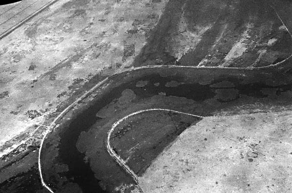 |
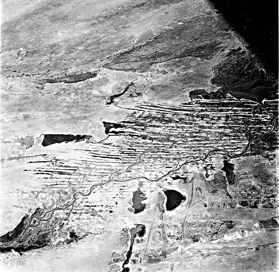
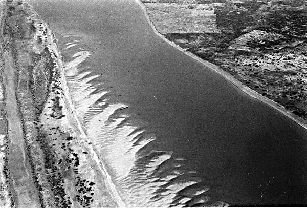
After the full-glacial period of maximum aridity, a more humid period ensued, reaching its maximum development 5500 to 5000 years ago. The dune sands were weathered and stabilized, and in the wetter areas of the delta, the river eroded them away (Figures F-20.3 and Figure F-20.4). The modern Niger continues in a great arc that turns southeastward near Timbuktu, flowing toward the humid tropical coast of Nigeria.
The Niger has a remarkable basin. It rises at only 800 m in the Futa Djallon Plateau of Guinea, and its headwaters are only 250 km east of the Atlantic at Sierra Leone and Liberia. Nevertheless, it flows northeastward in its great arc of 4200 km before reaching the same ocean at Nigeria. One theory for the development of this pattern is that the Niger headwaters were easily captured and diverted on the tropical planation surfaces of the Guinea Highlands. Its flow into the great cratonic basin of central East Africa, the E1-Djouf, resulted in a lake, Lake Arouâne. This lake eventually overspilled low divides southeast of Timbuktu to complete the great arc. Climatic change in the Quaternary has now resulted in the unusual pattern of a river that flows from a humid tropical coastal upland into a desert basin, reverses itself, and flows from the desert basin back to the humid tropical coast. The inland delta reflects this heritage since it is developed on plains derived from the sediments of ancient Lake Arouâne. Landsat 1529-10075-5, January 3, 1974.
Continue to Plate F-21| Chapter 4 Table of Contents.| Return to Home Page| Complete Table of Contents|