 |
 |
|---|---|
| Plate D-10 | Map |
|
|
|---|---|
| Plate D-10 | Map |
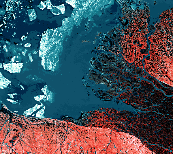
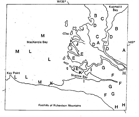
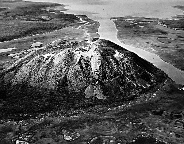
The Mackenzie River is the longest river in Canada, the second longest in North America, and one of the ten longest rivers in the world. The river drains a basin of approximately 1.8 million km2 in central Canada and has a total length of 4210 km. Its delta can be classified as an arctic delta; it is ice-free for approximately 3 to 4 months a year. The satellite image illustrates the northern portion of the delta plain that has formed between the foothills of the Richardson Mountains to the southwest and the elevated Pleistocene terrace surface to the east (A). The Pleistocene surface is composed primarily of permafrost or frozen ground on which numerous poorly oriented lakes (B) and polygonal or patterned ground (C) has developed (Samajlov, 1956). Permafrost again began to affect the region approximately 10 000 to 11 000 years ago and, in some instances, extends to depths of 100 to 130 m. Once permafrost commenced forming, pore water expelled from the encroaching frozen ground domed up the permafrost zone, pushing up ice-cored hills called pingos (D) (Figure D-10.1). These hills often attain extremely high elevation (100 to 150 m above the deltaic plain) and are typically conical in shape. Although many of these are located primarily on the Pleistocene surface, others are found within the modern or Holocene delta deposits (E). Many of these pingos are believed to be on the order of 10 000 to 11 000 years old, and more than 1350 of them have been mapped. Despite their sizes, pingos seldom show up well in Landsat images.
| Figure D-10.1 | Figure D-10.2 |
|---|---|
 |
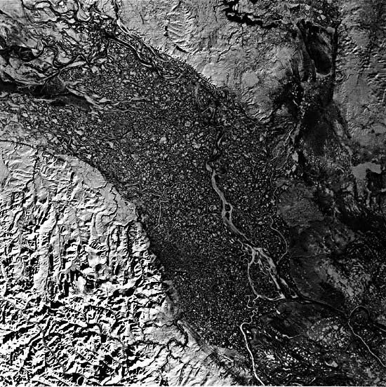 |
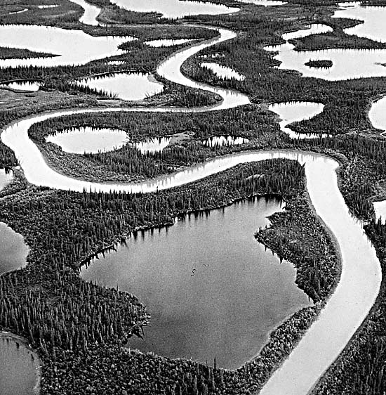
The Holocene delta of the Mackenzie River covers an area of 4700 km2. Only the northern or lower delta plain is shown in the image. The discharge of the river averages 11 300 m3/sec, 63 percent of which occurs during the ice- free months of May through August. The sediment load is approximately 15 million metric tons per year, a relatively small amount for such a large river. One of the most notable attributes of the Mackenzie is its large number of anastomosing distributaries (F). These channel patterns often show extremely high angles at the point of bifurcation. The natural levees bordering the distributaries are well developed, and the interdistributary regions are dominated by lakes (G). Myriads of lakes and additional river channels are spread over the entire Mackenzie floodplain (up to 60 km wide) upstream for at least 150 km, as seen in a mid-fall (October 23, 1973) Landsat image (Figure D-10.2). Ice jams and the late thaw of the delta relative to the river thaw cause extreme localized high-water levels in the distributaries; overbank crevassing and formation of splays are common features extending into the freshwater lakes (Figure D-10.3). In the upper delta plain, woody trees, such as spruce, dominate the natural levees and interdistributary regions, forming large woody swamps (H) (Figure D-10.4). In the lower delta, low grasses and shrubs cover the tundra landscape (I).
| Figure D-10.3 | Figure D-10.4 |
|---|---|
 |
 |
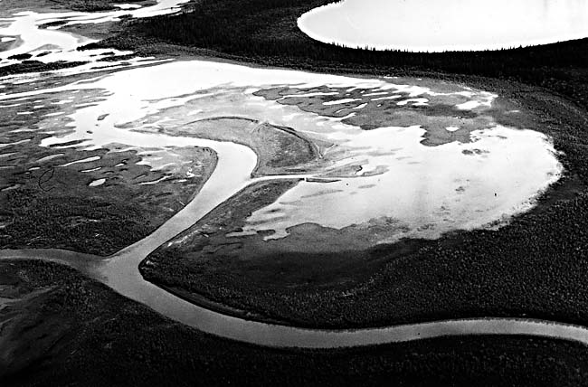
At the river mouths, broad sandy and silty shoals (J), often completely barren of vegetation (except for algal mats), are common. Low wave energy along the delta front on the sub-ice platform results in a lack of any wave-reworked landforms, and these bars often display highly irregular patterns. The river carries copious amounts of organic material, especially a large number of tree trunks. Organic accumulations (K), often referred to as "coffee grounds," are present along the shoreline. In some instances, logs accumulate to considerable thicknesses along the shoreline. A turbid river plume (L) can be seen on the image. The presence of offshore ice often controls the distribution of the plume, and early in the breakup, turbid river water frequently overrides the shore-fast ice (M) to spread large amounts of sediment on top of the ice. During breakup, this sediment is redeposited offshore. Landsat 21985-20125.
Continue to Plate D-11| Chapter 5 Table of Contents| Return to Home Page| Complete Table of Contents|