 |
 |
|---|---|
| Plate D-5 | Map |
|
|
|---|---|
| Plate D-5 | Map |
The Chang Jiang or Yangtze is the longest river in China. It originates in the Tibetan highlands province on the southern flank of the Kunlun Mountains of southwestern China. The river's course takes it from the Kunlun Mountain region (elevation approximately 5100 m) to the East China Sea through variable terrain for a total length of 5590 km (for the main river). The Yangtze drainage basin, which extends over 1 830 000 km2, can be roughly divided into two sections (Samajlov, 1956). Rugged mountain terrain is characteristic of the western part, which lies within and south of the Szechwan Basin of west China where the main river has its source. It flows through valleys and spectacular steep-sided gorges (Plate F-16) for 3790 km before it encounters a vast alluvial plain beginning some 950 km from the coast. This alluvial area is one of the most fertile and populated regions of China. The river is fed primarily by snow melt in the upper 75 percent of its course. Rainfall averages 970 mm/yr over the middle and lower parts of the catchment basin. Because of the narrow river valleys and erratic discharge, river stage can rise rapidly (as much as 10 m/day). The stage ranges between 20 and 30 m, but sometimes reaches a maximum of 40 m.
| Figure D-5.1 | Figure D-5.2 |
|---|---|
 |
 |
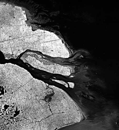
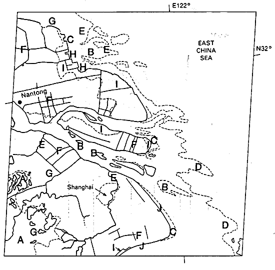
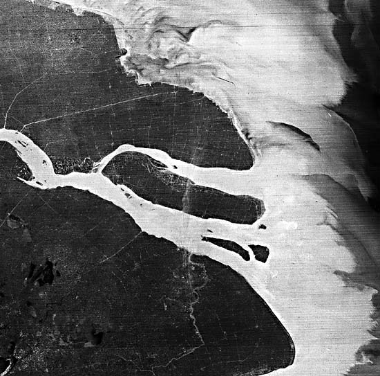
The eastern part of the Yangtze River basin is primarily a vast alluvial plain with numerous lakes situated along the main course. The most easterly end of this series of lakes is located around (A) on the index map. The coastal lowlands along the natural outlet of the huge basin are extensively cultivated and are irrigated by a rectangular grid of canals (Figure D-5.1, a Landsat subscene; note the city of Shanghai, a dark zone in the northwest corner of the figure). In this vicinity, the Yangtze is building a delta that is prograding into the East China Sea at an estimated rate of about 2 km per century.
In most delta classifications, the Yangtze would be categorized as a tidally dominated type because it has a semidiurnal tide of 3.7 m. Like other deltas (e.g., Shatt el Arab, Plate D-13) that are exposed to low levels of wave energy (e.g., the Colorado Delta, Plate D-12) but are building into basins with a high tide range, the channel mouths in this scene are bell-shaped. Other features common to deltas that are shaped mainly by tidal forces are the elongate sandy tidal bars (B), tidal flats (C), and lineated sediment plumes (D), all evident in the Landsat subscene shown in Figure D-5.2. These reflect similarly shaped seafloor topography. The tidal flats, as well as the subaerial coastal plains, are cut by numerous tidal channels (E). Because of the incredible demands on the subaerial parts of the lower delta to support a massive population, the surface is a maze of intersecting canals (F), many of which serve the triple purpose of drainage, irrigation, and transportation. The speckled pattern (G) that occurs over the entire subaerial delta, especially evident in Figure D-5.1, represents inhabited and cultivated areas segregated by the aforementioned network of manmade canals and a few natural channels.
| Figure D-5.3 | Figure D-5.4 |
|---|---|
 |
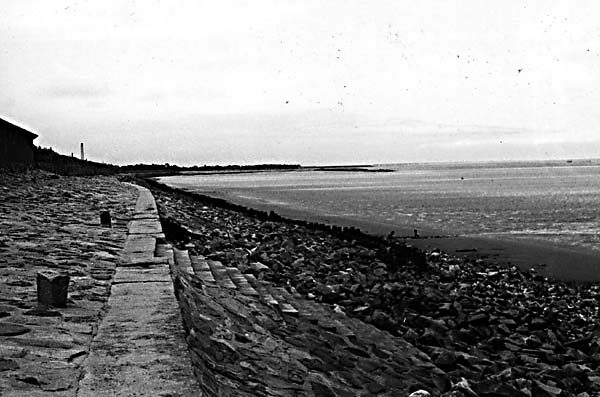 |
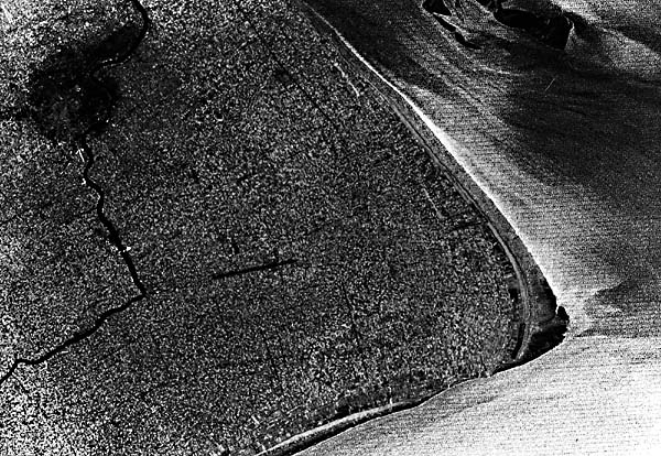
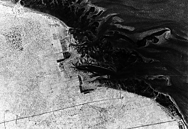
The Yangtze River discharge is about 690 km3/year (22000) m3/sec) at its mouth. Associated with this discharge is a heavy load of silt. The magnitude of this load is better revealed in a Landsat MSS band 5 image (October 1976) that emphasizes the offshore sediment plumes introduced from the Yangtze and other sources (Figure D-5.3). It is estimated that more than 142 million m3 of sediment pass down the Yangtze every year. Although subsidence is taking place in the delta, deposition occurs at a more rapid rate, in progradation. As sedimentation continues in the delta, reclamation dikes are built that contain sluice gates to allow inflow during flood tide and the settling out of mostly silt- and clay-sized particles. Much of the coastline along the northern flank of the delta, as well as in the main channel, has actually been built by man's intervention. The effects of active reclamation projects along the northern flank of the delta are readily surmised from the geometric appearance of this coast, as seen in the Landsat subimage of Figure D-5.2. Land recently reclaimed (I) by this process is now under extensive cultivation and habitation. Coastal protection with seawalls and rip-rap is widely used to preserve the coastal beach and agricultural lands from both marine and fluvial erosion (Figure D-5.4). These areas are dominated by tidal processes. Only the southern flank of the delta maintains the balance between wave action and sedimentation to create active but narrow beaches (J). The remainder of the coast is fronted by tidal flats (C) and tidal bars (B).
The combination of rich lower deltaic plain sediments, a hot wet summer, and a shallow water table leads to heavy cropping. Rice is by far the most important summer cereal. Other summer crops are cotton, soybeans, and corn. Rice is grown in rotation with winter wheat. Not only the lower delta serves as an important agricultural area, but also the entire alluvial plain, which extends inland some 900 km. Landsat 30067-01462-7, May 11, 1978.
Continue to Plate D-6| Chapter 5 Table of Contents| Return to Home Page| Complete Table of Contents|