 |
 |
|---|---|
| Plate D-6 | Map |
|
|
|---|---|
| Plate D-6 | Map |
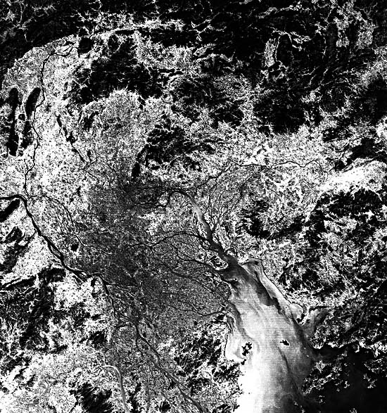
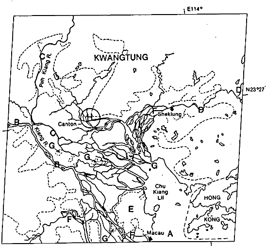
The Hsi River delta is also commonly referred to as the Canton delta or the Pearl River delta. Fed by three rivers at or near its head, the Hsi River delta is building into the Chu Chiang estuary (A), which interfaces with the South China Sea. These three rivers are the Si-Kiang or Hsi River (B), the Bei-Kiang (C), and the Tung-Kiang (D). Each is clearly visible in the Plate. However, together with their distributary networks, a very complicated deltaic morphology has developed. The distributaries of these rivers are separated by a large and rather circular mountainous block, the Chung Shan (E), around which deltaic sediments are being deposited as the deltaic plain progrades to the southeast.
Tributaries that contribute to the delta vary considerably in length, discharge, and sediment load. The Si-Kiang (West River) is the most important with regard to these parameters. It is nearly 2000 km long and can be considered South China's equivalent to Central China's Yangtze River (Plate F-16) and the Huang He River (Plate F-3) of Northern China. The Hsi River is an important artery of commerce because it is navigable by ship traffic over most of its length. Total discharge of this river system (the three major rivers and the smaller ones) is approximately 302 x 109 m3/year, or an average of over 9500 m3/sec. Of this total discharge, about 78 percent is contributed by the Si-Kiang (Hsi River) and its distributaries. Of the other two major tributaries, the Bei-Kiang (North River) accounts for about 12.8 percent of the total, and the Tung-Kiang (East River) contributes 8.5 percent. Smaller tributaries such as the Liu Qi River form part of the riverine network that builds the Hsi (Pearl) River delta, but their combined contribution to the total discharge throughout the system is only about 0.5 percent. Maximum discharges of the Hsi River system are over 70 000 m3/sec, which, in the whole of China, is second only to that of the Yangtze. Discharge is highly seasonal with nearly 78 percent of the annual volume occurring between April and September. The main contributor, the Hsi River, rises in East Yunnan province and flows east through Kwangsi and Kwangtung provinces to the region shown in this Plate where effluents from the aforementioned rivers and their distributaries flow into a shallow bay commonly known as the Pearl river estuary or Chu Chiang. Eight major channels and numerous smaller ones debouch sediment-laden fresh water into this water body, causing rapid seaward progradation of subaqueous shoals and the deltaic plain. It has been estimated that, during the summer peak-flow months, approximately 95 percent of the annual suspended load (~72 500 000 metric tons) is discharged through the delta. Although impressive, this suspended load is only about one tenth of that carried by the Yangtze, even though their total discharges are similar. Despite this lower load, the Hsi and other contributors to the Pearl River system have succeeded in constructing a delta over 100 km long during the past 4000 to 5000 years. In the process of delta-building, many former bays (F) became sediment-filled and have now become a part of the low- relief delta plain. Local topographic highs (G) of the present low- lying deltaic plain were once islands in the bays that have subsequently been filled with deltaic deposits.
| Figure D-6.1 | Figure D-6.2 |
|---|---|
 |
 |
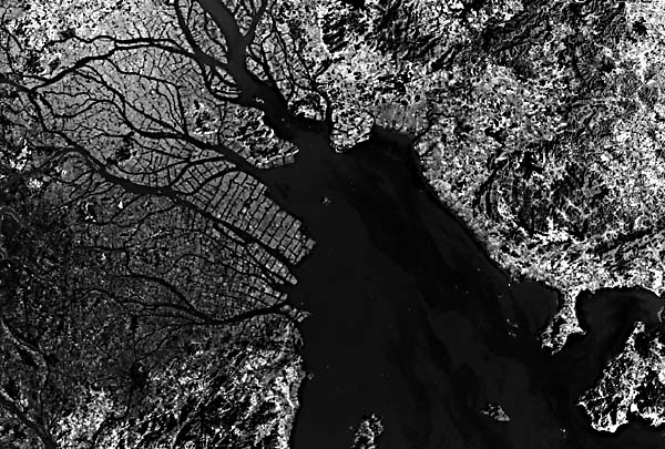
The seaward end of the subaerial delta comprises a complicated network of tidal creeks and major distributary channels with bell- shaped mouths typical of tide-dominated distributaries. These wide river mouths, although characterized by shifting shoals, allow excellent access to important inland ports such as Canton (H) by shallow draft ships and a variety of local fishing boats. An excellent example of this intricate alluvial morphology with numerous small channels can be seen at the distal margin of the Tung-Kiang (I). Although sedimentary processes produce complicated delta morphology under low wave energy, moderate tide, and river- dominated conditions, much of the present delta actually represents reclaimed land produced by a combination of manmade embankments and natural sedimentation forced by tidal flow. An enlarged image of part of the deltaic plain and Pearl River estuary (Figure D-6.1) shows the geometric pattern of manmade canals that irrigate and help to deliver sediment for building these fertile lower delta lands. Note the square-appearing land reclamation plots at the distal ends of prograding deltaic wetlands.
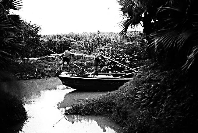
Historical records suggest that man has been cultivating the deltaic lands of this region of South China for well over 1000 years. Not only did man expand his agricultural territory as a consequence of natural advancement of the delta, but he learned to build new land by constructing dikes to accelerate reclamation. Many of these dikes are constructed so that the structure is submerged at high tide. This procedure allows tidally raised turbid water to enter the diked area and be trapped during the ebb-tide part of the cycle. This produces a new increment of sedimentation to the diked area with each tidal cycle. By 1950, the lower delta had over 1300 km of levees and dikes, some as much as 7 m high and 4 m wide. Since then, many others have been added. The net result has been to enhance agricultural production by increasing protection against the destructive effects of floods and by producing new land at a faster rate than the natural delta accretion process. Major crops of the lower delta are rice, sugarcane, and mulberries. Figure D-6.2 shows part of a canal and dike in a foliage- covered reclaimed portion of the delta where sugarcane is the main crop. Landsat 1520-02210-5, December 25, 1973.
Continue to Plate D-7| Chapter 5 Table of Contents| Return to Home Page| Complete Table of Contents|