 |  |
|---|---|
| Plate E-10 | Map |
| |
|---|---|
| Plate E-10 | Map |
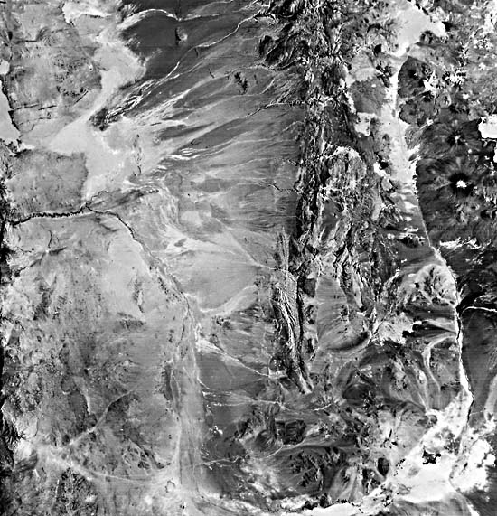
The Atacama Desert is not only a trade-wind desert and a coastal desert affected by the north-flowing Peru Current, but is also a rain-shadow desert protected by the Andes Mountains. Many investigators consider it the driest desert on Earth. Compare this desert with the Namib Desert (Plate E-9), a coastal desert in western Africa at the same latitude. The Tropic of Capricorn passes through both deserts.
This Plate is near the center of the Atacama Desert (and south of the scene in Plate C-12). The dark tones along the right margin represent vegetation on the eastern slopes of some of the Andes Mountains.
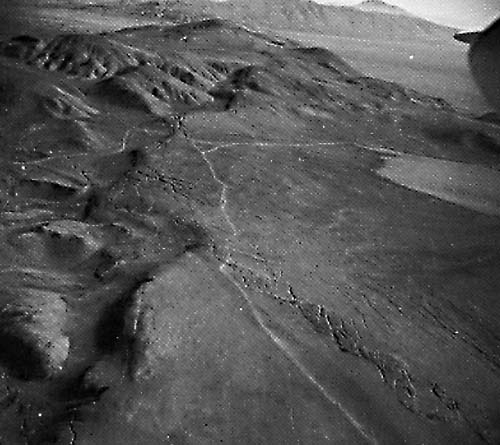
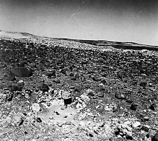
The low Coastal Range is immediately east of the Pacific Ocean. Throughout much of this Plate, the shoreline is a wave- cut cliff with a maximum height of about 1000 m (Ericksen, 1981). The drainage pattern from the Coastal Range is poorly defined. Note in Figure E-10.1 the influence of a mantle of dust that covers much of the range. The linear features in the foreground are open fissures formed during faulting.
The Central Valley separates the Andes from the Coastal Range. Alluvial fans in drainage deposits derived from the higher Andes dominate the surficial material of the valley. According to Ericksen (1981), the valley contains alluvium and interbedded lacustrine sediments up to 900-m thick. The dense coastal fogs that cover the Coastal Range nearly every austral winter night do not extend to the Central Valley (Ericksen, 1981).
| Figure E-10.1 | Figure E-10.2 |
|---|---|
 | 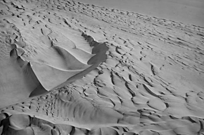 |
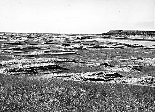
A small dune field lies directly north of this plate, and occasional large dunes have built up along the coast and even within the Coastal Range. Figure E-10.2 shows dunes near the coast directly north of this image. The slipface is toward the left. Except for these dunes, the Atacama is a region of eolian deflation and evaporation. Ericksen (1981) points out that, due to variable diurnal and seasonal winds, eolian- transported material spreads evenly over the desert rather than forming dunes. He found about 100 closed basins in northern Chile, many of which contain salars (playas). The map of the playas north of the Loa River on the Plate are based on Ericksen (1981). Figure E-10.3 is an eroded clay playa about 50 km north of the top of this Plate. Yardangs that formed in mudflows indicate fairly uniform wind direction. The large ridge on the far right is a mine refuse pile. Figure E-10.4 is also an eolian deflation zone and shows gypsum-rich soil on top of nitrate-rich caliche.
The Atacama Desert is unique among the deserts of the world in its great abundance of saline minerals. Sodium nitrate has been mined for explosives and fertilizer in the Atacama since the middle of the 19th century. Nearly 3 million metric tons were mined during World War I (Ericksen, 1983).
| Figure E-10.3 | Figure E-10.4 |
|---|---|
 |  |
The nitrate deposits are ubiquitous in the Atacama. The deposits are found on all types of topography and in all types of bedrock and unconsolidated sediments. Ericksen (1983) distinguishes two types of nitrate ore: alluvial ore in which the saline minerals cement the unconsolidated sediments, and bedrock ore in which the minerals vein into bedrock. He suggests that most of the nitrates formed through fixation of atmospheric nitrogen by micro-organisms in playa lakes and moist soils. Periodic evaporation led to crystallization of saline minerals, after which leaching and redeposition bring about secondary enrichment. He indicates that the chief sources of the saline constituents are water-soluble saline minerals from the volcanoes in the Andes. The minerals were leached by ground water and carried into the desert by streams, ground water, and wind.
Ericksen (1983) attributes the abundant nitrate deposits to the fact that the Atacama has had an extremely arid climate at least since the Middle Miocene time (10 to 15 Ma ago). Therefore, the present-day landscape has been modified only slightly, thus providing a long-time interval for depositional buildup of the nitrates. Landsat 2312-13514-7, November 30, 1975.
Continue to Plate E-11| Chapter 8 Table of Contents.| Return to Home Page| Complete Table of Contents