 |
 |
|---|---|
| Plate E-14 | Map |
|
|
|---|---|
| Plate E-14 | Map |
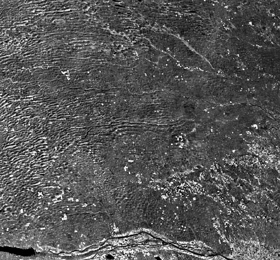
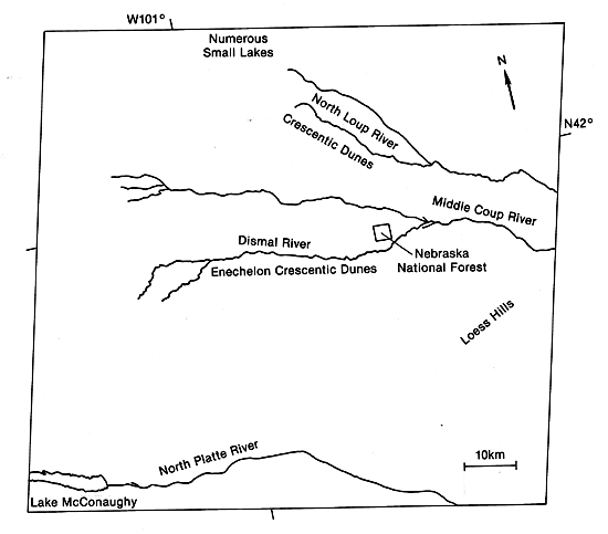
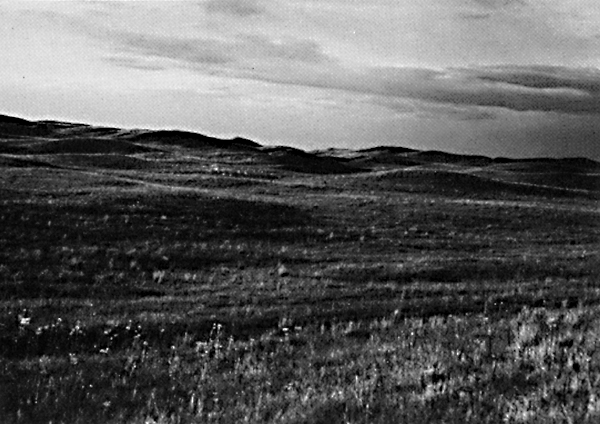
The 57 000-km2 Nebraska Sand Hills in central Nebraska is the largest dune field in the Western Hemisphere. It is bordered by the Niobrara River to the north, directly above this scene, and the North Platte and Platte Rivers to the south; loess borders the hills to the east; and the dunes overlie eroded remnants of the loess in the southeast. Ahlbrandt and Fryberger (1980) conclude that sands intercalated in the loess are probably fluvial rather than eolian. Precipitation in the sand sea varies between 406 mm/year in the west to 610 mm/year in the east (Ahlbrandt and Fryberger, 1980). These investigators analyzed basal sediments in a core and determined that the sand sea is of Holocene age. The Sand Hills presently are stabilized by grasses, as shown in Figure E-14.1 and Figure E-14.2.
Ahlbrandt and Fryberger (1980) classify the dunes as simple or compound crescentic. They note that some of the large dunes (up to 90 m high), particularly those south of the Dismal River, superficially resemble linear dunes. Internal stratification of the dunes, however, indicates that they are crescentic in nature. These authors suggest that these dunes may represent an early stage of evolution from en echelon crescentic types to linear dunes. The evolution was frozen in time when the climate became more humid. This illustrates the importance of field investigations in interpreting remote sensing data. Ahlbrandt and Fryberger (1980) found that the interdune deposits differ from nearby dunes in composition, color, and texture. As can be seen in the Plate and in Figure E-14.2 and Figure E-14.3, the interdune sediments are normally darker than the dune sands. Through laboratory analysis, these investigators determined that the interdune sediments are rich in organic matter and could produce petroleum on burial and heating.
| Figure E-14.1 | Figure E-14.2 |
|---|---|
 |
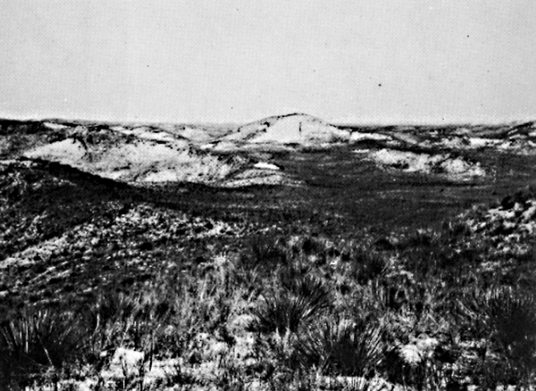 |
Blowout and parabolic dunes are ubiquitous in the sand sea. Ahlbrandt and Fryberger (1980) interpret them to be secondary features that developed after the large dunes formed. Blowout dunes are smaller than the resolution of the TM image (30 m). Three blowouts, indicated by a crescent-shaped hollow devoid of vegetation except at the top, appear in Figure E-14.2.
Ahlbrandt and Fryberger (1980) measured the orientation of cross-beds within the dunes and found a general northwest-southeast drift of sand with a more southerly drift in the southeast. These investigators point to a wide discrepancy between the present wind regime and the dune field. They state that if the rainfall did not support vegetation, the sand sea would be active and, in some areas, the dune forms would be different from those existing today. They surmise that the nature of change in wind circulation from the time of dune- building to the present cannot be determined from available data.
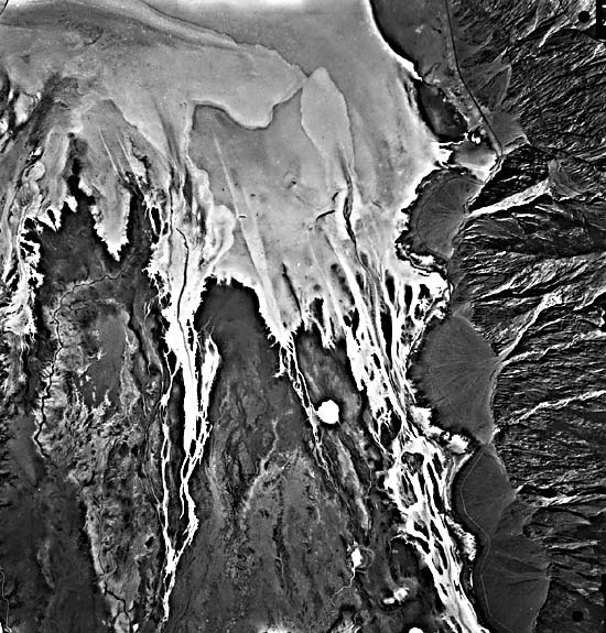
The paleoclimatic record of the sand sea reveals the climate to have fluctuated from arid to more humid than present. According to Smith (1965), pollen analysis indicates the presence of a spruce forest 12 600 years ago. The forest was succeeded abruptly by grassland and the numerous interdunal lakes of the present. These lakes may be seen in the upper center of the Plate image and in Figure E-14.3, a high-altitude aerial photograph. The lakes and grass suggest the presence of greater moisture than when the sand sea was formed. The dark areas on this photograph are not lakes, but may be swamps. About ten small lakes can be seen in the photograph and are indicated by a light-gray tone and a sharp contact with the grasses.
| Figure E-14.3 |
|---|
 |
In some areas in the Sand Hills, Ahlbrandt and Fryberger (1980) observe that wind erosion has created yardangs. In the western Sand Hills (left of the Plate), denudation of dry salt encrusted interdunes occurs during the summer. These in vestigators cite water erosion as the most important cause of present landscape alteration. Rainfall helps form organic- rich interdunal deposits and aids in the development of thin soils on the dune sands.
Clusters of ancient sand dunes now in semihumid terrain, and playas which represent formerly large lakes, now in arid environments, indicate that climatic conditions have changed over vast areas of the Earth. Applying remote sensing data, we can determine the sedimentary characteristics that reflect variations in geomorphic and hydrologic processes as functions of climatic changes. Likewise, vegetation changes that correspond to climatic changes may be recorded and dated. With this approach, the paleoenvironment of the arid lands can often be reconstructed.
Ample evidence exists for climatic changes on the Earth´s surface. Surficial features of arid lands are important indicators of such changes. By monitoring the surface from satellites, shifts in climate in arid lands can be followed over decades by observing changes in vegetation cover. Studies of this kind in the African Sahel using NOAA AVHRR imagery over a 5-year span have been reported by Tucker et al. (1985). Landsat TM- 4014116525-4, December 4, 1982.
Continue to Plate E-15| Chapter 8 Table of Contents.| Return to Home Page| Complete Table of Contents