 |
 |
|---|---|
| Plate E-18 | Map |
|
|
|---|---|
| Plate E-18 | Map |
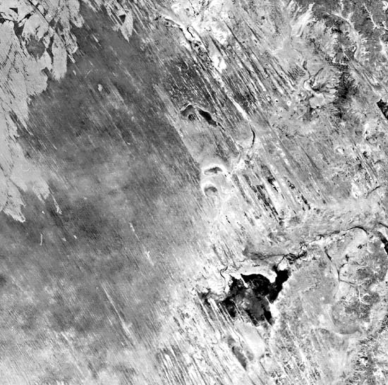
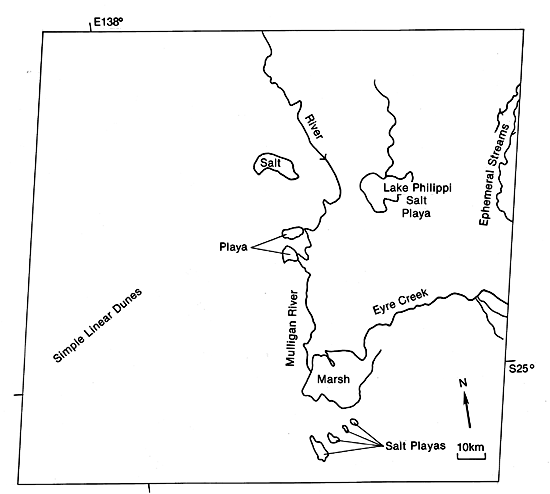
The 300 000-km2 Simpson Desert is situated predominately within the Lake Eyre structural basin in central Australia (Twidale, 1980). This Plate scene is about 400 km northeast of Lake Eyre. With a surface area of 9300 km2, Lake Eyre is one of the largest playas on Earth. Twidale (1980) suggests that it is bounded by a fault scarp and points out that it fills approximately twice a century. He affirms that, during the Late Pleistocene, a lake up to 17 m deep occupied an area at least three times larger than the present lake. He notes that the Simpson Desert sand sea is on the leeside of the main area of sediment accumulation in the Lake Eyre Basin.
| Figure E-18.1 | Figure E-18.2 |
|---|---|
 |
 |
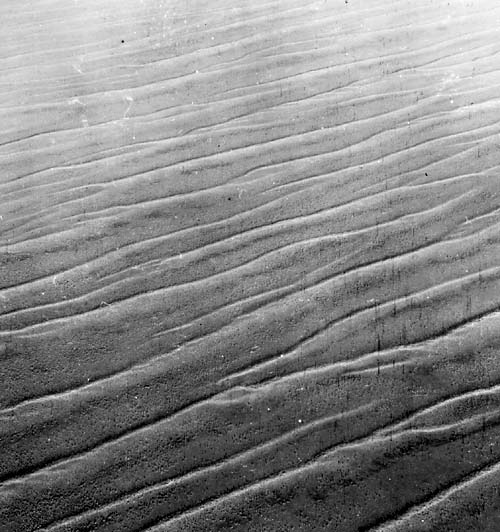
The simple linear dunes (Figure E-18.1) in this sand sea are similar to the linear dunes in the Great Victoria Desert to the southwest and to the Great Sandy Desert to the northwest (Plate E-17). The individual dunes in the Simpson Desert are 10 to 38 m high and generally 160 to 200 m apart and may extend without a break for more than 300 km (Langford-Smith, 1982). The interdunal areas are generally more vegetated. The conspicuous light-toned patterns in the upper left of this Plate are similar to the burning patterns of the Great Sandy Desert visible in Plate E-17. Repetitive Landsat coverage shows these patterns to change over the years as the vegetation recovers. Salt playas have formed in less vegetated areas of the scene.
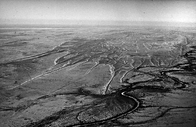
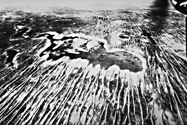
Figure E-18.2, looking south, shows the linear dunes advancing over the Late Pleistocene floodplain of the Diamantina River slightly northeast of this Plate. According to Twidale (1980), these dunes are migrating slowly to the north-northwest. He notes that, early in this century, some Simpson Desert dunes were advancing about 90 m per decade. He suggests that migration of wind-transported material from the many centers of alluvial and lacustrine sedimentation in the basin during the Late Pleistocene led to the development of the sand sea.
| Figure E-18.3 | Figure E-18.4 |
|---|---|
 |
 |
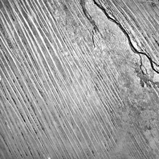
Twidale (1980) has observed a relationship between dune height and interdunal spacing taken in a direction normal to the dune trend. Note that the shorter dunes in the western Simpson Desert are much farther apart than the taller dunes in the east. Figure E-18.3, a vertical aerial photograph, was taken directly north of this Plate. Field River is in the northeast of this photograph of a 20-km wide area. The interdunal spacing decreases toward the river as the dunes become smaller. East of the river, however, no decrease in dune size or interdunal spacing occurs as the river is approached; this may be due to topographic variations in the river floodplain.
| Figure E-18.5 |
|---|
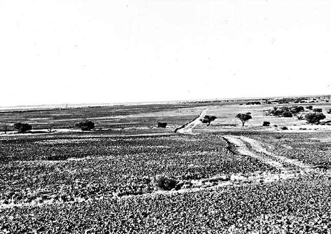 |
Figure E-18.4 shows linear dunes approaching small playas east of Lake Eyre in the southern Simpson Desert. A landing strip parallel to the dunes is in the upper right. The dunes in the right of this photograph appear much wavier than the dunes on the left, which suggests topographic influence on the wind regime.
Figure E-18.5 is a stony desert, called a gibber plains in Australia, in a deflation zone immediately to the west of this Plate. Except for the vegetation, it is quite similar to the gobi in the Turpan Depression (Plate E-24). Landsat 40090-00104-4, October 14, 1982.
Continue to Plate E-19| Chapter 8 Table of Contents.| Return to Home Page| Complete Table of Contents