 |
 |
|---|---|
| Plate C-18 | Map |
|
|
|---|---|
| Plate C-18 | Map |
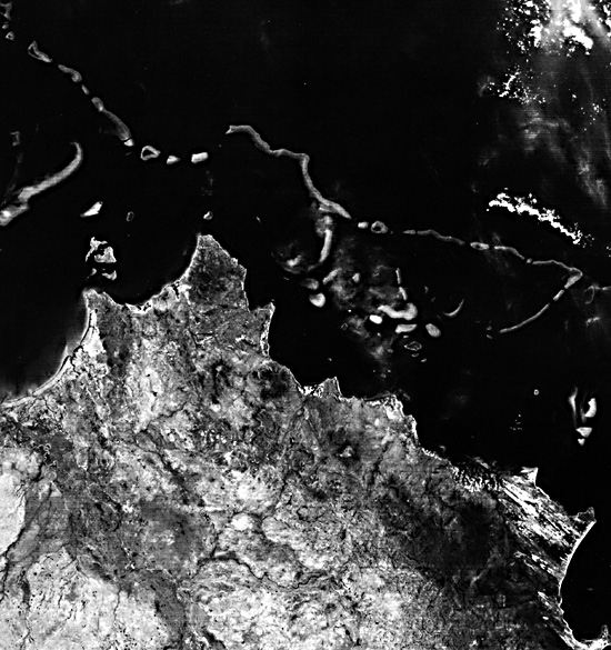
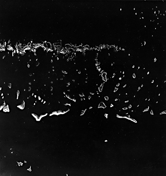
The Great Barrier Reef of Australia extends up the north-eastern coast of the continent from the Tropic of Capricorn (at the Cumberland Islands and Swain Reef, photographed from STS-8 (Shuttle; Figure C-18.1)) for 2300 km to Torres Strait, where it merges with the reefs along southern Papua New Guinea (as seen from Landsat-1 in Figure C-18.2). It includes thousands of individual reefs of a bewildering variety: patch reefs (Figure C-18.3), linear or ribbon reefs, crescentic reefs, submerged shoals, lagoonal reefs, and planar reefs (Hopley, 1982, p.274). All the modern reefs have evolved in the last 6000 years since sea level returned to its approximate present position, but they are only thin veneers of recent coral limestone, usually less than 10 m thick, over older reefs, mostly constructed during the last interglacial age and then modified by karst solution during the long exposure of low sea level during the last ice age.
| Figure C-18.1 | Figure C-18.2 |
|---|---|
 |
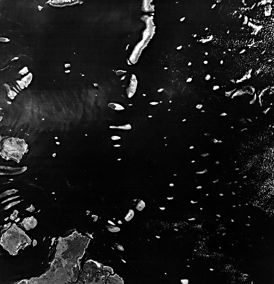 |
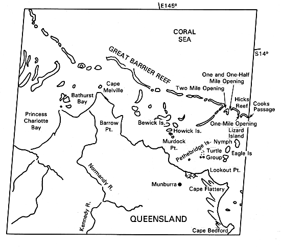
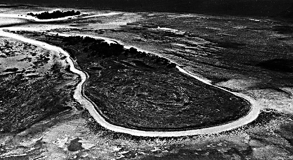
The segment of the Great Barrier Reef near Cape Melville in the image is typified by a ribbon reef (also called a wall reef or linear reef; Figure C-18.4) at the outer edge of the continental shelf. Farther south, the barrier reef system consists of large patch reefs or horseshoe-shaped crescentic reefs on a wider continental shelf. North of 16°S latitude, as in this view, the continental shelf becomes narrower, and the edge of the shelf is delineated by narrow ribbon reefs on which the powerful southeastern swell breaks in violence. The reef margin is so dangerous that few accurate soundings have been made, but divers have reported a depth of 400 m at a point 300 m seaward of Hicks Reef, along the right edge of this view (Veron and Hudson, 1978, p. 6). Depths of 1000 m are common within 1 km of the ribbon reefs, confirming that they define the edge of the continental shelf. Behind the ribbon reefs are a maze of submerged shoals, lagoonal reefs (those with a central atoll- like lagoon), and planar reefs (in which the central depression of a crescentic or lagoonal reef has been filled with coral debris to become a low-tide platform). The maximum depth among the shelf reefs is only 36 m. North of Cape Melville the ribbon reef approaches to within 25 km of the mainland, the narrowest part of the channel behind the entire Great Barrier Reef.
Captain James Cook's discovery of the Great Barrier Reef was a near tragedy. He had sailed north for 1400 km along the mainland coast for many weeks in early 1770, unaware of the great reef system that was closing in on him from the east. On June 11, he went aground on Endeavour Reef near the place now named Cooktown, just southeast of this image (Hopley, 1982, p. 1). After beaching and repairing the ship, he threaded his way through the shelf reefs to Lizard Island, a granitic island that rises 360 m above sea level in the eastern part of the image. From the summit of Lizard Island, he planned a course that took him through the outer ribbon reef at Cooks Passage, at the extreme east edge of this image. It is ironic that, although the crew cheered at their harrowing escape from the Great Barrier Reef, after sailing north for a time in terrible weather, Cook was forced to run inside the reef once again. The tidal current miraculously swept HMS Endeavour, without any rudder control, back inside the reef through a pass. From that time on, Cook was able to navigate safely through the Torres Strait and north to Dutch settlements in present Indonesia. The first written description of the Great Barrier Reef is also one of the epics of maritime history.
| Figure C-18.3 | Figure C-18.4 |
|---|---|
 |
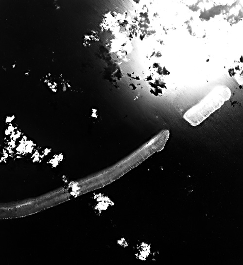 |
Among the shelf islands of the northern Great Barrier Reef are a number of "low wooded islands," former patch reefs or lagoon reefs that have partially filled with storm beaches, coral debris, and dunes, and which now support mangrove swamps and tough woodland shrubs and trees typical of the northern Australia savanna. A cluster of these low wooded islands north of Cape Flattery includes Bewick, Howick, the Pethebridge Group, the Turtle Group, and Nymph Island. The ecology and geology of these unique reef islands were subjects of extended British research in 1928-1929 (Yonge, 1930). The northern Great Barrier Reef was again studied in 1973-1974 by a combined Australian, British, and U.S. team (Royal Society of London, 1978; Stoddart, 1978). Landsat 1203- 23543-5, February 11, 1973.
Continue to Plate C-19| Chapter 6 Table of Contents.| Return to Home Page| Complete Table of Contents|